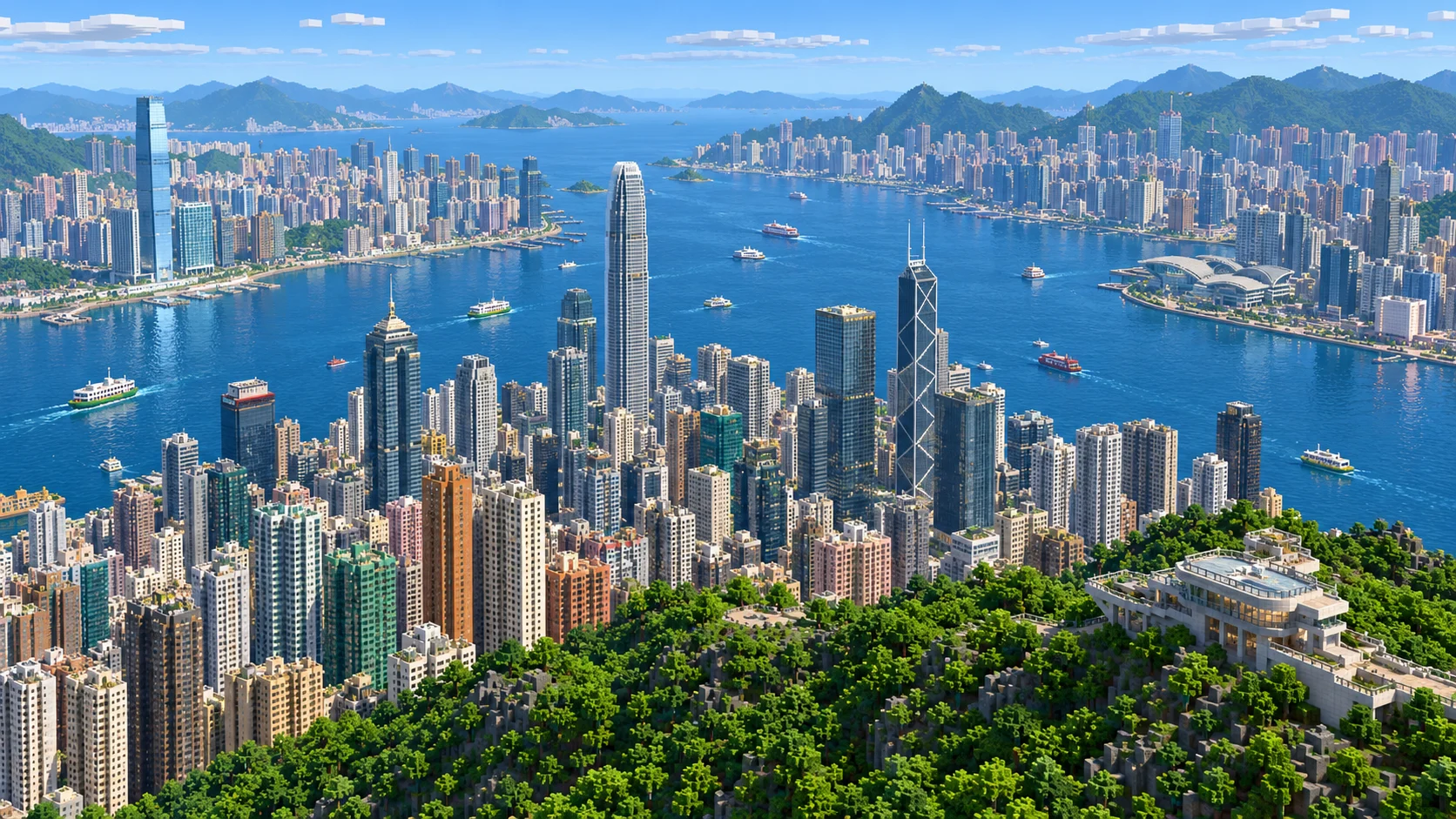
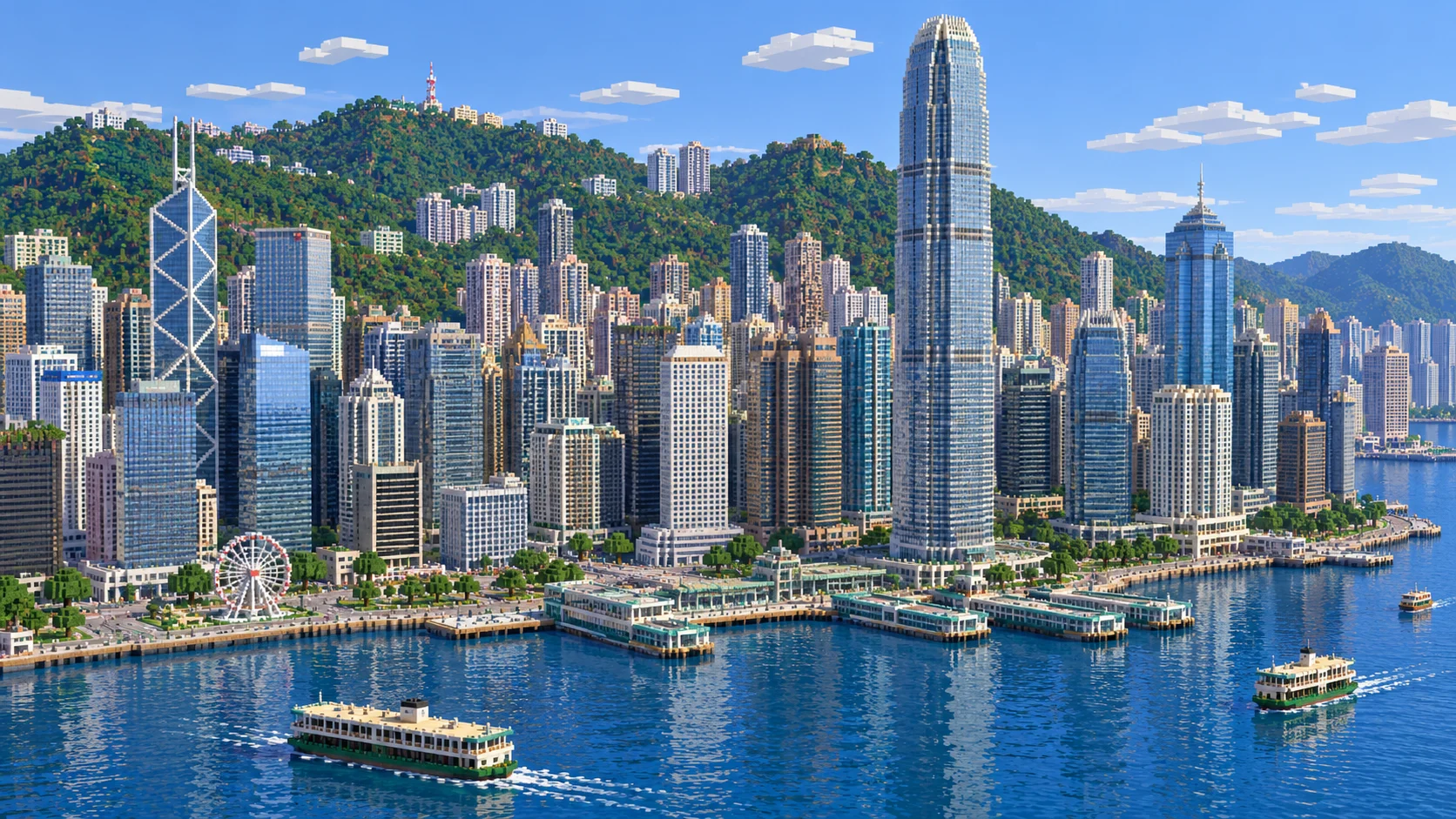
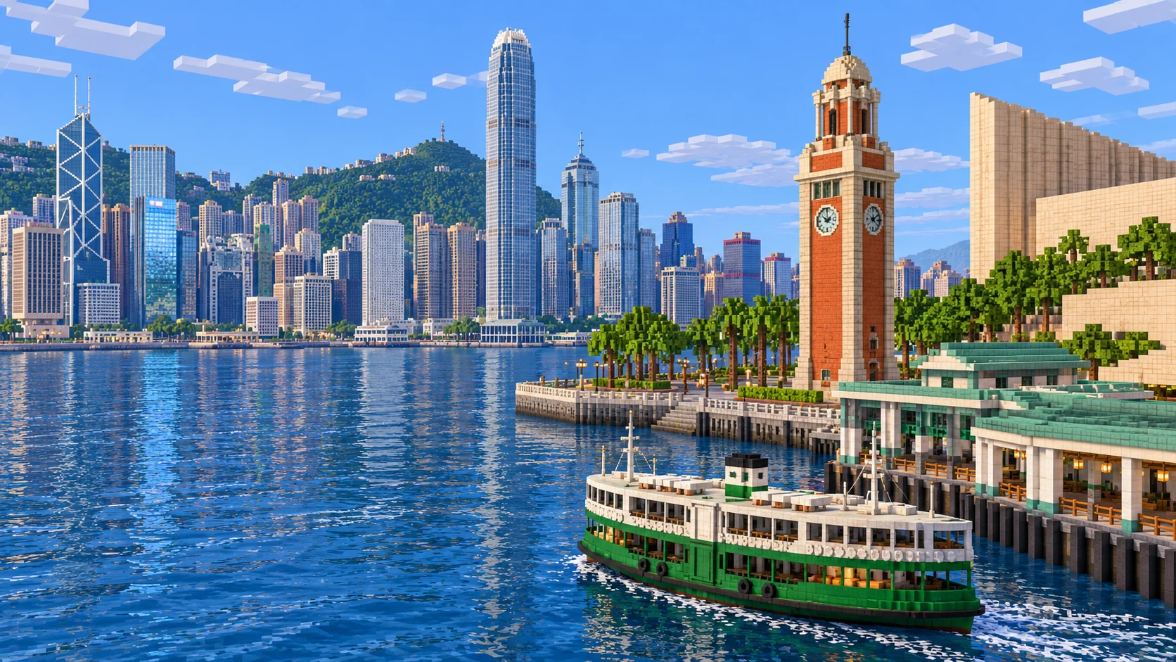
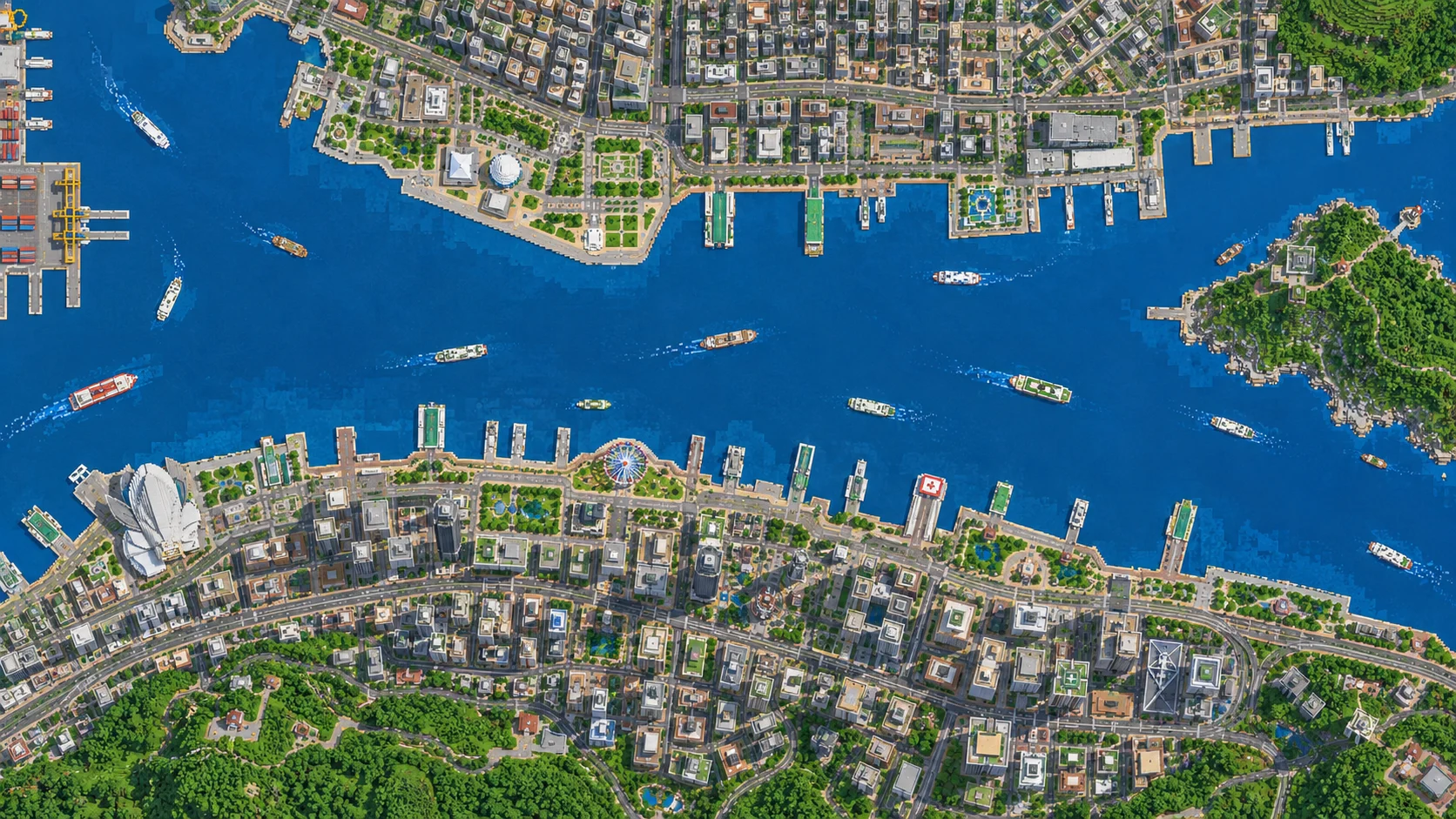
Start on the Tsim Sha Tsui waterfront beside the Clock Tower. Across Victoria Harbour are the Central ferry piers, the towers of the financial district and the wooded ridge of Victoria Peak. This Hong Kong Minecraft map covers 26.2 km² on both shores. The Java and Bedrock downloads share the same geographic selection. You can also open the world in the browser after unlocking the map.
Illustrations. Generated worlds follow OpenStreetMap data and differ in detail.
Starting area
Victoria Harbour: Tsim Sha Tsui, Central, Wan Chai & The Peak
Size
26.2 km²
Editions
Java & Bedrock
Download
Ready to play
Data
OpenStreetMap
01 / Overview
From Kowloon’s waterfront to Victoria Peak
Victoria Harbour is the easiest way to read this map. The water divides the flat Tsim Sha Tsui waterfront in the north from Hong Kong Island in the south. The selection stretches roughly 5.35 km west to east and 4.9 km north to south. It includes the peninsula around Kowloon Park and the West Kowloon waterfront, then crosses the harbour to take in Sheung Wan, Central and the Wan Chai convention centre. The southern part of the rectangle climbs from Queen’s Road Central into Mid-Levels and reaches the ridge at The Peak. The boundary cuts through a much larger city, so a road that ends at the border may continue for kilometres outside the download.
Begin by walking east from the Clock Tower. The Cultural Centre interrupts the street grid with a large footprint, and the Avenue of Stars keeps you beside the water as you continue toward Tsim Sha Tsui East. Heading northwest takes you toward West Kowloon. The park and museum occupy land that projects into the harbour, so the bend of the shore is easier to recognise from above than from between the neighbouring buildings. Across the water, the Central ferry piers give you a second set of landmarks before you start uphill.
On the island, use the waterfront on one side and Hollywood Road on the other to judge where you are on the slope. A short route south from the piers goes from reclaimed ground through the office towers and into stepped side streets. The Peak Tram corridor continues that climb farther inland. There is no need to travel the whole rectangle at once. For a first visit, pick one shore and use the opposite skyline to orient yourself before heading into the hills.
Illustrations. Generated worlds follow OpenStreetMap data and differ in detail.
02 / Inside the map
What's included in the Hong Kong map
The recommended starting area covers Victoria Harbour, the Tsim Sha Tsui Clock Tower and Star Ferry Pier, Hong Kong Cultural Centre, Avenue of Stars, Kowloon Park, West Kowloon Cultural District and M+, the International Commerce Centre, Central ferry piers, Two IFC, Central Market, Hollywood Road, Man Mo Temple, Central–Mid-Levels Escalator, the Bank of China Tower, Hong Kong Park, the Peak Tram corridor, Victoria Peak, Lugard Road, Golden Bauhinia Square and the Hong Kong Convention and Exhibition Centre. Places marked as separate presets are outside it. Open them from the customize section below.
Starting area
Clock Tower and the Star Ferry
The starting point is on the paved waterfront about 20 blocks north of the Clock Tower, between the Star Ferry pier and the Cultural Centre. The Java sample renders the tower as a grey stone brick column with its top near Y −5. The real ferry links this side of the harbour to Central Pier 7. There are about 1,080 blocks of open water along the mapped route between the two piers. Use the pier footprints to place your own landing stages. The ferry shown in the illustration is a build idea rather than a vehicle waiting at the dock.
Starting area
Avenue of Stars and Salisbury Road
East of the Clock Tower, the promenade bends past the Cultural Centre and the Hong Kong Museum of Art. Salisbury Road runs inland roughly parallel to it. Keep the promenade open on the water side if you rebuild here. Hong Kong Island stays in view and the turn around the museum marks where the straight waterfront ends. The film plaques, statues and signs pictured in tourist photos are details you can add by hand.
Starting area
West Kowloon and M+
West Kowloon projects out from the north shore into Victoria Harbour. M+ and the Art Park are on that extension, southwest of the International Commerce Centre and its rail approaches. Compare its wide park paths and large building plots with the blocks around Nathan Road. The International Commerce Centre is a low white volume in the Java sample, so treat its footprint as a starting point for building the tower. For a harbour build with separate working areas, use West Kowloon as a park and museum zone and keep the busy ferry terminal farther east.
Starting area
Central piers and Two IFC
On Hong Kong Island the ferry lands beside the Central waterfront and the IFC complex. Two IFC is one of the tall real buildings that cannot be represented at its full height within a standard Minecraft world at this scale. In the Java sample, Two IFC has a flat andesite roof at Y 318. Next to it, One IFC tops out around Y 160. You can use the difference to tell the two towers apart from the water. If you want to rebuild a recognisable skyline, lay out the towers from the opposite shore first and pick heights that preserve the gaps between them.
Starting area
Central Market, Hollywood Road and Man Mo Temple
Start at Queen’s Road Central near Central Market for a climb into the old street grid. The real Central–Mid-Levels Escalator opened in 1993 and covers about 800 m to Conduit Road. Hollywood Road cuts across the slope toward Man Mo Temple. Build short stairs, level landings and retaining walls in sections. A single uninterrupted staircase would miss the turns and changes of level that make this part of the map worth exploring.
Starting area
Bank of China Tower and Hong Kong Park
The Bank of China Tower and Hong Kong Park sit inland from the Central waterfront. Together they mark the transition between the big building plots near the shore and the uphill approach to Garden Road. For a recreation, mark the tower’s diagonal braces in contrasting blocks. Work from the ground plan and reserve enough space beside the tower for a view from the street.
Starting area
Victoria Peak, Lugard Road and Harlech Road
The real summit is 552 m above sea level. Around The Peak, Lugard Road and Harlech Road form part of a circuit of about 3.5 km. The northern side faces the harbour, giving you a place to build a viewing terrace. The Peak Tram’s upper terminus is at Victoria Gap, below the summit. At the mapped summit point, stone steps in the Java sample reach Y 317. Put your lookout lower on the slope if you want room to build above it.
Starting area
Wan Chai and Golden Bauhinia Square
The convention centre and Golden Bauhinia Square are east of the Central ferry piers, at the tip of a waterfront projection in Wan Chai. From Kowloon it gives you a second target farther east than Two IFC. The mapped shoreline is a good starting point for rebuilding the apron and roof profile. Leave a path along the edge so visitors can get around the building without crossing the exhibition halls.
Illustrations. Generated worlds follow OpenStreetMap data and differ in detail.
03 / Why this city
What the blocks capture about Hong Kong
The straight waterfronts, piers and stepped roads are the parts you can use immediately. A trip from the Clock Tower to Central crosses open water first, then threads through large tower bases and climbs toward Mid-Levels. Compare the view at each stop. From the ferry pier you can look across toward the opposite shore. Increase your render distance to pick out the buildings beyond the piers. From a side street above Queen’s Road Central, the useful landmarks are stairs, intersections and the occasional opening between buildings.
The generator reads building footprints and available height tags from OpenStreetMap, with elevation data for the ground. It does not reproduce glass curtain walls, working escalators, moving trams, ferries or the complete interiors of railway stations. The illustrations show possible builds. If the location of a particular tower matters to your project, check its block footprint before planning a facade or calculating how much glass you need.
04 / Play
Best ways to play the Hong Kong map
Challenge 01
Make a ferry route between Tsim Sha Tsui and Central
Put a boat rack and a lantern on the Kowloon side, then use Central Pier 7 as the destination. Have a second builder wait on the island to check the approach from water level. Set the dock entries on the same side as the real piers so the route still makes sense when you fly over it.
Challenge 02
Build the Central skyline from the quay
Mark Two IFC and the Bank of China Tower on the island. Before building up, cross back to the Clock Tower to test the outlines at distance. Use distinct materials for the lighter glass of Two IFC and the diagonal frame of the Bank of China Tower. Set a height budget that leaves room below the build ceiling for each roof.
Challenge 03
Trace the hillside above Hollywood Road
Start near Central Market and choose a path up the slope through the Mid-Levels street grid. Use stairs and landings to keep the climb walkable in Survival. For a second route, plot a line along Garden Road toward The Peak. Use signs at both trailheads so friends can find the waterfront when they come back downhill.
Challenge 04
Link two viewpoints on a multiplayer map
Set a meeting point on the Kowloon waterfront and a lookout on the slope of The Peak overlooking the harbour. Test both on the same render distance your server normally uses. If the opposite shore disappears in fog, add a closer viewpoint on the Central side and turn the tour into three stops.
05 / Download
Download and install
Download the Victoria Harbour: Tsim Sha Tsui, Central, Wan Chai & The Peak starting area as a ready-made world for Java or Bedrock Edition.
Java Edition
UnzipExtract the ZIP to get a folder with level.dat inside.
CopyMove the folder into .minecraft/saves.
PlayOpen Minecraft Java Edition and choose Singleplayer.
Bedrock Edition
OpenOn Windows, double-click the .mcworld file. On phones and tablets, open it with Minecraft.
ImportMinecraft imports the world automatically.
PlayFind the new world in your Worlds list and open it.
If the world does not show up
Java: check that level.dat sits directly inside the world folder, not one folder deeper.
Bedrock: if double-clicking does nothing, open Minecraft first and then open the .mcworld file again.
Open the world with the listed Minecraft version or a newer one.
Lower your render distance if a large city loads slowly at first.
A separate southern waterfront selection around Aberdeen Harbour and the north side of Ap Lei Chau, including the channel, bridge approaches and waterfront parks.
The download covers 26.18 km² between 22.266° and 22.310° N and 114.138° and 114.190° E. The generated world measures about 5,350 by 4,892 blocks, at about one metre per block across the ground. The starting point is 22.29378° N, 114.16952° E by the Clock Tower.
Roads, piers, shorelines and building footprints come from OpenStreetMap. The ground follows elevation data and the generator uses mapped building heights or floor counts where available.
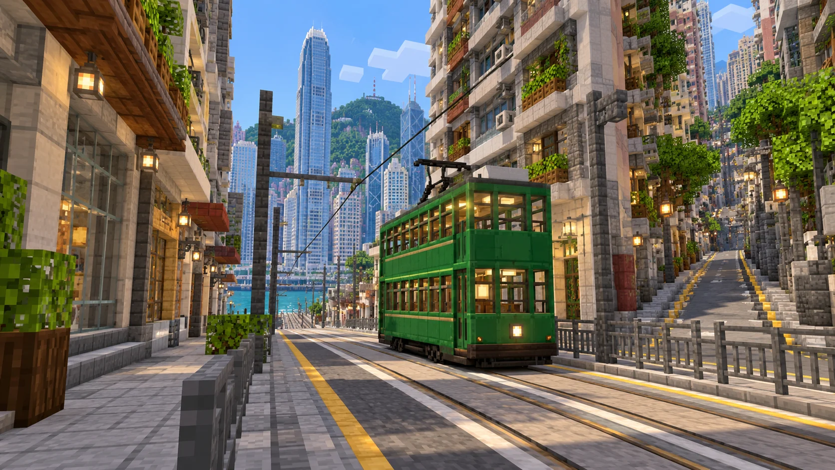
Tall towers and steep terrain are subject to the game’s build range. Fine details such as tram wires, facade patterns and clock faces can be added using the illustrated gallery as a reference.
The Java ZIP and Bedrock .mcworld contain the same selected area. The supplied OpenStreetMap attribution should stay with the files if you share or host the world.
OpenStreetMap is edited by volunteers, so coverage varies from street to street, and recent changes may be missing.
Yes. During the promotion, sign in to download any published city map for Java or Bedrock without using points or paying.
What part of Hong Kong is in this Minecraft map?
The selection spans Tsim Sha Tsui and West Kowloon on the north shore and Sheung Wan, Central, Wan Chai and Victoria Peak on Hong Kong Island. Lantau, the airport and Disneyland lie outside the rectangle. Aberdeen and Quarry Bay are available as separate generator presets.
Can I cross Victoria Harbour by boat?
Yes. Launch from the water beside the Tsim Sha Tsui dock and head to Central Pier 7, about 1,080 blocks along the ferry route. You can build your own ramps and marked landing spots at either end.
Is the Star Ferry or Peak Tram ride included?
The waterfront and the Peak Tram corridor give you locations for a build. Add your own ferry structures, landing stages or minecart track for a working route. The gallery is artwork.
Can I see the full height of Two IFC and Victoria Peak?
In the Java sample, Two IFC is capped at Y 318 and stone steps at the mapped summit reach Y 317. The real summit is 552 m above sea level. If you plan to rebuild a tower, check how much room the game leaves above its base first.
How do I import it into Minecraft Java?
Download the 182 MB ZIP saved with Java 1.21.4, extract the world folder into .minecraft/saves and check that level.dat is directly inside that world folder. Open Singleplayer and select the imported world, Arnis World 1. Keep a backup if you upgrade the world to a newer Minecraft version.
Can I play the Hong Kong map in Bedrock on a phone?
Open the separate 99 MB .mcworld file with Minecraft Bedrock on Android, iOS or Windows to import it. Consoles do not support importing arbitrary .mcworld files directly.
Can I put the Hong Kong world on a server?
Yes. For Java, place the extracted world on your server and set level-name in server.properties to match the folder. For Bedrock Dedicated Server, extract the .mcworld as an archive into a named folder under worlds and point level-name at it. Keep the attribution file with the map.