Skip to content

China / City map

Shanghai Minecraft Map

Central Shanghai in one Minecraft world, from Jing’an Temple to the Lujiazui towers. This Shanghai Minecraft map covers 26.5 km² built from real OpenStreetMap data: the Bund and its row of early-20th-century banks and hotels, the Huangpu River, the Oriental Pearl Tower and the Lujiazui towers, Nanjing Road, People’s Square, Yu Garden and Xintiandi. You spawn on the Bund promenade at the end of Nanjing Road, facing Pudong across the river. Download it for Java or Bedrock, or open it in the in-browser player on this site.

Java Edition · Bedrock Edition

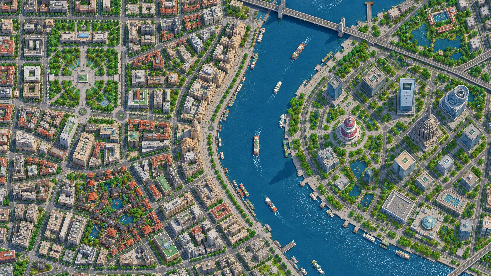
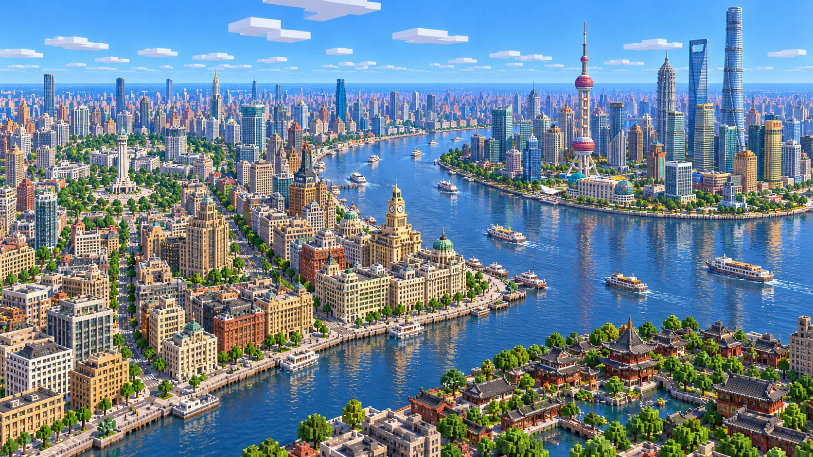
Illustration of central Shanghai in Minecraft blocks seen from high above: the Huangpu River curving between the stone buildings of the Bund and the Lujiazui skyline with the Oriental Pearl Tower and Shanghai Tower, and Chinese garden roofs in the foreground
Illustrations. Generated worlds follow OpenStreetMap data and differ in detail.
Starting area
Central Shanghai: Bund, Lujiazui and Nanjing Road
Size
26.5 km²
Editions
Java & Bedrock
Download
Ready to play
Data
OpenStreetMap

01 / Overview

Overview: Shanghai as a Minecraft world

This map is a rectangle of about 7.2 km east to west and 3.7 km north to south. The west edge runs about 450 m past Jing’an Temple, at the far end of Nanjing West Road. The east edge is in Pudong, about 1 km beyond Shanghai Tower, so the whole Lujiazui cluster and its riverside promenade are inside. To the north the map takes in Suzhou Creek and the first blocks of the North Bund, including Broadway Mansions; to the south it stops just below Xintiandi and cuts through the south end of the old walled city around Yu Garden. Wukang Road, in the western part of the Former French Concession, starts about 200 m below the southwest corner and has its own area below.

The Huangpu River crosses the east third of the map from south to north and bends east past Lujiazui. Because of that bend, the Bund looks straight across at the towers. In the world the river is about 430 to 480 blocks wide off the Bund, and the Oriental Pearl Tower stands about 900 blocks from the spawn, on the far side of the riverside park. Suzhou Creek comes in from the west along the north edge and meets the Huangpu at the Waibaidu Bridge. West of the river, Nanjing Road runs from the Bund through People’s Square to Jing’an Temple, about 4.6 km in a straight line, and the Yan’an Road elevated expressway cuts across the map parallel to it.

The world is generated, not built by hand. The generator reads streets, building footprints, the rivers, parks and land cover from OpenStreetMap, turns them into blocks at about one block per meter and shapes the ground from elevation data. Shanghai sits on a flat river delta only a few meters above sea level, so the ground barely changes height across the whole world: the height comes almost entirely from buildings. Every building is still a simplified shape.

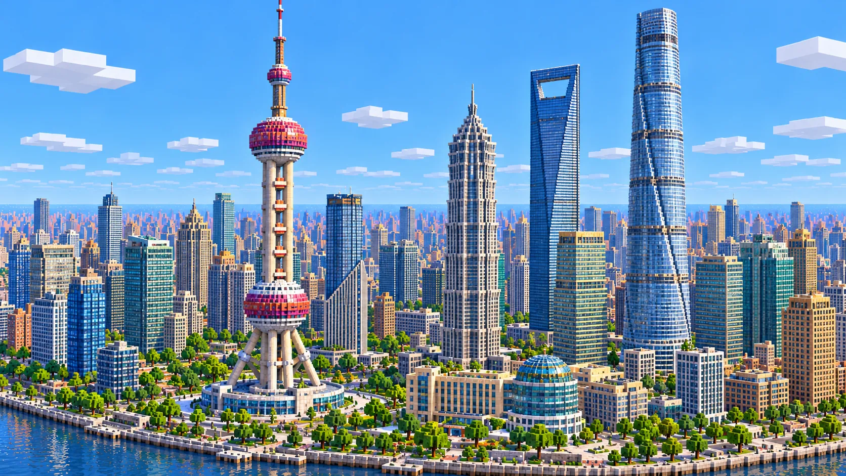
Illustration of the Lujiazui skyline in Minecraft blocks: the Oriental Pearl Tower with its pink spheres, Jin Mao Tower, the Shanghai World Financial Center with its open top and the twisting Shanghai Tower above the riverbank
Illustrations. Generated worlds follow OpenStreetMap data and differ in detail.

02 / Inside the map

What's included in the Shanghai map

The recommended starting area covers the Bund, the Waibaidu Bridge and Suzhou Creek, the Peace Hotel and the Custom House, the Huangpu River, the Oriental Pearl Tower, Jin Mao Tower, the Shanghai World Financial Center, Shanghai Tower, Lujiazui Central Green, Nanjing Road, People’s Square, the Shanghai Museum and Grand Theatre, Yu Garden and the City God Temple, Xintiandi, the Shanghai Exhibition Centre and Jing’an Temple. Places marked as separate presets are outside it. Open them from the customize section below.

  • Starting area

    The Bund

    The spawn is on the paved riverside promenade, opposite the east end of Nanjing Road and about 20 blocks from the water. Behind you, the old banks and trading houses line Zhongshan East 1st Road for about 1.5 km, among them the Peace Hotel (1929), the Custom House with its clock tower (1927) and the domed former HSBC building (1923).

  • Starting area

    Oriental Pearl Tower and the Lujiazui riverfront

    The TV tower, finished in 1994 and 468 m tall, stands at the tip of the Lujiazui bend, about 900 blocks from the spawn across the Huangpu. Around it are the circular elevated walkway at Century Avenue and the riverside promenade, which runs the length of the bend on the Pudong side.

  • Starting area

    Jin Mao, the World Financial Center and Shanghai Tower

    Three supertall towers stand within about 300 m of each other: Jin Mao (1999, 420.5 m), the Shanghai World Financial Center (2008, 492 m) with the trapezoid opening at its top, and Shanghai Tower (2015, 632 m), the tallest building in China. None of them fits under the build limit, and Shanghai Tower does not come out as a tower at all; see the notes below.

  • Starting area

    Nanjing Road

    The pedestrian street runs about 1 km from People’s Square to Henan Road, and since 2020 another 500 m to the Bund. Past People’s Square it continues west as Nanjing West Road, a wide shopping avenue that reaches Jing’an Temple near the west edge of the map.

  • Starting area

    People’s Square

    The square and People’s Park stand on the old Shanghai Race Club course; its 1933 clubhouse still stands on Nanjing West Road at the north edge of the park. The round-topped Shanghai Museum is on the south side and the Grand Theatre (1998), with its upturned roof, on the northwest.

  • Starting area

    Yu Garden and the City God Temple

    About 1.2 km south of the spawn, inside the ring road that follows the line of the old city wall. The garden was begun in 1559; next to it, the Huxinting teahouse stands in a pond reached by the zigzag Bridge of Nine Turnings. The bazaar streets around the City God Temple fill the blocks around the garden.

  • Starting area

    Xintiandi and the shikumen lanes

    South of People’s Square, the Xintiandi blocks keep the shikumen pattern: rows of two- and three-story stone-gate houses on narrow lanes. The lanes give a much finer street pattern than Pudong’s towers. The site of the first congress of the Communist Party of China, held in 1921, is here.

  • Starting area

    Jing’an Temple and the Shanghai Exhibition Centre

    Jing’an Temple was founded in 247 and has stood on this site since 1216; its current halls are from a rebuilding that began in the 1990s. About 600 m east, the Shanghai Exhibition Centre, built in the 1950s, is a long symmetrical hall with a tall gilded spire at its center.

  • Separate preset

    Wukang Road, Zhujiajiao and the Expo site

    Three places people often look for are outside this world. Wukang Road and its plane trees start just below the southwest corner, the 2010 Expo site with the former China Pavilion is about 6 km south of the Bund, and the canal town of Zhujiajiao is about 45 km west. Wukang Road and Zhujiajiao each have an area below.

Illustrations. Generated worlds follow OpenStreetMap data and differ in detail.

03 / Why this city

What makes Shanghai special in Minecraft

Two eras of building face each other across one river. On the west bank the Bund is a single row of stone banks, hotels and trading houses from the 1900s to the 1930s, facing the water. On the east bank, Lujiazui was mostly warehouses and docks until the 1990s, and is now a cluster of glass towers on wide plots around lawns. In the world the difference shows straight away from the promenade: tight, even-height blocks behind you, and big footprints with open space between them across the water.

The skyline is where the world falls short of the real city, and it is the main thing to know before you buy this map. Streets sit between Y -52 and Y -47 and the build limit is Y 319, so about 370 blocks of height are available above street level. The Bund fits easily: the Peace Hotel tops out at Y 26, about 77 blocks above the road. Most of the Lujiazui office towers fit too. The Oriental Pearl Tower, Jin Mao and the World Financial Center do not, so the generator stops all three at Y 319, as flat-topped shafts of the right footprint. Shanghai Tower is a different problem. OpenStreetMap draws it as an outline plus stacked parts, and the generator does not raise them, so the tallest building in China comes out as a podium about 15 blocks high on its real footprint. The site is there, with Jin Mao and the World Financial Center next to it; the tower is yours to build.

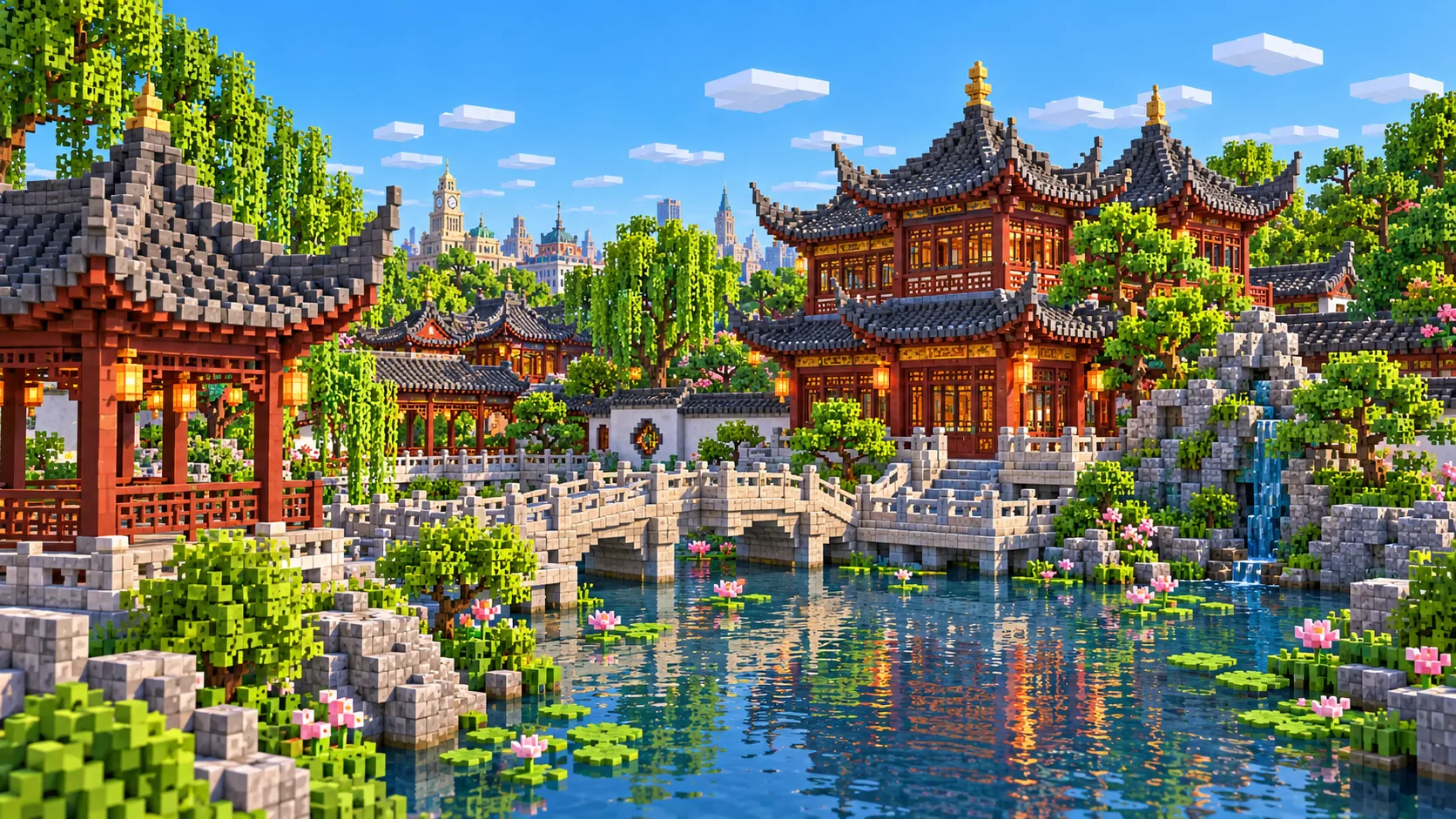
Detail is not generated either. The Oriental Pearl Tower has no spheres and the World Financial Center has no opening at the top; each is its mapped outline stacked up. The Bund buildings come out as blocks of the right footprint and roughly the right height, without domes, columns or the Custom House clock. Yu Garden is mapped down to its ponds, pavilions and halls, but the upturned roofs, rockeries and carved woodwork are not generated. No building has an interior. The illustrations on this page show the city after you build on it; the world gives you the plan, the river and the heights.

04 / Play

Best ways to play the Shanghai map

Challenge 01

Build Shanghai Tower on its empty site

The podium on the site of Shanghai Tower is a ready-made base. A full-height tower would need a top around Y 580, so on a standard world build it at half scale: about 316 blocks from street level, which fits under the build limit. Give it the 120° twist with a slowly rotating floor plan and a notch running up one side. Then add the Pearl’s two spheres, 50 and 45 blocks across at full size, to the shaft at the tip of the bend.

Challenge 02

Walk Nanjing Road from Jing’an Temple to the Bund

Start at Jing’an Temple near the west edge and head east along Nanjing West Road, past the Shanghai Exhibition Centre and People’s Square, then down the pedestrian street to the Bund promenade: about 4.6 km in a straight line. Hang lanterns, and banners or colored wool for shop signs, as you go; the generated shopfronts are plain.

Challenge 03

Rebuild the Huangpu ferry

No bridge crosses the Huangpu in this map: the crossings near the Bund are tunnels, which the generator does not build, and real ferries still carry people across. Run a boat line from the spawn to the Pudong bank, about 450 blocks of water, or dig your own tunnel under the river. The Waibaidu Bridge over Suzhou Creek, at the north end of the Bund, is in the map.

Challenge 04

Rebuild Yu Garden on its plan

The ponds, halls and walls of the garden are in their mapped places. Add the swept-up eaves with stair blocks, rockeries of andesite and tuff, and the zigzag bridge to the Huxinting teahouse. The garden covers about 2 hectares, so at this scale it is roughly 20,000 blocks of ground: a good size for a server team.

05 / Download

Download and install

Download the Central Shanghai: Bund, Lujiazui and Nanjing Road starting area as a ready-made world for Java or Bedrock Edition.

Java Edition

  1. UnzipExtract the ZIP to get a folder with level.dat inside.
  2. CopyMove the folder into .minecraft/saves.
  3. PlayOpen Minecraft Java Edition and choose Singleplayer.

Bedrock Edition

  1. OpenOn Windows, double-click the .mcworld file. On phones and tablets, open it with Minecraft.
  2. ImportMinecraft imports the world automatically.
  3. PlayFind the new world in your Worlds list and open it.

If the world does not show up

  • Java: check that level.dat sits directly inside the world folder, not one folder deeper.
  • Bedrock: if double-clicking does nothing, open Minecraft first and then open the .mcworld file again.
  • Open the world with the listed Minecraft version or a newer one.
  • Lower your render distance if a large city loads slowly at first.

Step-by-step help: Java import guide · Bedrock import guide

Shanghai mapCentral Shanghai: Bund, Lujiazui and Nanjing Road

  • Java Edition

    ZIP world folder

    • 182 MB
    • 26.5 km²
    • Java 1.21.4
  • Bedrock Edition

    .mcworld file

    • 94 MB
    • 26.5 km²
    • Bedrock 1.21

06 / Customize

Customize this Shanghai map

Each area opens the generator with the rectangle already drawn. Move it, resize it or change the mode before you generate.

Central Shanghai: Bund, Lujiazui and Nanjing Road

26.5 km²

The area of this map: central Shanghai from Jing’an Temple to Lujiazui, 26.5 km².

Open in generator

Wukang Road & the former French Concession

3.8 km²

About 3.8 km² just south of this map’s southwest corner: Wukang Road from Huashan Road down to the wedge-shaped Wukang Mansion (1924) at Huaihai Road, with the garden villas and plane-tree streets of the Former French Concession around it.

Open in generator

Zhujiajiao water town

3.0 km²

About 3 km² of the canal town of Zhujiajiao, 45 km west of the Bund: the canals and lanes of the old town, Kezhi Garden and the five-arch Fangsheng Bridge, about 70 m long and first built in 1571.

Open in generator

07 / Limits

What to expect from the map data

  • The map covers 26.5 km², from 31.217° to 31.250° N and 121.436° to 121.512° E. At about one block per meter the world is roughly 7,230 × 3,660 blocks.
  • The ground comes from elevation data. Shanghai is a flat delta a few meters above sea level: the Huangpu is at Y -54 and the streets between Y -52 and Y -47, leaving about 370 blocks of height above street level.
  • Streets, building footprints, the Huangpu and Suzhou Creek, parks and land cover come from OpenStreetMap. Building heights come from height and level tags where they exist and a default height where they do not. Buildings that would reach above Y 319 are cut off there; buildings mapped only as stacked parts, such as Shanghai Tower, are not raised.
  • Roof shapes, facades, the Pearl’s spheres, spires, tunnels, metro lines and interiors are not generated. The river tunnels and the Bund Sightseeing Tunnel are underground and do not appear.
  • OpenStreetMap is edited by volunteers, so coverage varies from street to street, and recent changes may be missing.

Map data © OpenStreetMap contributors, available under the Open Database License. Generated with the open-source Arnis project.

Questions before you generate

What does the Shanghai Minecraft map include?

Central Shanghai on both banks of the Huangpu, from Jing’an Temple in the west to about 1 km east of the Lujiazui towers, and from Suzhou Creek and Broadway Mansions in the north to just below Xintiandi and Yu Garden in the south. Wukang Road and Zhujiajiao are separate areas.

Is the Shanghai map free?

No. It costs $6.99 or 700 points, paid once. You keep it: the Java and Bedrock versions stay in your account to download again, and you can open it in the in-browser player on this site.

Does the Shanghai map work with Minecraft Java Edition?

Yes. The Java download is a ZIP of about 190 MB, saved in Java 1.21.4. Unzip it so the world folder sits directly in .minecraft/saves, not inside a second folder, then open it from Singleplayer. Newer Java versions upgrade the world when they load it.

Is there a Bedrock version of the Shanghai map?

Yes. The Bedrock download is an .mcworld file of about 100 MB. Open it on Windows, Android or iOS and Minecraft imports the world. Consoles cannot import .mcworld files directly, and Mac has no Bedrock Edition, so Mac players should use the Java version.

Is Shanghai Tower in the map?

Its site is, the tower is not. OpenStreetMap maps Shanghai Tower as an outline plus stacked parts, which the generator does not raise, so it comes out as a podium about 15 blocks high on the right footprint. Even fully generated it would not fit: the tower is 632 m tall and the world has about 370 blocks above street level. The Oriental Pearl Tower, Jin Mao and the World Financial Center are generated and cut off at the build limit, Y 319.

Does the Oriental Pearl Tower look like the real one?

Only by its position: it stands at the tip of the Lujiazui bend facing the Bund, as a plain shaft cut off at Y 319. The spheres are not generated. The real ones are 50 m and 45 m across, so about 50 and 45 blocks wide if you build them in.

Is Yu Garden in the map?

Yes, about 1.2 km south of the spawn, with the Huxinting teahouse, the zigzag bridge and the City God Temple next to it. You get the ponds, walls and halls on their mapped plan, not the curved roofs or rockeries.

Is the Shanghai map 1:1 scale?

Across the ground, yes: about one block per meter, so the world is roughly 7,230 × 3,660 blocks and the walk from the spawn on the Bund to Jing’an Temple is about 4,600 blocks in a straight line. Building heights follow OpenStreetMap tags and fall back to a default height where there are none.

What game mode does the world open in?

Creative, at midday, with the spawn point on the Bund promenade facing the Lujiazui towers. Switch to Survival with /gamemode survival once you are in the world.

Can I use the Shanghai map on a server?

Yes. Put the Java world folder next to your server jar and set level-name in server.properties to its folder name. For Bedrock Dedicated Server, rename the .mcworld to .zip, extract it into its own folder inside worlds and set level-name to that folder’s name. Keep the OpenStreetMap attribution file that comes with the world.
More maps

Browse all city maps · City generator · Terrain generator