Guides / Updated 2026-09-30
OpenStreetMap to Minecraft: How Map Data Becomes Blocks
Understand how OSM roads, building footprints and terrain inputs shape a Minecraft world. Learn why data coverage matters before selecting an area.
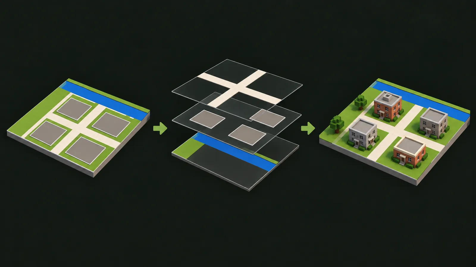
OpenStreetMap supplies roads, building footprints, water and land use for your Minecraft world. Select an area on the map to turn its geographic features into blocks.
From geographic features to blocks
Choose a location on the map, select a small rectangle, and let the generator work with the available geographic features. The selected coordinates describe the area; the rendered map picture is not itself converted into blocks.
Arnis-based generation uses mapped objects such as roads and building footprints. Elevation is a separate input used by terrain modes. A map can contain detailed roads but limited building attributes, so different parts of a scene can have different levels of detail.
What each source feature contributes
| Source feature | Contribution | Important limit |
|---|---|---|
| Road geometry | Street positions and connections | Missing mapped roads may be absent. |
| Building footprint | The outline of a building | It does not describe a photographed facade or interior. |
| Building attributes | Additional shape or height information when available | Incomplete attributes limit the result. |
| Water and land use | Mapped water areas and surface context | Coverage and interpretation vary. |
| Elevation data | Landforms in supported terrain modes | This is separate from OSM building footprints. |
Why coverage matters
A sparse map area cannot supply the same detail as a well-mapped neighborhood. A road may exist in the real world without being represented in the data used by the generator. A building outline may be present while its height is unknown.
Search for an address to center the map, then review the mapped buildings and roads before drawing your rectangle. The Google Maps explanation shows how to find the same real-world location in the generator.
For a useful first result, choose a well-mapped neighborhood and start with a compact selection.
Choose a useful first selection
- Search for a place you know well enough to recognize its streets or river shape.
- Zoom in and choose a compact neighborhood with mapped buildings and connected roads.
- Keep the area within the live limit and select the mode that matches your goal.
- Generate a small result, download the correct edition, and inspect it before attempting a larger area.
Use the city generator for neighborhood planning or the terrain page to compare modes. These pages use the same core generation service, with different guidance and defaults.
Files, imagery and updates
The live map is the starting point: search for a location, draw a rectangle, and choose the edition and generation mode shown in the tool.
OpenStreetMap is maintained by contributors. For map corrections, follow the project's editing guidance and map real features. The generator uses the data available at the time of generation.
Sources and attribution
Map data is credited to OpenStreetMap contributors. See OpenStreetMap's copyright and license page for data licensing and attribution information. The live map keeps its attribution visible.
For the upstream generator, consult the Arnis repository. This site's current capabilities, area limit and available modes are shown in the online tool, rather than inferred from upstream screenshots.
Ready to create a world? Select a location in the online generator and download your Java world.