Skip to content

Japan / City map

Osaka Minecraft Map

Central Osaka in one Minecraft world, from Osaka Station and the Umeda Sky Building in the north to Tennoji and Abeno Harukas in the south. This Osaka Minecraft map covers 33.6 km² built from real OpenStreetMap data: Osaka Castle inside its double ring of moats, the Okawa river and the island of Nakanoshima, the 4 km of Midosuji, the Dotonbori canal through Namba, Shinsekai under Tsutenkaku, and Shitennoji on the ridge that runs down the east side of the city. You spawn on Ebisu-bashi, the bridge over Dotonbori in front of the Glico sign. Download it for Java or Bedrock, or open it in the in-browser player on this site.

Java Edition · Bedrock Edition

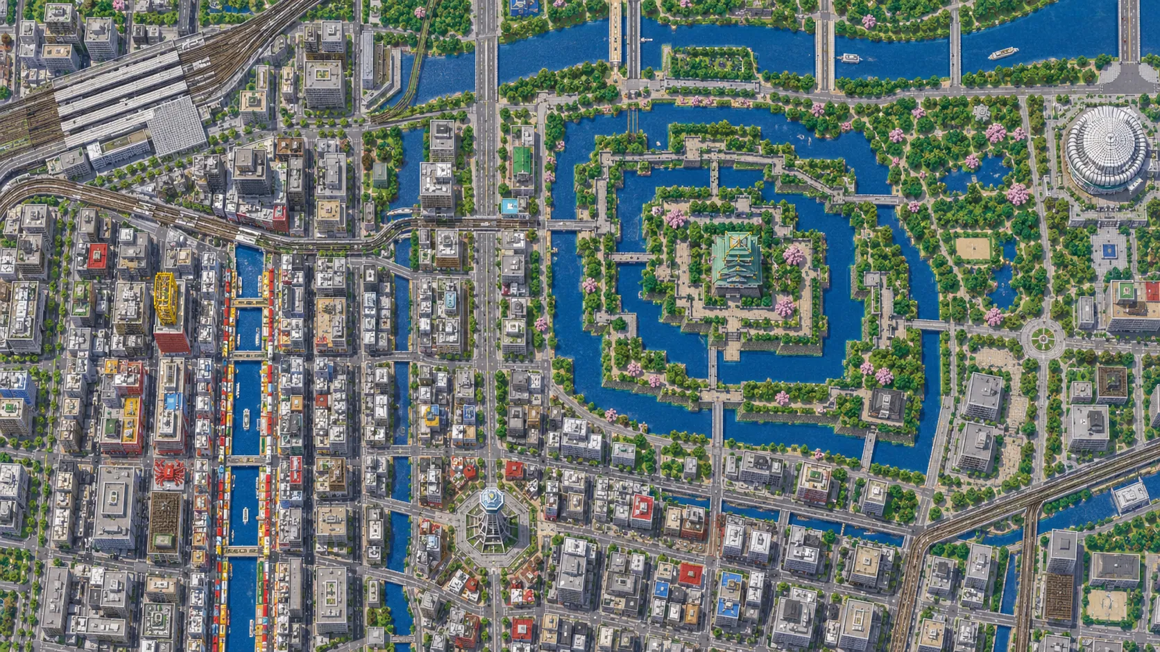
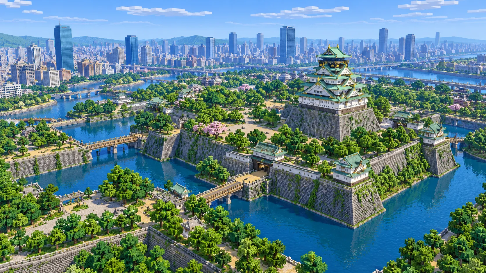
Illustration of Osaka Castle in Minecraft blocks seen from high above: a white and green castle tower with gold trim on tall stone walls, ringed by wide moats with bridges and trees, and a city of high-rises along a river behind it
Illustrations. Generated worlds follow OpenStreetMap data and differ in detail.
Starting area
Central Osaka: Osaka Castle, Umeda, Dotonbori & Tsutenkaku
Size
33.6 km²
Editions
Java & Bedrock
Download
Ready to play
Data
OpenStreetMap

01 / Overview

Overview: Osaka as a Minecraft world

The map is a tall rectangle, about 4.6 km from west to east and 7.3 km from north to south. The north edge runs just past the Umeda Sky Building, a little short of the north end of the Tenjinbashi-suji arcade; the south edge just below Abeno Harukas and Tennoji Station. On the east side the map takes in the whole of Osaka Castle Park and the office towers of Osaka Business Park; on the west it stops about 1 km short of the Kyocera Dome, running just west of Umeda and Amerikamura and cutting across the west end of Nakanoshima. Kita, the northern center around Umeda, and Minami, the southern one around Namba and Dotonbori, are both inside, along with everything between them.

Midosuji, the main street of the city, runs straight down the middle for about 4 km, from Umeda to Namba. Water crosses it from east to west twice: first the rivers around Nakanoshima, a long island between the Dojima and Tosabori rivers that holds City Hall and the old public buildings, and 2.6 km further south the Dotonbori canal, dug between 1612 and 1615. On the east side the Okawa river bends around the north of Osaka Castle. Bridges cross the water every few hundred blocks, and the moats around the castle are wider than most streets.

The world is generated, not built by hand. The generator reads streets, building footprints, rivers, moats, parks and land cover from OpenStreetMap, turns them into blocks at about one block per meter and shapes the ground from elevation data. From the spawn on Ebisu-bashi it is about 800 m south-east to Kuromon Market, 1.9 km south to Tsutenkaku, 2.1 km south-east to Shitennoji, 2.8 km south-south-east to Abeno Harukas, 2.7 km north to the Central Public Hall on Nakanoshima, 3 km north-east to the castle tower and 4.1 km north to the Umeda Sky Building.

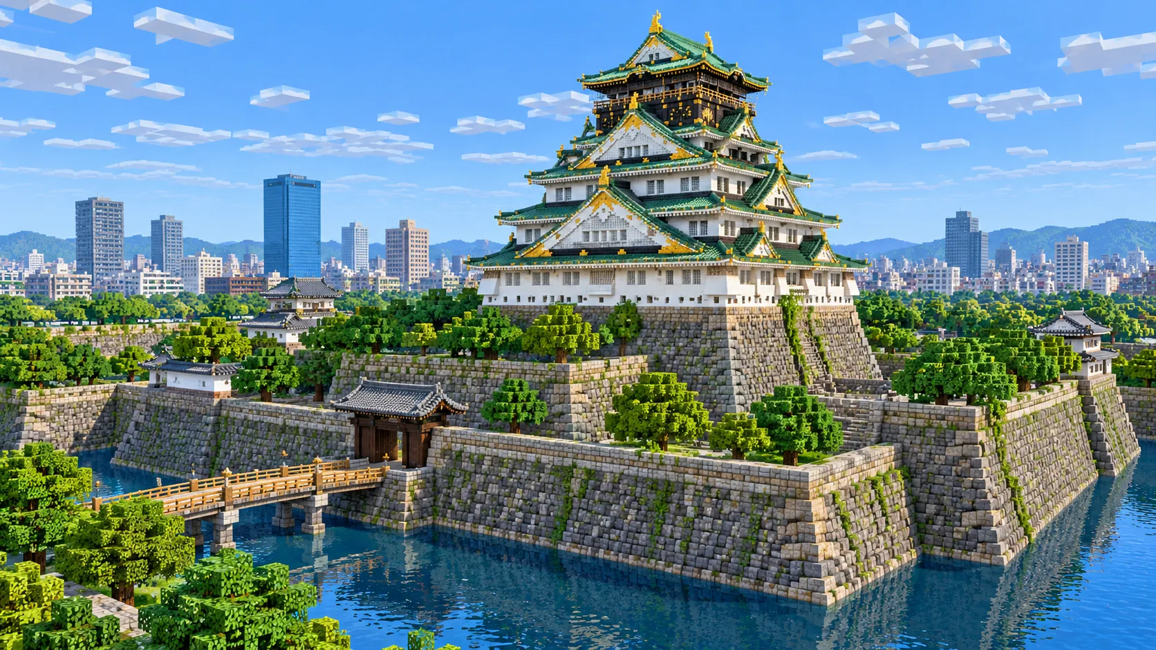
Illustration of the main tower of Osaka Castle built from Minecraft blocks: five tiers of white walls, green roofs and gold ornaments on a stone base above a moat, with a wooden bridge and gate in front and office towers in the distance
Illustrations. Generated worlds follow OpenStreetMap data and differ in detail.

02 / Inside the map

What's included in the Osaka map

The recommended starting area covers Osaka Castle, its moats and park, Osaka-jo Hall, Osaka Business Park, the Okawa river, Osaka Tenmangu, the Tenjinbashi-suji shopping street, Nakanoshima with the Central Public Hall, the Nakanoshima Library and City Hall, Osaka Station and Grand Front Osaka, the Umeda Sky Building, the HEP Five Ferris wheel, Midosuji, Shinsaibashi-suji, Amerikamura, Dotonbori and Ebisu-bashi, Hozenji Yokocho, Namba, Kuromon Market, Den Den Town, Shinsekai and Tsutenkaku, Tennoji Park with Chausuyama and Tennoji Zoo, Shitennoji and Abeno Harukas. Places marked as separate presets are outside it. Open them from the customize section below.

  • Starting area

    Osaka Castle and its moats

    Toyotomi Hideyoshi began the castle in 1583. It was destroyed in the Summer Siege of 1615, and the Tokugawa shoguns rebuilt it with the stone walls that stand today. The present main tower dates from 1931 and is steel-framed concrete: 39.4 m tall on a 13.3 m stone base, with a museum inside. Around it, Osaka Castle Park covers about 106 hectares, with Osaka-jo Hall on its east side. The two rings of moats and the walled islands are the clearest shapes in the whole world.

  • Starting area

    Dotonbori and Ebisu-bashi

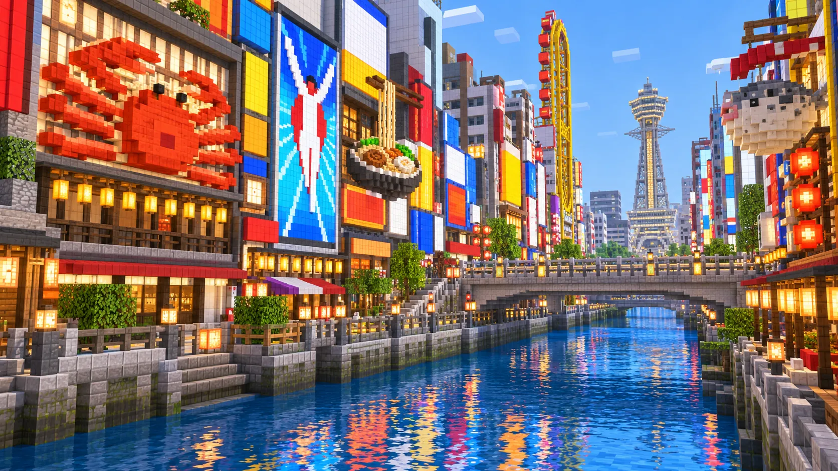
    The spawn is on Ebisu-bashi, where the Shinsaibashi-suji and Ebisubashi-suji arcades meet across the canal, one block east of Midosuji. The Glico running man has been on the wall beside it since 1935; the current sign is the sixth. When the Hanshin Tigers win the pennant, some fans jump from this bridge into the canal, most famously in 1985 and 2003, despite police warnings. East of the bridge, the Tombori River Walk follows both banks past the restaurants; Hozenji Yokocho, a stone-paved alley with a moss-covered Fudo statue, is one block south.

  • Starting area

    Shinsaibashi-suji, Amerikamura and Kuromon Market

    North of Ebisu-bashi, the covered Shinsaibashi-suji arcade runs about 600 m to Nagahori-dori. West of it, across Midosuji, is Amerikamura, a district of clothing shops and cafés around a small square. About 800 m south-east of the spawn, Kuromon Market is a covered street of fish, meat and street-food stalls, about 580 m long, with the electronics and anime shops of Den Den Town just south of it.

  • Starting area

    Nakanoshima and the Okawa

    Osaka City Hall, the domed Nakanoshima Library of 1904 and the red-brick Central Public Hall of 1918 stand side by side on the island’s eastern half. Upstream, the Okawa River curves around the north of the castle park; Osaka Tenmangu stands a few streets north of it, near Tenjinbashi, and its Tenjin Matsuri on 24 and 25 July ends with about a hundred boats on the river. Tenjinbashi-suji, about 2.6 km and often called Japan’s longest shopping street, runs north from the shrine to the top edge of the map.

  • Starting area

    Umeda and the Umeda Sky Building

    Osaka Station, its rail yard and the towers of Grand Front Osaka fill the north-west corner. The Umeda Sky Building, finished in 1993, is two 173 m towers joined at the top by an open-air observation deck. To the east of the station the red HEP Five Ferris wheel sits on the roof of a shopping building. Midosuji starts here and runs south to Namba.

  • Starting area

    Shinsekai and Tsutenkaku

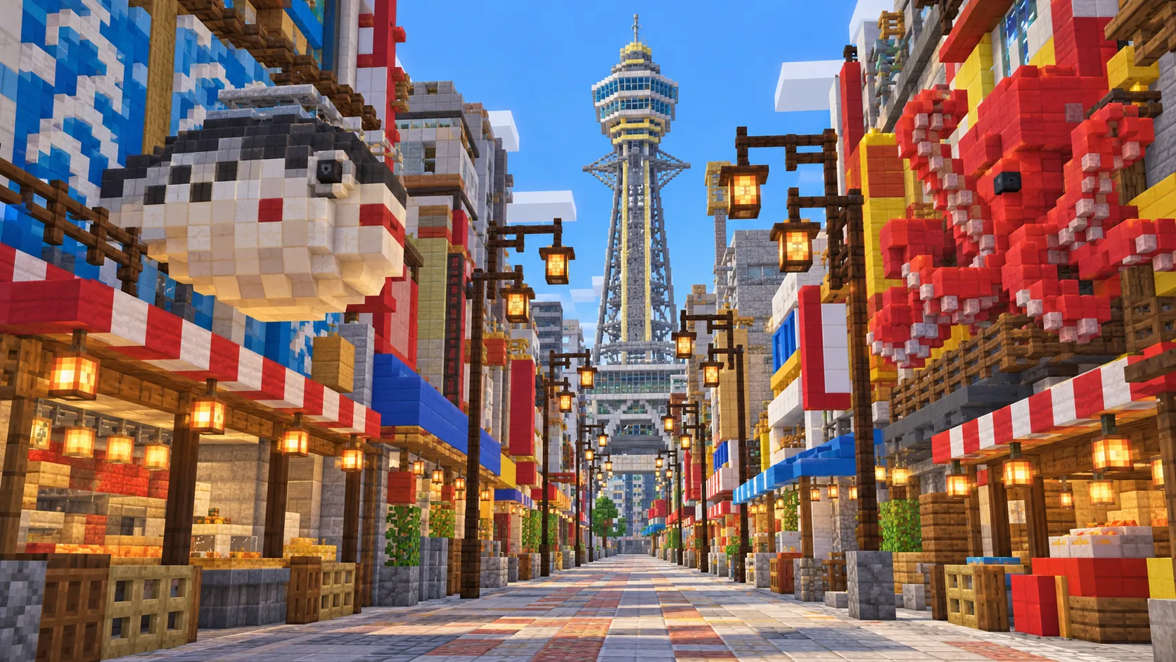
    Shinsekai, the “New World” district, was laid out around an amusement park in 1912, with a tower modeled on the Eiffel Tower in the middle. That tower was taken down during the war. The present Tsutenkaku was built in 1956 to a design by Tachu Naito, who also engineered Tokyo Tower, and is 108 m tall including its lightning rod. Kushikatsu restaurants line the streets that radiate from it, and the Billiken, a lucky god, sits in its observation deck.

  • Starting area

    Tennoji Park, Chausuyama and Shitennoji

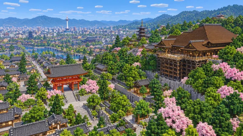
    East of Shinsekai, Tennoji Park holds Tennoji Zoo and Chausuyama, a mound whose top is 26 m above sea level, where Tokugawa Ieyasu camped in the Winter Siege of 1614 and Sanada Yukimura in the summer of 1615. About 700 m north-east, Shitennoji was founded in 593 by Prince Shotoku and is one of the oldest temples in Japan; its present halls and five-story pagoda are post-war concrete rebuilds on the old plan.

  • Starting area

    Abeno Harukas

    Abeno Harukas, opened in 2014, is 300 m tall and was the tallest building in Japan until Azabudai Hills Mori JP Tower in Tokyo passed it in 2023. It stands on the south edge of the map, over Kintetsu Osaka-Abenobashi Station and across the road from JR Tennoji. From the street it is visible across most of the southern half of the map; from its roof, a distant-view mod such as Distant Horizons on Java brings the castle and Umeda into view.

  • Separate preset

    Universal Studios Japan, Kaiyukan and Sumiyoshi Taisha

    Three places many players look for are outside this world. Universal Studios Japan is on the bay about 5 km west of the map’s west edge, next to the Tempozan harbor area with the Kaiyukan aquarium; Sumiyoshi Taisha is about 3.3 km south of the south edge; the Kyocera Dome is about 1 km west. Tempozan with Kaiyukan and Sumiyoshi Taisha each have an area below.

Illustrations. Generated worlds follow OpenStreetMap data and differ in detail.

03 / Why this city

What makes Osaka special in Minecraft

Osaka Castle is the strongest moat-and-wall site in this world. The castle grounds are a set of nested rectangles of water and cut stone, and because OpenStreetMap maps the moats, the walls and the islands separately, the world gets them right: the wide outer moat, the inner moat around the Honmaru, the sloping gates and bridges between them.

Kita and Minami also feel different. Around Umeda the blocks are big, the towers tall and the roads wide; around Namba the streets are narrow, the buildings small and packed, and the Dotonbori canal cuts a straight line through them. Midosuji ties the two together in a single straight line. There is also a little terrain. Most of Osaka is flat land barely above sea level, but the Uemachi plateau, a low ridge 10 to 25 m high, runs from the castle south through Shitennoji to Tennoji, so the castle, the temple and the park stand a little above the streets to the west.

What you do not get is the look of the city. The Glico sign, the crab and the other giant shop signs of Dotonbori are not in the data, so the canal comes out as plain blocks of the right size on both banks. Osaka Castle’s tower is a two-step block on the Honmaru, its flat roof at about Y 17, 40 blocks above the courtyard, without the curved roofs, gables or gold trim, Tsutenkaku is a solid tower rather than a steel lattice, and the open-air deck between the Umeda Sky Building’s towers is not modeled. No building has an interior. The illustrations on this page show the city after you build on it; the world gives you the plan, the water and the heights.

04 / Play

Best ways to play the Osaka map

Challenge 01

Rebuild Osaka Castle’s main tower

The base and the moats are already there. The generated tower is a plain two-step block of the right height. Recut it into five outer tiers, about 39 blocks from the top of the stone platform to the ridge, with white concrete walls, roofs of oxidized copper stairs and slabs, and gold blocks for the shachihoko on the ridges and the tiger reliefs below the gables. Then walk around the walls and find the Tako-ishi, the largest stone in the castle, in the Sakuramon gate court south of the tower.

Challenge 02

Light up Dotonbori

Both banks of the canal between Ebisu-bashi and Nipponbashi are plain walls in the world. Fill them in: a running figure in white and blue wool beside the spawn, a giant crab with moving legs made from pistons on the restaurant to the east, and lanterns, glowstone and colored concrete on every frontage. At night, with the canal reflecting them, this is the view on every Osaka postcard.

Challenge 03

Drive or walk Midosuji

Midosuji runs from Umeda to Namba and has been one-way southbound since 1970, a wide boulevard under four rows of ginkgo trees. Lay a minecart track or a road down it from Osaka Station, past Nakanoshima and Shinsaibashi, to Namba Station, and fake the autumn ginkgos with yellow wool or yellow concrete on birch trunks, or use a resource pack. It is the straight spine of the map: Kita, Nakanoshima and Minami all hang off it.

Challenge 04

Hold the Tenjin Matsuri on the Okawa

On the evening of 25 July, about a hundred boats sail on the Okawa near Osaka Tenmangu while fireworks go up over the river. Build barges from blocks, with lanterns and note blocks for drums, and line them up on the river between Tenjinbashi and Sakuranomiya. Put dispensers of firework rockets along the banks and in the castle park, wired to a clock, so the tower stands against them.

05 / Download

Download and install

Download the Central Osaka: Osaka Castle, Umeda, Dotonbori & Tsutenkaku starting area as a ready-made world for Java or Bedrock Edition.

Java Edition

  1. UnzipExtract the ZIP to get a folder with level.dat inside.
  2. CopyMove the folder into .minecraft/saves.
  3. PlayOpen Minecraft Java Edition and choose Singleplayer.

Bedrock Edition

  1. OpenOn Windows, double-click the .mcworld file. On phones and tablets, open it with Minecraft.
  2. ImportMinecraft imports the world automatically.
  3. PlayFind the new world in your Worlds list and open it.

If the world does not show up

  • Java: check that level.dat sits directly inside the world folder, not one folder deeper.
  • Bedrock: if double-clicking does nothing, open Minecraft first and then open the .mcworld file again.
  • Open the world with the listed Minecraft version or a newer one.
  • Lower your render distance if a large city loads slowly at first.

Step-by-step help: Java import guide · Bedrock import guide

Osaka mapCentral Osaka: Osaka Castle, Umeda, Dotonbori & Tsutenkaku

  • Java Edition

    ZIP world folder

    • 286 MB
    • 33.6 km²
    • Java 1.21.4
  • Bedrock Edition

    .mcworld file

    • 175 MB
    • 33.6 km²
    • Bedrock 1.21

06 / Customize

Customize this Osaka map

Each area opens the generator with the rectangle already drawn. Move it, resize it or change the mode before you generate.

Osaka: Osaka Castle, Umeda, Dotonbori & Tsutenkaku

33.6 km²

The area of this map: central Osaka from Umeda to Tennoji, with Osaka Castle, Nakanoshima, Dotonbori, Shinsekai and Abeno Harukas, about 33.6 km².

Open in generator

Sumiyoshi Taisha

2.4 km²

About 2.4 km² around Sumiyoshi Taisha, 3.3 km south of this map: the shrine with its steep arched Sorihashi bridge and its four main halls in the Sumiyoshi-zukuri style, built in 1810 and listed as national treasures.

Open in generator

Tempozan & Kaiyukan Aquarium

2.4 km²

About 2.4 km² of the Tempozan harbor on Osaka Bay, 5 km west of this map: the Kaiyukan aquarium, opened in 1990, the Tempozan Ferris wheel, 112.5 m tall, and Tempozan itself, a hill of 4.5 m and one of the lowest named mountains in Japan.

Open in generator

07 / Limits

What to expect from the map data

  • The map covers 33.6 km², from 34.643° to 34.709° N and 135.487° to 135.537° E. At about one block per meter the world is roughly 4,580 × 7,330 blocks.
  • The ground comes from elevation data. The lowland streets of Kita and Minami, Midosuji among them, sit at about Y -52, with the Dotonbori canal just below. On the east side the Uemachi plateau rises to between Y -40 and Y -33 along Tanimachi-suji and around Shitennoji and Tennoji Park; Chausuyama tops out near Y -24, and the Honmaru of Osaka Castle, on its stone walls, is at about Y -23. The tallest structure is Abeno Harukas, which reaches Y 264, about 300 blocks above the street; the Umeda Sky Building tops out at Y 119 and Tsutenkaku at Y 59. The build limit is Y 319.
  • Streets, building footprints, rivers, canals, moats, parks, rail lines and land cover come from OpenStreetMap. Building heights come from height and level tags where they exist and a default height where they do not.
  • Roof shapes, castle gables, shop signs, billboards, the steel lattice of Tsutenkaku, the Sky Building’s top bridge, interiors and the subway are not generated. The bridges are road decks over the water.
  • OpenStreetMap is edited by volunteers, so coverage varies from street to street, and recent changes may be missing.

Map data © OpenStreetMap contributors, available under the Open Database License. Generated with the open-source Arnis project.

Questions before you generate

What does the Osaka Minecraft map include?

Central Osaka from Umeda to Tennoji: Osaka Castle and its park, Osaka Business Park, the Okawa and Osaka Tenmangu, Nakanoshima, Osaka Station and the Umeda Sky Building, Midosuji, Shinsaibashi, Amerikamura, Dotonbori, Namba, Kuromon Market, Den Den Town, Shinsekai and Tsutenkaku, Tennoji Park, Shitennoji and Abeno Harukas. Universal Studios Japan, the Kaiyukan and Sumiyoshi Taisha are outside it.

Is the Osaka map free?

No. It costs $6.99 or 700 points, paid once. You keep it: the Java and Bedrock versions stay in your account to download again, and you can open it in the in-browser player on this site.

Does the Osaka map work with Minecraft Java Edition?

Yes. The Java download is a ZIP of about 300 MB, saved in Java 1.21.4. Unzip it so the world folder sits directly in .minecraft/saves, not inside a second folder, then open it from Singleplayer. Newer Java versions upgrade the world when they load it.

Is there a Bedrock version of the Osaka map?

Yes. The Bedrock download is an .mcworld file of about 185 MB. Open it on Windows, Android or iOS and Minecraft imports the world. Consoles cannot import .mcworld files directly, and Mac has no Bedrock Edition, so Mac players should use the Java version.

Is Universal Studios Japan in the map?

No. Universal Studios Japan is on Osaka Bay, about 5 km west of the map’s west edge and about 6.3 km from the spawn. The Tempozan area on this page generates the harbor across the water from it, with the Kaiyukan aquarium and the Ferris wheel, as a separate world of about 2.4 km².

Does Osaka Castle look like the real one?

In plan, yes: the moats, stone walls, islands, gates and bridges follow the mapped layout, and the tower stands on its base in the right place. The tower itself is a two-step block about 40 blocks tall, without the curved green roofs, white walls and gold ornaments, so it is a base to rebuild on rather than a finished castle.

Is the Glico sign in the map?

No. Shop signs and billboards are not in OpenStreetMap, so the wall beside Ebisu-bashi is plain. The bridge, the canal, the riverside walks and the buildings on both banks are all in place, and you spawn on the bridge itself.

Is the Osaka map 1:1 scale?

Across the ground, yes: about one block per meter, so the world is roughly 4,580 × 7,330 blocks and the walk from the spawn on Ebisu-bashi to the castle tower is about 3,000 blocks in a straight line. Building heights follow OpenStreetMap tags and fall back to a default height where there are none.

What game mode does the world open in?

Creative, at midday, with the spawn point on Ebisu-bashi over the Dotonbori canal, between Shinsaibashi-suji and Namba. Switch to Survival with /gamemode survival once you are in the world.

Can I use the Osaka map on a server?

Yes. Put the Java world folder next to your server jar and set level-name in server.properties to its folder name. For Bedrock Dedicated Server, rename the .mcworld to .zip, extract it into its own folder inside worlds and set level-name to that folder’s name. Keep the OpenStreetMap attribution file that comes with the world.
More maps

Browse all city maps · City generator · Terrain generator