Skip to content

Japan / City map

Kyoto Minecraft Map

Central Kyoto in one Minecraft world, from the To-ji pagoda and Kyoto Station in the south to the Imperial Palace and Ginkaku-ji in the north. This Kyoto Minecraft map covers 32.7 km² built from real OpenStreetMap data: the old checkerboard of streets, the Kamo River, Gion and Pontocho, the Higashiyama temples from Kiyomizu-dera to Nanzen-ji, Nijo Castle with its moats, and the slope where the Daimonji fire is lit every August. You spawn on the Shijo Bridge over the Kamo River. Download it for Java or Bedrock, or open it in the in-browser player on this site.

Java Edition · Bedrock Edition

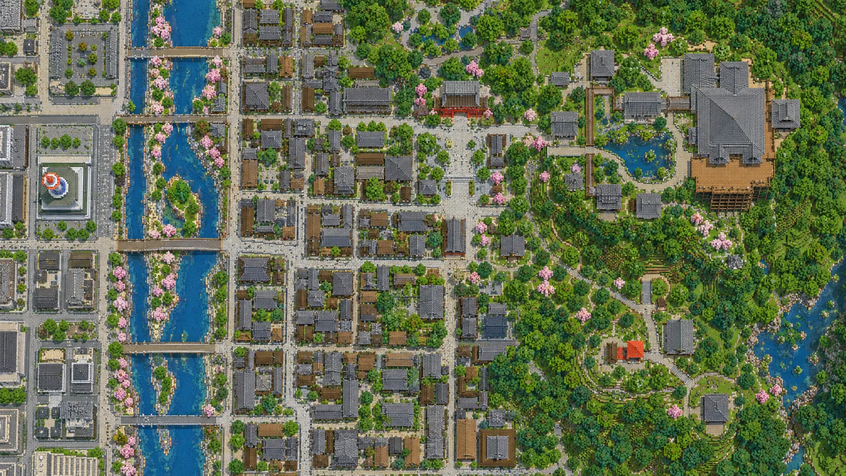
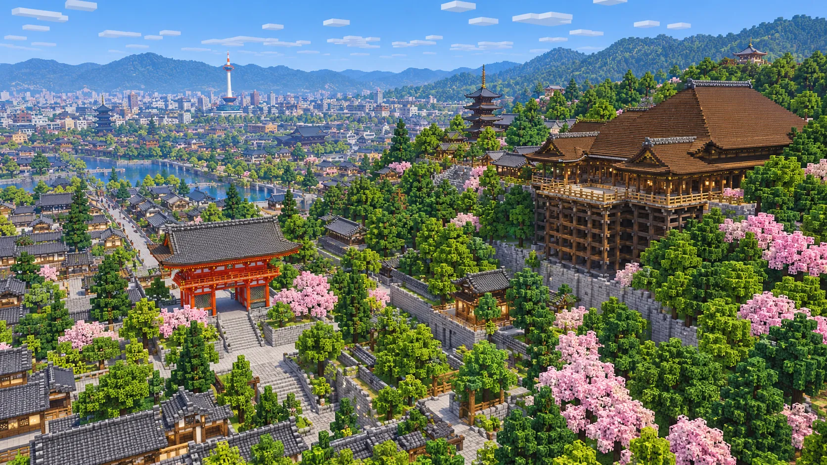
Illustration of Kyoto in Minecraft blocks seen from high above: a large wooden temple hall on a timber stage over a wooded slope, a vermilion gate and a pagoda among cherry trees, tiled roofs down the hill, a river with bridges and a slender white tower in the distance
Illustrations. Generated worlds follow OpenStreetMap data and differ in detail.
Starting area
Central Kyoto: Higashiyama, Gion, Nijo Castle & Kyoto Station
Size
32.7 km²
Editions
Java & Bedrock
Download
Ready to play
Data
OpenStreetMap

01 / Overview

Overview: Kyoto as a Minecraft world

The map is close to a square, about 5.7 km east to west and 5.8 km north to south. Its south edge runs just below To-ji and Kyoto Station, its north edge along Imadegawa-dori past the top of the Imperial Palace park, its west edge just outside the moats of Nijo Castle, and its east edge up the wooded Higashiyama hills, far enough to take in the Daimonji fire bed. The Kamo River runs down the middle from the point where its two branches meet at Demachiyanagi, on the north edge, to below the Shichijo Bridge.

Kyoto was laid out in 794 as Heian-kyo, a capital on a Chinese-style grid, and stayed the seat of the emperor until 1868. Much of that grid survives west of the river. The east–west streets are still counted from the north, so Sanjo means Third Street and Shijo Fourth Street, and they cross long north–south streets such as Karasuma and Kawaramachi. In the world those streets form a clean checkerboard of narrow blocks. East of the river the grid gives way to Gion and the temple slopes of Higashiyama.

The world is generated, not built by hand. The generator reads streets, building footprints, the river, the castle moats, parks and land cover from OpenStreetMap, turns them into blocks at about one block per meter and shapes the ground from elevation data. From the spawn on the Shijo Bridge it is 650 m east to Yasaka Shrine, 1.6 km south-east to Kiyomizu-dera, 2.4 km to Nijo Castle in the west-north-west and 2.4 km south-south-west to Kyoto Station.

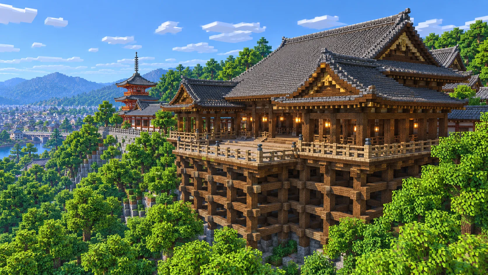
Illustration of Kiyomizu-dera built from Minecraft blocks: a hall with a wide grey tiled roof on a wooden stage held up by a lattice of pillars, with a red three-story pagoda and wooded hills behind
Illustrations. Generated worlds follow OpenStreetMap data and differ in detail.

02 / Inside the map

What's included in the Kyoto map

The recommended starting area covers Kiyomizu-dera, Sannenzaka and Ninenzaka, the Yasaka Pagoda, Kodai-ji, Yasaka Shrine, Chion-in, Gion and Hanamikoji, Pontocho, the Kamo River with the Shijo and Sanjo bridges, Nishiki Market, Nijo Castle, the Kyoto Imperial Palace and Kyoto Gyoen, Heian Shrine, Nanzen-ji and its brick aqueduct, the Philosopher’s Path, Ginkaku-ji, the Daimonji fire bed, Sanjusangen-do, the Kyoto National Museum, Higashi and Nishi Hongan-ji, Kyoto Station, Kyoto Tower and the To-ji five-story pagoda. Places marked as separate presets are outside it. Open them from the customize section below.

  • Starting area

    Kiyomizu-dera and the Sannenzaka slopes

    The temple was founded in 778, and most of its present buildings date from a rebuilding finished in 1633. Its main hall stands on a wooden stage 13 m above the slope, held up by a frame of zelkova pillars with no nails. The stone-paved lanes of Sannenzaka and Ninenzaka climb up to it from the north past wooden shops; the 46 m Yasaka Pagoda of Hokan-ji rises just off them on Yasaka-dori.

  • Starting area

    Yasaka Shrine, Gion and Hanamikoji

    From the spawn, Shijo-dori runs east off the bridge through Gion and ends at the vermilion West Gate of Yasaka Shrine, about 650 m away. The Gion Matsuri, held all through July, is this shrine’s festival. South of Shijo, Hanamikoji is the main street of Gion’s teahouse district, a straight lane of wooden machiya with Kennin-ji, Kyoto’s oldest Zen temple, at its far end.

  • Starting area

    Pontocho, the Kamo River and Nishiki Market

    Pontocho is a lane only a few meters wide that runs about 500 m between the Sanjo and Shijo bridges on the west bank. From May to September its restaurants put out wooden dining platforms over the riverside channel. One block north of Shijo-dori, Nishiki Market is a roofed street of food stalls about 390 m long, running west from Teramachi to Takakura.

  • Starting area

    Nijo Castle

    Tokugawa Ieyasu began the castle in 1601 as his base in the capital, and in 1867 the last shogun announced the return of power to the emperor in its Ninomaru Palace. The grounds are a rectangle of roughly 500 by 400 m inside a stone-walled outer moat, with an inner moat around the Honmaru. In the world both moats and the walled islands are easy to read from above; the palace halls are flat-roofed outlines.

  • Starting area

    The Imperial Palace and Kyoto Gyoen

    The palace and its park take up a rectangle 1.3 km long at the north edge of the map, about 2.5 km north of the spawn. The walled palace enclosure sits inside the park, which is mostly gravel avenues, lawns and pine trees. The present palace buildings were rebuilt in 1855.

  • Starting area

    Heian Shrine, Nanzen-ji and the Philosopher’s Path

    Heian Shrine was built in 1895 for the 1,100th anniversary of the capital; its concrete torii, 24.4 m tall and built in 1929, stands over the approach road to the south. Nanzen-ji, about 1 km south-east, has a large wooden gate and a red-brick aqueduct of 1888 that carries the Lake Biwa Canal through the temple grounds. From near there the Philosopher’s Path (Tetsugaku-no-michi) follows a canal about 2 km north to Ginkaku-ji.

  • Starting area

    Ginkaku-ji and the Daimonji fire bed

    Ginkaku-ji, the Silver Pavilion, began as the retirement villa of the shogun Ashikaga Yoshimasa in 1482; it was never covered in silver. Above it, on the west face of Daimonji-yama, is the bare slope where the character 大 is lit in a line of pine-wood fires at 8 pm every 16 August, its strokes 80, 160 and 120 m long. The slope is inside the map; the summit of the hill is just outside the east edge.

  • Starting area

    Kyoto Station, Kyoto Tower and To-ji

    The station building, opened in 1997, is 470 m long and 60 m tall. Kyoto Tower, 131 m tall and opened in 1964, stands across Shiokoji-dori and is the tallest structure in the map. About 1.2 km west-south-west, To-ji’s five-story wooden pagoda, rebuilt in 1644, is 55 m tall, the tallest wooden pagoda in Japan. Just north of the station are the two huge temple compounds of Higashi and Nishi Hongan-ji, and to the east, across the river, Sanjusangen-do, a hall 120 m long with 1,001 statues of Kannon.

  • Separate preset

    Kinkaku-ji, Fushimi Inari and Arashiyama

    Three places many players look for are outside this world. Kinkaku-ji, the Golden Pavilion, is about 1.7 km north-west of the map’s north-west corner; Fushimi Inari Taisha and its tunnels of torii are about 1.2 km south of the south edge; Arashiyama and its bamboo grove are about 6.5 km west of the west edge. Kinkaku-ji and Fushimi Inari each have an area below.

Illustrations. Generated worlds follow OpenStreetMap data and differ in detail.

03 / Why this city

What makes Kyoto special in Minecraft

Kyoto is a low city. Since 2007 most of the center has had a height limit of 31 m, with lower limits in the historic districts, so the generated world is a wide carpet of two- and three-story buildings rather than a skyline. The few tall things stand out: Kyoto Tower, the station building, the To-ji pagoda and the temple halls. From the top of Kyoto Tower you look down on the station, the Hongan-ji roofs and the grid running north; with a distant-view mod such as Distant Horizons you can see the hills on three sides and the river running down the middle.

It also has real terrain on one side. The city floor slopes gently down from north to south, and on the east the ground climbs out of Gion into the Higashiyama hills. Kiyomizu-dera, Kodai-ji, Chion-in and Ginkaku-ji sit at the foot of that slope or on it, so the temples sit on terraces above the town, and the Daimonji slope rises well above everything else. The Kamo River gives the world a long north–south line to follow, with low bridges at every main street.

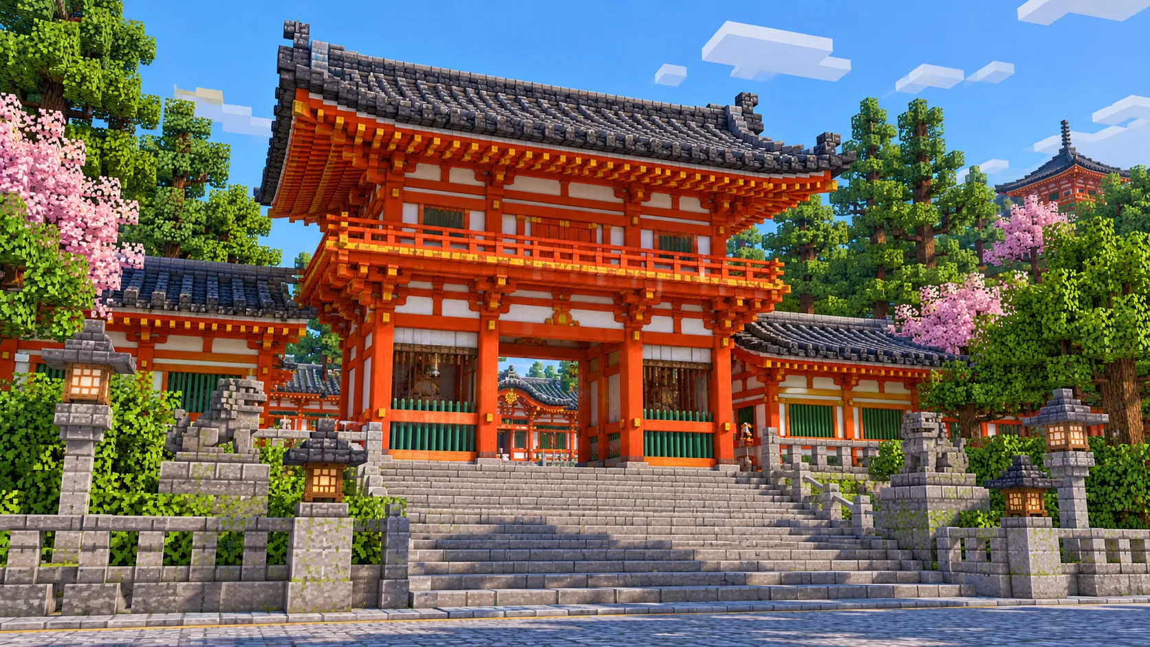
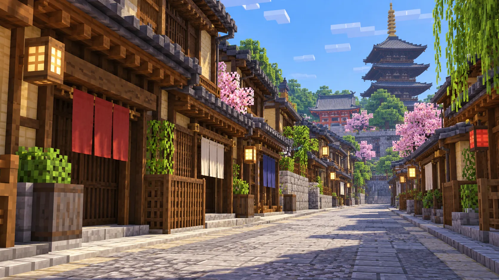
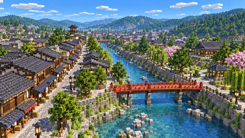
What you do not get is the architecture. Kyoto’s temples are curved tile roofs, deep eaves, bracket sets and vermilion woodwork, and the generator makes none of it: Kiyomizu-dera is a flat-roofed outline on the slope without its pillar stage, the pagodas are plain square towers, Yasaka Shrine’s gate is a block, and the machiya of Gion and Pontocho are boxes without lattices or curtains. Gardens are trees and ponds, not raked gravel. The illustrations on this page show the city after you rebuild it; the world gives you the plan, the river and the hills.

04 / Play

Best ways to play the Kyoto map

Challenge 01

Build the Kiyomizu stage

Start at the temple. Clear the slope under the main hall and build the stage out about 13 blocks above the ground on a frame of spruce logs, crossing the posts with horizontal beams every few blocks, the way the real stage is held up without nails. Then put the hipped roof back with spruce or dark oak stairs and slabs for the cypress-bark thatch, and rebuild the red three-story pagoda to the west, by the entrance gates.

Challenge 02

Run the Gion Matsuri float parade

On 17 July the big floats of the Gion Matsuri roll east along Shijo-dori from Karasuma, turn north at Kawaramachi and west at Oike, about 3 km. Build a few hoko floats, tall towers on four big wheels, save each one with a structure block and load copies along the route. At Kawaramachi and Oike, load the float rotated 90°: the real floats are turned on the spot at each corner, and it is the hardest part of the parade.

Challenge 03

Walk from Kiyomizu-dera to Ginkaku-ji

The classic Higashiyama walk is about 5 km: down Sannenzaka and Ninenzaka past the Yasaka Pagoda, through Maruyama Park behind Yasaka Shrine, past Chion-in’s gate to Heian Shrine and Nanzen-ji, then north along the Philosopher’s Path canal to Ginkaku-ji. Lay a stone lantern path along it and put a tea house at each temple.

Challenge 04

Light the Daimonji

The fire bed is already on the hillside above Ginkaku-ji. Mark out the three strokes of 大 on the slope with netherrack or campfires, about 80, 160 and 120 blocks long, run /gamerule doFireTick false so the fire does not spread into the woods, and light them at night. In the real city the 大 is seen from the Kamo River and most of the center; in the game you need a distant-view mod to see it from the riverbank.

05 / Download

Download and install

Download the Central Kyoto: Higashiyama, Gion, Nijo Castle & Kyoto Station starting area as a ready-made world for Java or Bedrock Edition.

Java Edition

  1. UnzipExtract the ZIP to get a folder with level.dat inside.
  2. CopyMove the folder into .minecraft/saves.
  3. PlayOpen Minecraft Java Edition and choose Singleplayer.

Bedrock Edition

  1. OpenOn Windows, double-click the .mcworld file. On phones and tablets, open it with Minecraft.
  2. ImportMinecraft imports the world automatically.
  3. PlayFind the new world in your Worlds list and open it.

If the world does not show up

  • Java: check that level.dat sits directly inside the world folder, not one folder deeper.
  • Bedrock: if double-clicking does nothing, open Minecraft first and then open the .mcworld file again.
  • Open the world with the listed Minecraft version or a newer one.
  • Lower your render distance if a large city loads slowly at first.

Step-by-step help: Java import guide · Bedrock import guide

Kyoto mapCentral Kyoto: Higashiyama, Gion, Nijo Castle & Kyoto Station

  • Java Edition

    ZIP world folder

    • 294 MB
    • 32.6 km²
    • Java 1.21.4
  • Bedrock Edition

    .mcworld file

    • 177 MB
    • 32.6 km²
    • Bedrock 1.21

06 / Customize

Customize this Kyoto map

Each area opens the generator with the rectangle already drawn. Move it, resize it or change the mode before you generate.

Kyoto: Higashiyama, Gion, Nijo Castle & Kyoto Station

32.7 km²

The area of this map: central Kyoto from To-ji and Kyoto Station to the Imperial Palace and Ginkaku-ji, with Higashiyama, Gion, the Kamo River and Nijo Castle, about 32.7 km².

Open in generator

Fushimi Inari Taisha & Mount Inari

3.6 km²

About 3.7 km² around Fushimi Inari Taisha, about 2.5 km south-east of Kyoto Station: the shrine and the trails of torii up Mount Inari, 233 m above sea level, with the summit inside the area.

Open in generator

Kinkaku-ji & Ryoan-ji

4.4 km²

About 4.4 km² in north-west Kyoto: Kinkaku-ji, the Golden Pavilion on its pond, first built in 1397 and rebuilt in 1955 after a fire, and Ryoan-ji with its rock garden about 1.2 km to the south-west.

Open in generator

07 / Limits

What to expect from the map data

  • The map covers 32.7 km², from 34.978° to 35.030° N and 135.744° to 135.806° E. At about one block per meter the world is roughly 5,660 × 5,780 blocks.
  • The ground comes from elevation data. The city floor slopes from about Y -25 at Imadegawa-dori on the north edge to about Y -50 around Kyoto Station and To-ji, and the Kamo River drops from about Y -31 at Demachiyanagi to about Y -46 at Shichijo. On the east side the ground climbs: the main hall of Kiyomizu-dera is near Y 47, about 85 blocks above Shijo-dori, and the Daimonji fire bed lies between roughly Y 235 and Y 275, close to 300 blocks above the river. The build limit is Y 319.
  • Streets, building footprints, the Kamo River, the castle moats, ponds, parks and land cover come from OpenStreetMap. Building heights come from height and level tags where they exist and a default height where they do not, which suits a low city like Kyoto.
  • Curved roofs, eaves, temple stages, pagoda tiers, torii, lattices, statues, gardens’ raked gravel and interiors are not generated. The bridges are road decks over the water.
  • OpenStreetMap is edited by volunteers, so coverage varies from street to street, and recent changes may be missing.

Map data © OpenStreetMap contributors, available under the Open Database License. Generated with the open-source Arnis project.

Questions before you generate

What does the Kyoto Minecraft map include?

Central Kyoto from To-ji and Kyoto Station to the Imperial Palace and Ginkaku-ji: Kiyomizu-dera and the Sannenzaka slopes, Yasaka Shrine, Gion and Hanamikoji, Pontocho and the Kamo River, Nishiki Market, Nijo Castle, Heian Shrine, Nanzen-ji, the Philosopher’s Path, the Daimonji fire bed, Sanjusangen-do, the Hongan-ji temples and Kyoto Tower. Kinkaku-ji, Fushimi Inari and Arashiyama are outside it.

Is the Kyoto map free?

No. It costs $6.99 or 700 points, paid once. You keep it: the Java and Bedrock versions stay in your account to download again, and you can open it in the in-browser player on this site.

Does the Kyoto map work with Minecraft Java Edition?

Yes. The Java download is a ZIP of about 310 MB, saved in Java 1.21.4. Unzip it so the world folder sits directly in .minecraft/saves, not inside a second folder, then open it from Singleplayer. Newer Java versions upgrade the world when they load it.

Is there a Bedrock version of the Kyoto map?

Yes. The Bedrock download is an .mcworld file of about 185 MB. Open it on Windows, Android or iOS and Minecraft imports the world. Consoles cannot import .mcworld files directly, and Mac has no Bedrock Edition, so Mac players should use the Java version.

Is Kinkaku-ji, the Golden Pavilion, in the map?

No. Kinkaku-ji is in north-west Kyoto, about 1.7 km beyond the corner of this map. Use the Kinkaku-ji area on this page to generate the pavilion, its pond and Ryoan-ji as a separate world of about 4.4 km².

Is Fushimi Inari in the map?

No. The shrine is about 1.2 km south of the map’s south edge. The Fushimi Inari area on this page generates the shrine and Mount Inari as their own world of about 3.7 km². The torii themselves are not generated; the paths up the hill are.

Does Kiyomizu-dera look like the real temple?

Only in plan and position. The main hall is an outline with a flat roof on the hillside, without the wooden stage or the curved roof. Its place on the slope above the town is right, so it is a good base for rebuilding the stage.

Is the Kyoto map 1:1 scale?

Across the ground, yes: about one block per meter, so the world is roughly 5,660 × 5,780 blocks and the walk from the Shijo Bridge to Kiyomizu-dera is about 1,600 blocks in a straight line. Building heights follow OpenStreetMap tags and fall back to a default height where there are none.

What game mode does the world open in?

Creative, at midday, with the spawn point on the Shijo Bridge over the Kamo River, at the west end of Shijo-dori’s run to Gion. Switch to Survival with /gamemode survival once you are in the world.

Can I use the Kyoto map on a server?

Yes. Put the Java world folder next to your server jar and set level-name in server.properties to its folder name. For Bedrock Dedicated Server, rename the .mcworld to .zip, extract it into its own folder inside worlds and set level-name to that folder’s name. Keep the OpenStreetMap attribution file that comes with the world.
More maps

Browse all city maps · City generator · Terrain generator