Skip to content

South Korea / City map

Seoul Minecraft Map

The old royal city of Seoul in one Minecraft world, from Gyeongbokgung down to the top of Namsan. This Seoul Minecraft map covers 21 km² built from real OpenStreetMap data: Gyeongbokgung and Gwanghwamun Square, the hanok lanes of Bukchon, Changdeokgung and Jongmyo, the Cheonggyecheon stream, Myeongdong, Namdaemun and Seoul Station, Dongdaemun Design Plaza, and Namsan with N Seoul Tower. You spawn at the north end of Gwanghwamun Square, looking up the avenue at the palace gate. Download it for Java or Bedrock, or open it in the in-browser player on this site.

Java Edition · Bedrock Edition

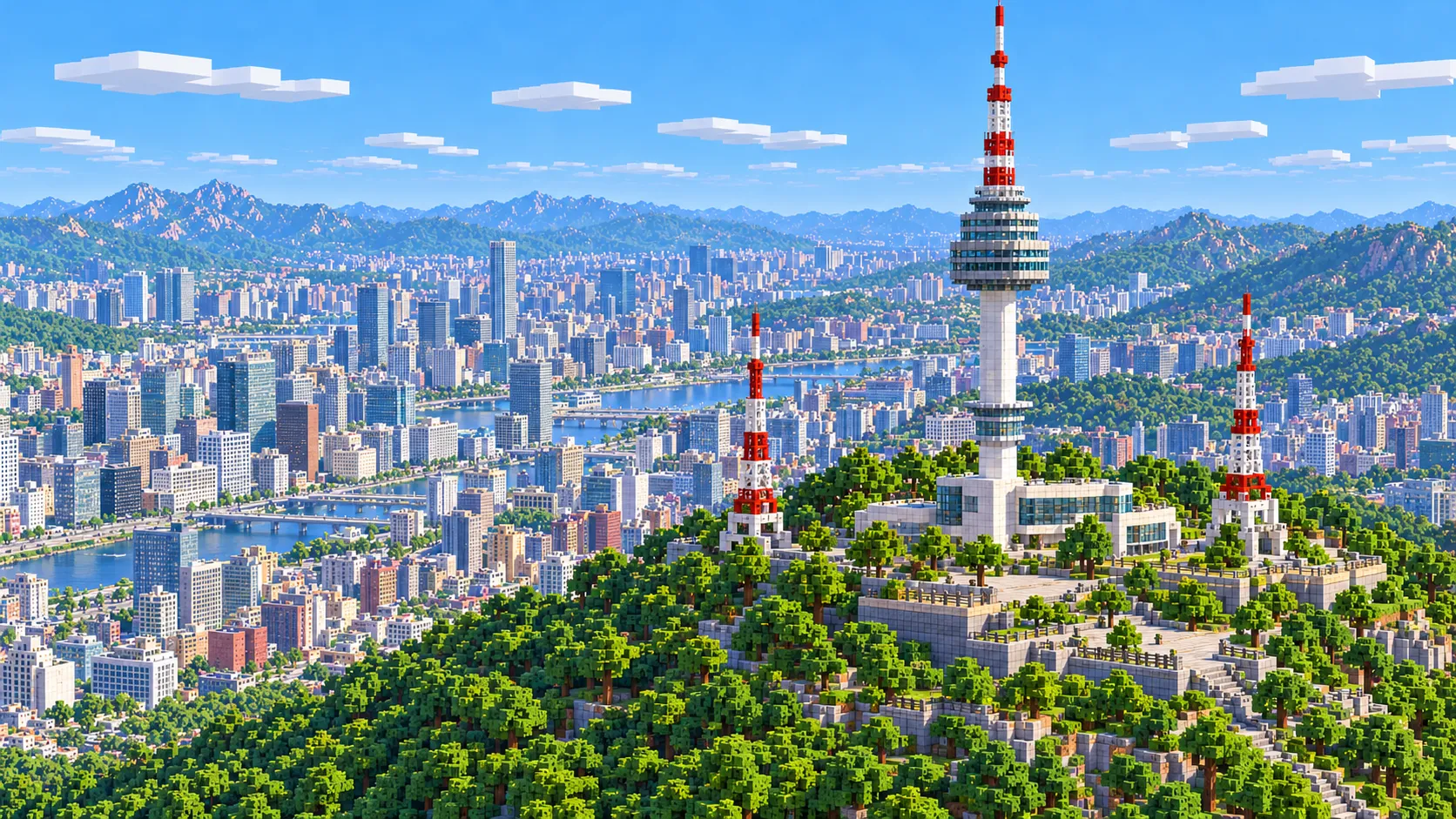
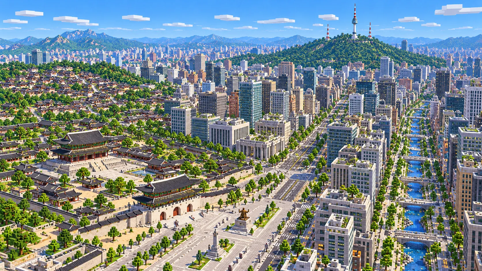
Illustration of central Seoul in Minecraft blocks seen from high above: Gyeongbokgung and Gwanghwamun gate at the head of a wide avenue, office blocks, the Cheonggyecheon stream running between trees, and Namsan with N Seoul Tower in the distance
Illustrations. Generated worlds follow OpenStreetMap data and differ in detail.
Starting area
Central Seoul: Gyeongbokgung, Myeongdong and Namsan
Size
21.1 km²
Editions
Java & Bedrock
Download
Ready to play
Data
OpenStreetMap

01 / Overview

Overview: Seoul as a Minecraft world

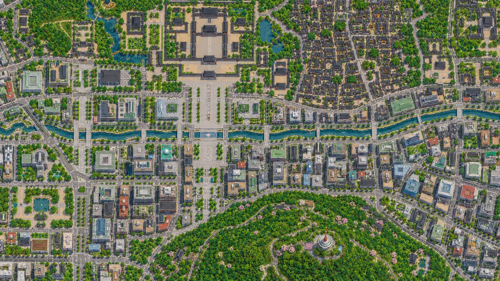
This map is a rectangle of about 4.4 km east to west and 4.8 km north to south, roughly the walled capital of the Joseon dynasty. The north edge runs just above Gyeongbokgung and the main buildings of Cheong Wa Dae, at the foot of Bugaksan. The south edge is about 700 m past the summit of Namsan, so the whole north face of the mountain and the tower are inside. To the west the map takes in Gyeonghuigung and Seoul Station; to the east it reaches Naksan Park, Heunginjimun (the East Gate) and Dongdaemun Design Plaza, which sits right at the edge. The Han River is about 2 km south of the map and is not in it.

Two lines organize the city. The first runs north to south: Gyeongbokgung, Gwanghwamun gate, Gwanghwamun Square and Sejong-daero, which continues past City Hall to Sungnyemun (Namdaemun) and Seoul Station. The second runs west to east: the Cheonggyecheon stream, which starts at Cheonggye Plaza about 500 blocks south of the spawn and flows about 3 km across the map to the Dongdaemun area between paths and bridges. Myeongdong and the shopping streets lie between the stream and Namsan; the palaces, Bukchon and Insadong lie north of it.

The world is generated, not built by hand. The generator reads streets, building footprints, water, parks and land cover from OpenStreetMap, turns them into blocks at about one block per meter and shapes the ground from elevation data. Unlike Shanghai or Chicago, Seoul is not flat. Downtown streets sit low in a basin, Bukchon climbs toward Bugaksan, and Namsan rises about 210 blocks above Myeongdong, so the terrain is half of what makes this map. Every building is still a simplified shape.

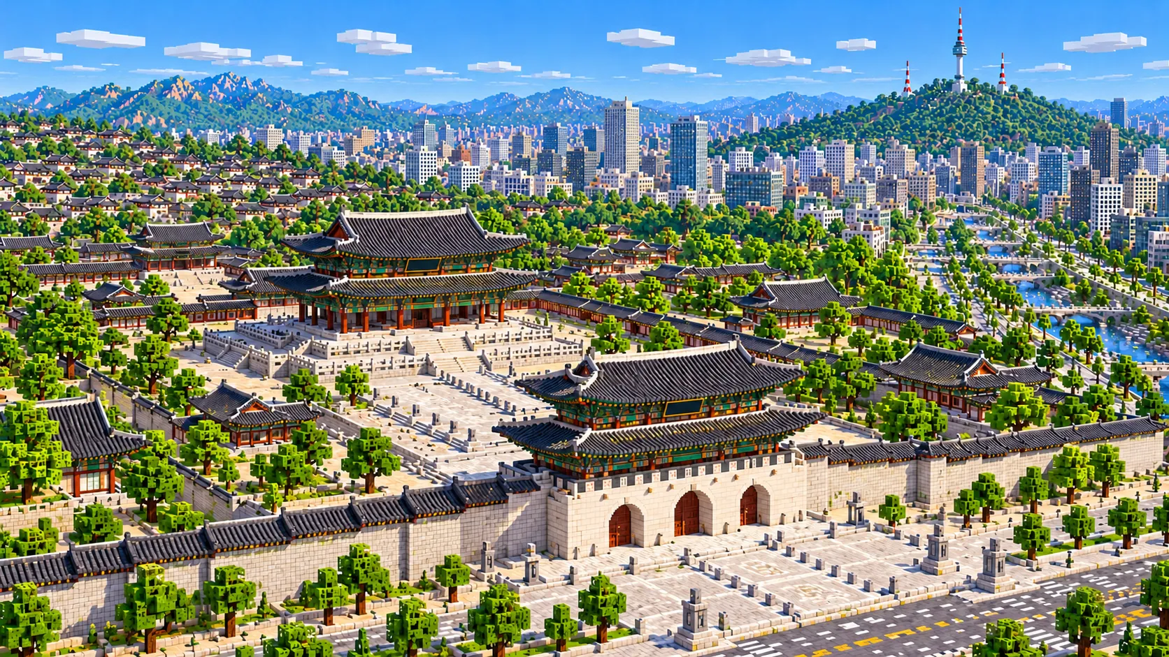
Illustration of Gyeongbokgung in Minecraft blocks: Gwanghwamun gate with its three arched openings in a stone wall, the stone courtyards behind it and the two-tiered throne hall with dark tiled roofs and red and green painted timber
Illustrations. Generated worlds follow OpenStreetMap data and differ in detail.

02 / Inside the map

What's included in the Seoul map

The recommended starting area covers Gyeongbokgung and Gwanghwamun gate, Gwanghwamun Square with the statues of King Sejong and Admiral Yi Sun-sin, Cheong Wa Dae, Bukchon Hanok Village, Changdeokgung and its Secret Garden, Changgyeonggung, Jongmyo, Insadong, the Cheonggyecheon stream, Seoul Plaza and City Hall, Deoksugung, Gyeonghuigung, Myeongdong and Myeongdong Cathedral, Namdaemun Market and Sungnyemun, Seoul Station and Seoullo 7017, Gwangjang Market, Heunginjimun and Dongdaemun Design Plaza, Naksan Park and the city wall, Namsan and N Seoul Tower. Places marked as separate presets are outside it. Open them from the customize section below.

  • Starting area

    Gwanghwamun Square

    The spawn is at the north end of the square, about 140 m north of the seated statue of King Sejong (2009); Admiral Yi Sun-sin (1968) stands about 200 m further south. Statues are not generated, so both spots are empty paving to build on. The square was rebuilt and reopened in 2022, wider on its west side. Ahead of you, about 230 blocks up the avenue, is Gwanghwamun, the main gate of Gyeongbokgung.

  • Starting area

    Gyeongbokgung

    The main royal palace, founded in 1395, burned in 1592 and rebuilt in the 1860s. Gwanghwamun gate was restored to its original position in 2010. Inside the walls, about 43 hectares hold Geunjeongjeon, the throne hall, about 500 blocks from the spawn, and Gyeonghoeru, the banquet pavilion on its square pond, to the west of it.

  • Starting area

    Bukchon Hanok Village

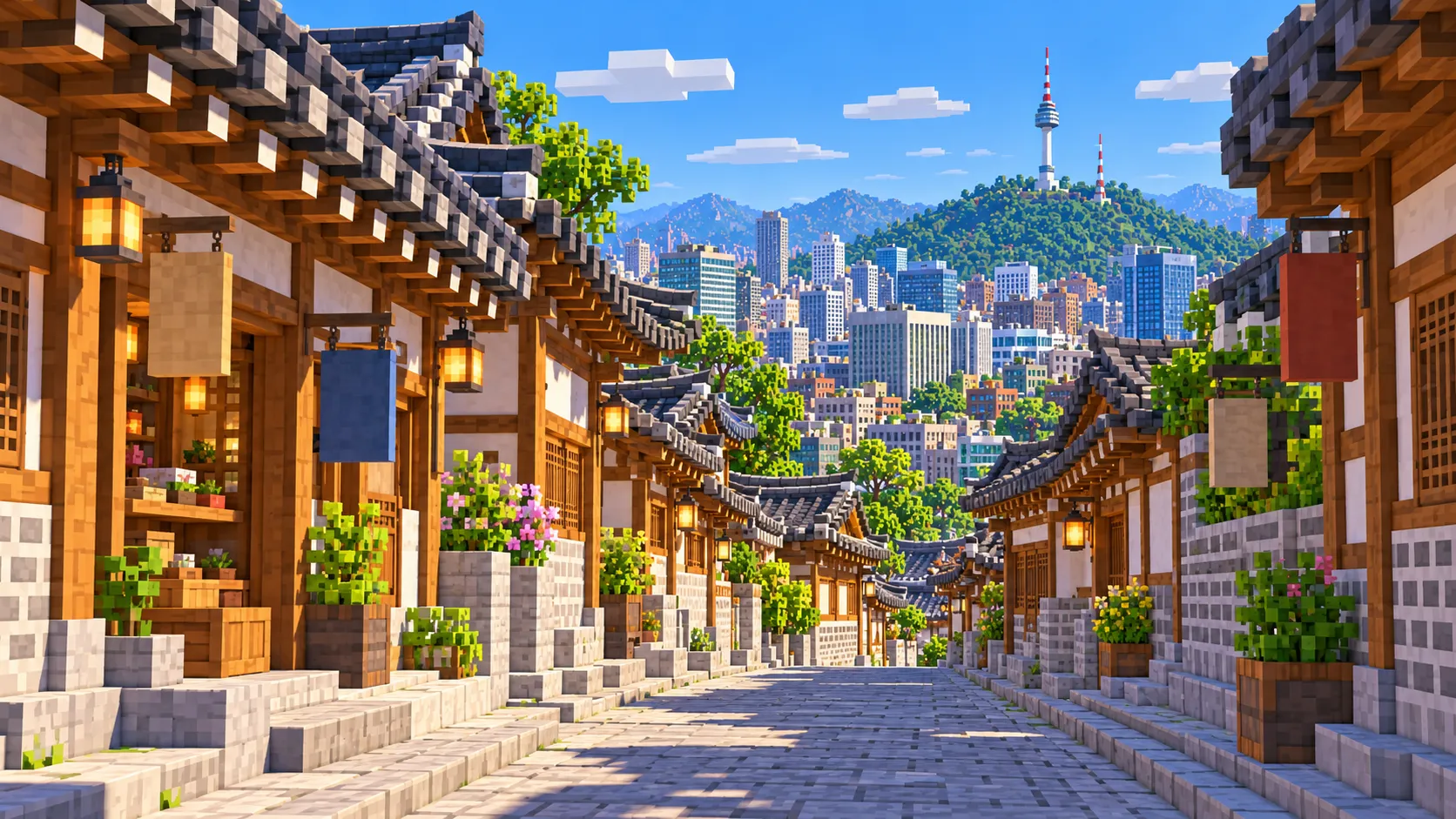
    The hillside between Gyeongbokgung and Changdeokgung is packed with hanok, traditional houses with tiled roofs around small courtyards, on lanes that climb north. In the world the lanes come out as narrow streets, often 3 to 5 blocks wide, so this is the densest part of the map and the best one to explore on foot. In the real Bukchon, since March 2025 tourists may enter the busiest lanes, around Bukchon-ro 11-gil, only between 10 am and 5 pm, because people live there.

  • Starting area

    Changdeokgung, Changgyeonggung and Jongmyo

    East of Bukchon is Changdeokgung, a UNESCO World Heritage palace laid out to follow its hills rather than a straight axis, with the wooded Secret Garden behind it reaching almost to the north edge of the map. Changgyeonggung adjoins it to the east, and Jongmyo, the royal ancestral shrine, lies south of both: three large walled compounds with more trees than buildings.

  • Starting area

    Cheonggyecheon

    The stream was paved over from the late 1950s, with an elevated expressway on top from 1971, until the city tore both down and reopened the stream in 2005. In the map it runs about 3 km from Cheonggye Plaza east to Dongdaemun, a narrow ribbon of water with paths on both banks and bridges every few hundred meters. Gwangjang Market, the covered market famous for bindaetteok stalls, is a block north of it.

  • Starting area

    Myeongdong and Myeongdong Cathedral

    The shopping district is about 1.3 km south-east of the spawn, a grid of small streets between Euljiro and the lower slope of Namsan. On its rise stands Myeongdong Cathedral (1898), the first Gothic-style church built in Korea, its brick spire visible from the streets below.

  • Starting area

    Namsan and N Seoul Tower

    The mountain fills the south of the map: a wooded ridge with the city wall along it and roads and footpaths up from Myeongdong and Huam-dong. N Seoul Tower, 236.7 m tall and opened to visitors in 1980, stands on the summit about 2.7 km south of the spawn. In the world the summit is at about Y 170 to 185, more than 200 blocks above the city streets, so the tower runs into the build limit; see the notes below.

  • Starting area

    Sungnyemun, Seoul Station and Seoullo 7017

    Sungnyemun, the South Gate, was built in 1398, burned in an arson attack in 2008 and reopened in 2013; it stands on a traffic island next to Namdaemun Market. About 700 m south-west is Seoul Station, and beside it Seoullo 7017, a 1970 road overpass turned into a raised walkway in 2017, which crosses the tracks for about 1 km.

  • Separate preset

    Gangnam, Lotte World Tower, Yeouido and the Han River

    Several places people look for are on or across the Han River and outside this world. Lotte World Tower and Lotte World are about 13 km south-east in Jamsil, Yeouido with the National Assembly and the 63 Building is about 7 km south-west, and Gangnam is across the river to the south. Jamsil and Yeouido each have an area below, and the Yeouido area includes the Han River.

Illustrations. Generated worlds follow OpenStreetMap data and differ in detail.

03 / Why this city

What makes Seoul special in Minecraft

Most city maps are flat, with all the height in their buildings. Seoul has real terrain inside its center. The capital was placed in the 1390s in a basin between Bugaksan to the north, Naksan to the east, Inwangsan to the west and Namsan to the south, and the city wall ran along the ridges of all four. Two of them are in this world. You can stand at Gwanghwamun gate, look south down Sejong-daero and see Namsan close the view, as it does in the real city, and you can climb the ridge on the old wall at Naksan Park in the east.

The second thing is the change of scale. Within a few hundred blocks you go from the large stone courtyards of Gyeongbokgung to Bukchon, where houses nearly touch across 3-block lanes, and then down to Jongno and Euljiro, where office towers line wide roads along the Cheonggyecheon. Palaces, hanok lanes, markets and towers sit side by side, and in the map you can see exactly where each one starts.

Detail is where the world falls short of the photographs. Palace halls come out as blocks of the right footprint: there are no curved roofs, no layered brackets, no dancheong paint in green and red. Hanok in Bukchon are small boxes on their real plots, without the tiled roofs that make the area photogenic, and the shops of Myeongdong and Insadong have no signs. N Seoul Tower is the clearest case. The generator gets an outline and a height, so instead of a slim shaft with observation decks you get a solid round column about 24 blocks across on a platform at Y 200, stepping up to Y 281 and Y 294, with a 2-block spike cut off at the build limit, Y 319. That is about 135 blocks above the summit; the real tower would need a top near Y 420. The illustrations on this page show the city after you build on it; the world gives you the plan, the terrain and the street pattern.

04 / Play

Best ways to play the Seoul map

Challenge 01

Put the roofs back on Gyeongbokgung

The halls, gates and courtyards are in their mapped places. Build hipped-and-gabled roofs with dark stair and slab blocks, curve the eaves up at the corners, and paint the timber under them with green and red concrete for dancheong. Start with Gwanghwamun gate, a few hundred blocks from the spawn, then Geunjeongjeon on its two-tier stone platform.

Challenge 02

Walk the Seoul city wall over Naksan and Namsan

The Joseon wall, about 18.6 km in full, crosses this map in two places: over Naksan in the north-east, past Heunginjimun, and along the ridge of Namsan in the south. Trace the mapped segments, fill the missing stretches through the city with stone brick and crenellations, and you have a walking route that climbs from the basin to the tower.

Challenge 03

Follow Cheonggyecheon with lanterns

Start at Cheonggye Plaza and walk east along the stream for about 3 km to Dongdaemun. Hang lanterns along both paths, as the city does for the Seoul Lantern Festival each winter, and add stepping stones and small falls where the water drops. It is the best route in the map for a night-time server event.

Challenge 04

Build a hanok on a Bukchon plot

Pick one of the small courtyard plots in Bukchon and turn its box into a hanok: a stone base, timber posts, white plaster walls, a tiled roof with upswept corners and a courtyard in the middle. The plots are real sizes, so a team can rebuild a whole lane house by house.

05 / Download

Download and install

Download the Central Seoul: Gyeongbokgung, Myeongdong and Namsan starting area as a ready-made world for Java or Bedrock Edition.

Java Edition

  1. UnzipExtract the ZIP to get a folder with level.dat inside.
  2. CopyMove the folder into .minecraft/saves.
  3. PlayOpen Minecraft Java Edition and choose Singleplayer.

Bedrock Edition

  1. OpenOn Windows, double-click the .mcworld file. On phones and tablets, open it with Minecraft.
  2. ImportMinecraft imports the world automatically.
  3. PlayFind the new world in your Worlds list and open it.

If the world does not show up

  • Java: check that level.dat sits directly inside the world folder, not one folder deeper.
  • Bedrock: if double-clicking does nothing, open Minecraft first and then open the .mcworld file again.
  • Open the world with the listed Minecraft version or a newer one.
  • Lower your render distance if a large city loads slowly at first.

Step-by-step help: Java import guide · Bedrock import guide

Seoul mapCentral Seoul: Gyeongbokgung, Myeongdong and Namsan

  • Java Edition

    ZIP world folder

    • 164 MB
    • 21.1 km²
    • Java 1.21.4
  • Bedrock Edition

    .mcworld file

    • 91 MB
    • 21.1 km²
    • Bedrock 1.21

06 / Customize

Customize this Seoul map

Each area opens the generator with the rectangle already drawn. Move it, resize it or change the mode before you generate.

Central Seoul: Gyeongbokgung, Myeongdong and Namsan

21.1 km²

The area of this map: central Seoul from Gyeongbokgung to Namsan and from Seoul Station to Dongdaemun, 21 km².

Open in generator

Jamsil: Lotte World Tower & Seokchon Lake

3.5 km²

About 3.5 km² in Jamsil, 13 km south-east of the center: Lotte World Tower (555 m, the tallest building in Korea), Lotte World and Seokchon Lake.

Open in generator

Yeouido & the Han River

6.9 km²

About 6.9 km² of Yeouido, the island in the Han River: the domed National Assembly building, the 63 Building, Yeouido Park and the Hangang park along the south bank of the river.

Open in generator

07 / Limits

What to expect from the map data

  • The map covers 21 km², from 37.545° to 37.588° N and 126.962° to 127.012° E. At about one block per meter the world is roughly 4,400 × 4,800 blocks.
  • The ground comes from elevation data. Sejong-daero and Euljiro are at about Y -47 to -49, Myeongdong rises from Y -36 toward Namsan, the upper lanes of Bukchon reach about Y 0, Naksan Park about Y 30 to 40, and the summit of Namsan about Y 170 to 185. The build limit is Y 319, about 365 blocks above the lowest streets.
  • Streets, building footprints, Cheonggyecheon, palace grounds, parks and land cover come from OpenStreetMap. Building heights come from height and level tags where they exist and a default height where they do not.
  • Roof shapes, dancheong paint, statues, signs, subway lines, underground shopping arcades and interiors are not generated. The cable car up Namsan is not built.
  • OpenStreetMap is edited by volunteers, so coverage varies from street to street, and recent changes may be missing.

Map data © OpenStreetMap contributors, available under the Open Database License. Generated with the open-source Arnis project.

Questions before you generate

What does the Seoul Minecraft map include?

Central Seoul, roughly the old walled city: from Gyeongbokgung and Cheong Wa Dae in the north to just past the summit of Namsan in the south, and from Gyeonghuigung and Seoul Station in the west to Naksan Park and Dongdaemun Design Plaza in the east. Jamsil and Yeouido are separate areas.

Is the Seoul map free?

No. It costs $6.99 or 700 points, paid once. You keep it: the Java and Bedrock versions stay in your account to download again, and you can open it in the in-browser player on this site.

Does the Seoul map work with Minecraft Java Edition?

Yes. The Java download is a ZIP of about 170 MB, saved in Java 1.21.4. Unzip it so the world folder sits directly in .minecraft/saves, not inside a second folder, then open it from Singleplayer. Newer Java versions upgrade the world when they load it.

Is there a Bedrock version of the Seoul map?

Yes. The Bedrock download is an .mcworld file of about 95 MB. Open it on Windows, Android or iOS and Minecraft imports the world. Consoles cannot import .mcworld files directly, and Mac has no Bedrock Edition, so Mac players should use the Java version.

Is N Seoul Tower in the map?

Yes, in its real place on the summit of Namsan, about 2,700 blocks south of the spawn, but not in its real shape. It comes out as a solid round column about 24 blocks across, rising from a platform at Y 200 to Y 294, with a short spike to the build limit at Y 319. The slim shaft, the observation decks and the full 236.7 m height, which would need a top near Y 420, are yours to build, at a smaller scale if you stay under the limit.

Is the Han River in the Seoul map?

No. The river is about 2 km south of the map’s south edge, on the far side of Namsan, so the city ends in the woods behind the tower. Generate the Yeouido area if you want the river: it includes the Hangang park and the south bank.

Does Gyeongbokgung look like the real palace?

In plan, yes: the walls, gates, courtyards, halls and the Gyeonghoeru pond are where they are on the ground. The roofs, brackets and painted timber are not generated, so the halls are flat-topped blocks until you build them up.

Is the Seoul map 1:1 scale?

Across the ground, yes: about one block per meter, so the world is roughly 4,400 × 4,800 blocks and the walk from the spawn on Gwanghwamun Square to N Seoul Tower is about 2,700 blocks in a straight line. Building heights follow OpenStreetMap tags and fall back to a default height where there are none.

What game mode does the world open in?

Creative, at midday, with the spawn point at the north end of Gwanghwamun Square facing Gwanghwamun gate. Switch to Survival with /gamemode survival once you are in the world.

Can I use the Seoul map on a server?

Yes. Put the Java world folder next to your server jar and set level-name in server.properties to its folder name. For Bedrock Dedicated Server, rename the .mcworld to .zip, extract it into its own folder inside worlds and set level-name to that folder’s name. Keep the OpenStreetMap attribution file that comes with the world.
More maps

Browse all city maps · City generator · Terrain generator