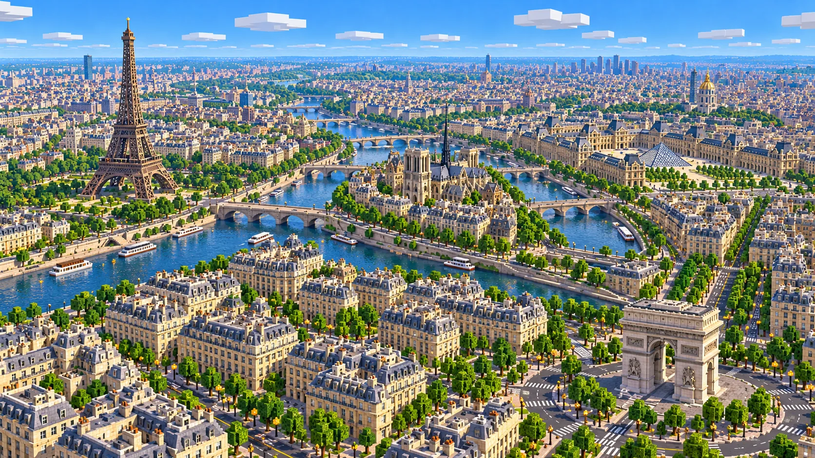
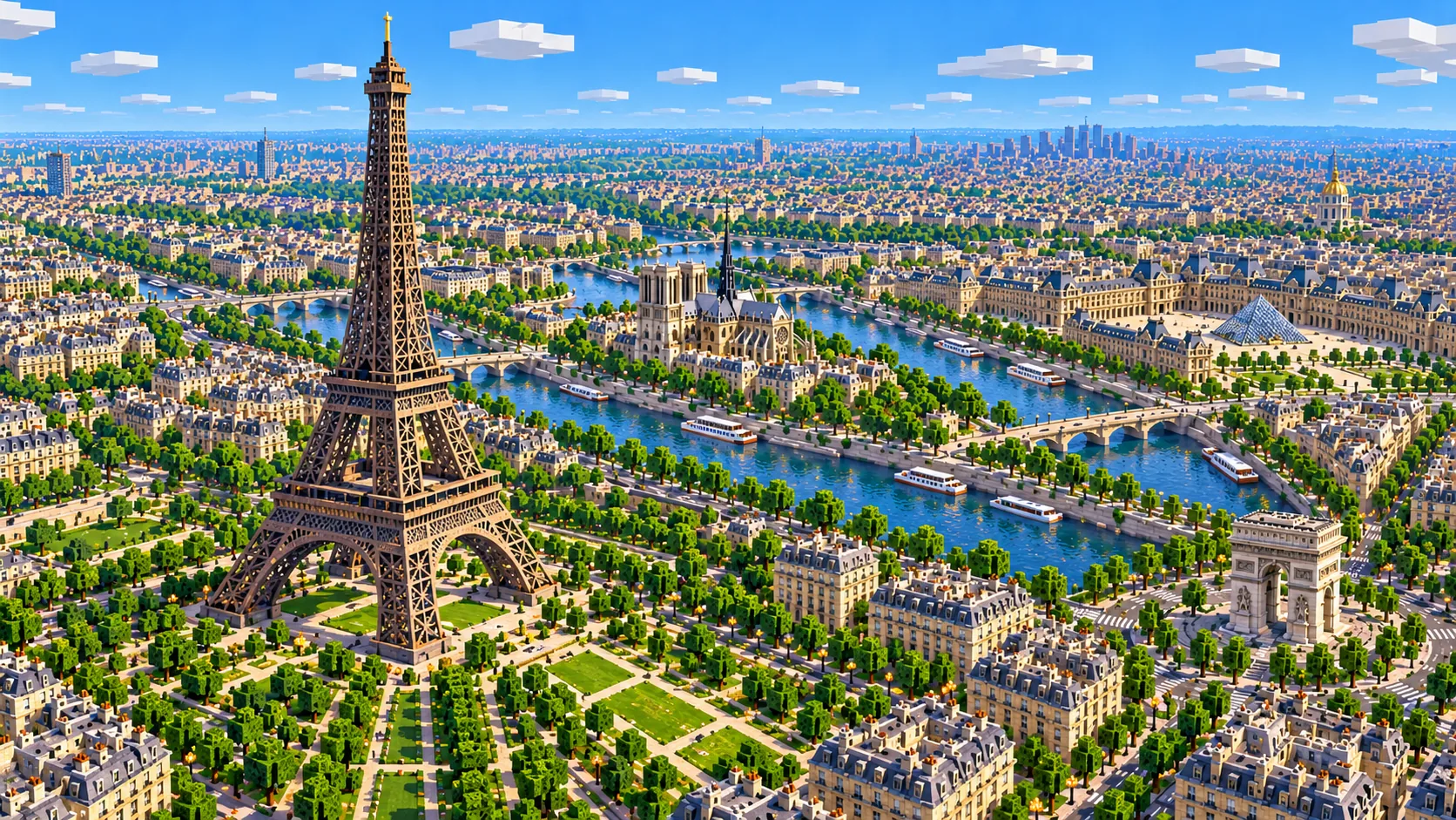
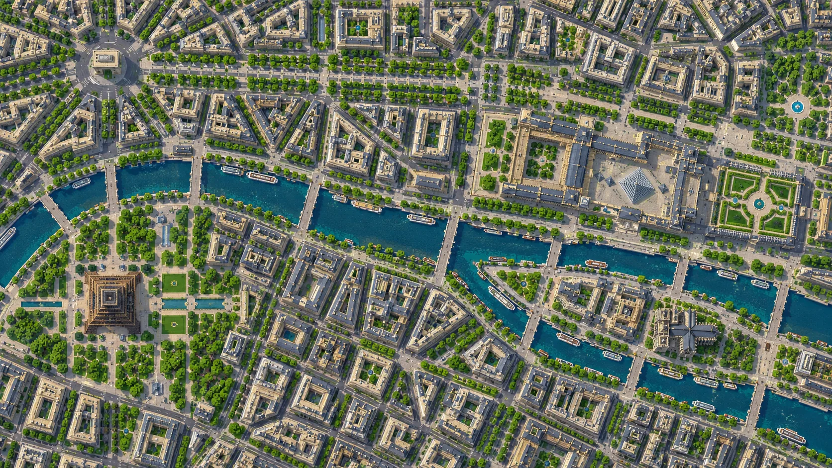
Central Paris in one Minecraft world, from the Trocadéro to the tip of Île Saint-Louis. This Paris Minecraft map covers 27 km² built from real OpenStreetMap data: the Eiffel Tower and the Champ de Mars, the Arc de Triomphe and the Champs-Élysées, the Louvre and the Tuileries, Île de la Cité with Notre-Dame, the Latin Quarter, Les Invalides and the Opéra. You spawn on the Pont d’Iéna, between the Trocadéro and the foot of the tower. Download it for Java or Bedrock, or open it in the in-browser player on this site.
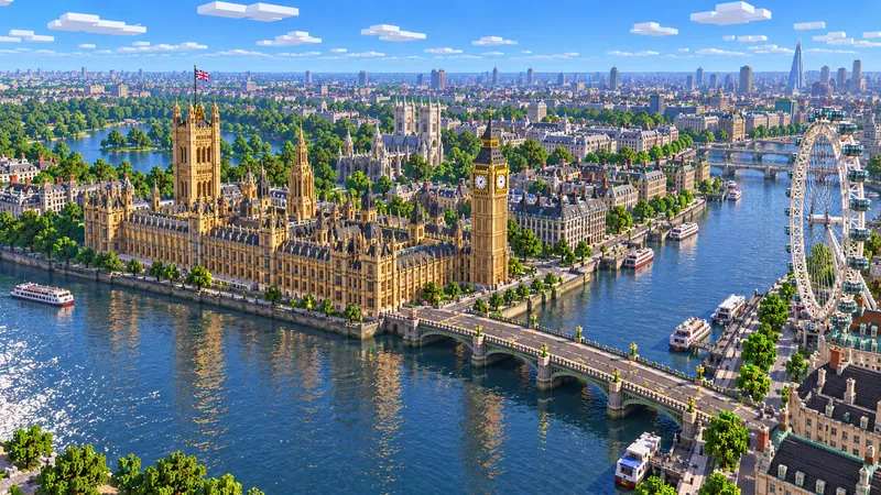
Illustrations. Generated worlds follow OpenStreetMap data and differ in detail.
Starting area
Central Paris: Eiffel Tower to Île Saint-Louis
Size
27.0 km²
Editions
Java & Bedrock
Download
Ready to play
Data
OpenStreetMap
01 / Overview
Overview: Paris as a Minecraft world
This map is a rectangle of about 6.1 km east to west and 4.4 km north to south, about a quarter of the city of Paris. The west edge runs through the 16th arrondissement just behind the Palais de Chaillot. The east edge falls a few hundred meters short of Place de la Bastille, past the eastern tip of Île Saint-Louis. To the north the map stops about 700 m past the Arc de Triomphe and 900 m past the Palais Garnier, and to the south just below the Tour Montparnasse and the Luxembourg Garden. Montmartre and Sacré-Cœur are about 700 m beyond the north edge; they have their own area below.
Inside that rectangle the Seine enters at the east edge near the Pont d’Austerlitz, splits around Île Saint-Louis and Île de la Cité, runs west past the Louvre and the Grand Palais, then bends southwest past the Eiffel Tower and leaves the map by the Pont de Grenelle. Most of the arrondissements a visitor knows are here, all or in part: the 1st to the 8th, plus parts of the 9th, 15th, 16th and 17th and small corners of a few others. The ground rises from the river, about 26 m above sea level, to around 60 m on the Chaillot hill and the Montagne Sainte-Geneviève, where the Panthéon stands. Étoile sits roughly 20 m above Concorde, so the Champs-Élysées climbs the whole way to the Arc de Triomphe.
The world is generated, not built by hand. The generator reads streets, building footprints, the river, parks and land cover from OpenStreetMap, turns them into blocks at about one block per meter and shapes the ground from elevation data. Paris is one of the most thoroughly mapped cities in OpenStreetMap, so the courtyard blocks, squares and footbridges are in their real places and the layout reads as the real city from the air. Every building is still a simplified shape.
Illustrations. Generated worlds follow OpenStreetMap data and differ in detail.
02 / Inside the map
What's included in the Paris map
The recommended starting area covers the Eiffel Tower, the Champ de Mars and the Trocadéro, the Arc de Triomphe and the Champs-Élysées, Place de la Concorde, the Grand Palais and Pont Alexandre III, Les Invalides, the Musée d’Orsay, the Louvre and the Tuileries, the Palais Garnier, the Centre Pompidou, Île de la Cité with Notre-Dame and Sainte-Chapelle, Île Saint-Louis, the Panthéon, the Luxembourg Garden and the Tour Montparnasse. Places marked as separate presets are outside it. Open them from the customize section below.
Starting area
Eiffel Tower, Champ de Mars and the Trocadéro
The spawn is on the Pont d’Iéna, the bridge between the Trocadéro gardens on the right bank and the tower on the left. The tower, finished in 1889, is 330 m tall to the top of its antennas; behind it the Champ de Mars runs about 800 m southeast to the École Militaire.
Starting area
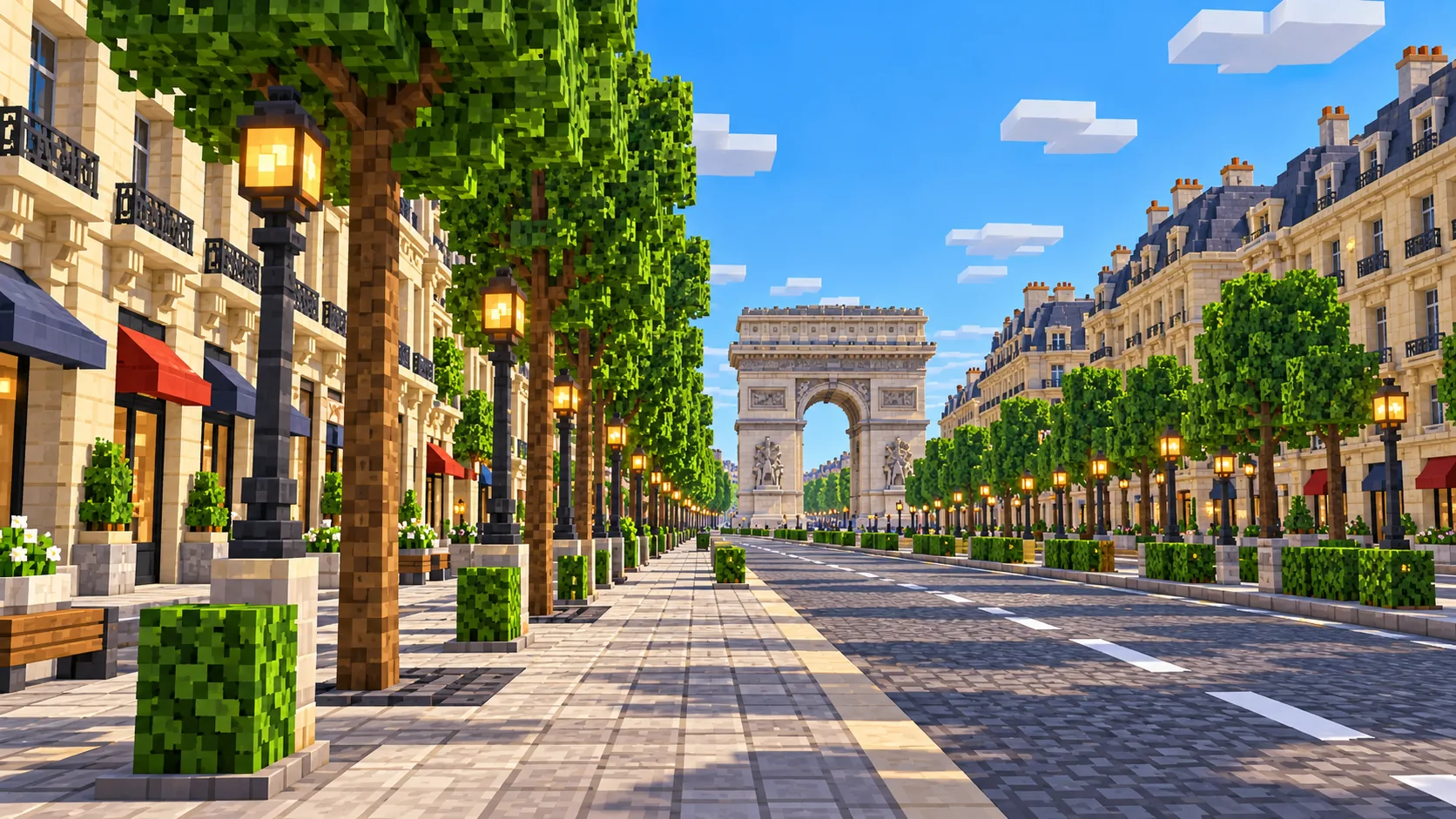
Arc de Triomphe and the Champs-Élysées
Twelve avenues meet at Place Charles-de-Gaulle, the roundabout around the 50 m Arc de Triomphe, near the north-west corner of the map. The Champs-Élysées runs about 1.9 km from there down to Place de la Concorde, with the Grand Palais and Petit Palais to the south near its lower end.
Starting area
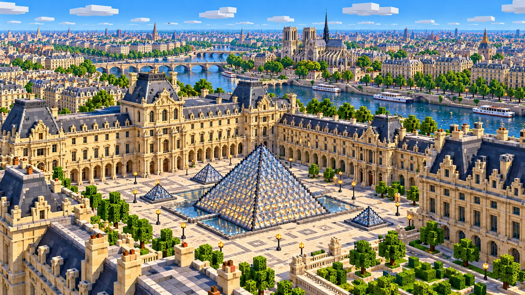
The Louvre and the Tuileries
The Louvre palace stretches about 600 m along the right bank, with the glass pyramid in the Cour Napoléon. West of it the Tuileries Garden runs to Place de la Concorde, so the axis from the pyramid to the Arc de Triomphe crosses the map as one straight line, bent only slightly at the Louvre, about 3.3 km long.
Starting area
Île de la Cité: Notre-Dame and Sainte-Chapelle
The island where Paris began sits in the middle of the Seine about 4 km upstream of the Eiffel Tower. Notre-Dame is at its east end, the Palais de Justice with Sainte-Chapelle in the middle, and the Pont Neuf, finished in 1607 and the oldest standing bridge in the city, crosses its western tip.
Starting area
Île Saint-Louis and the Marais edge
The smaller island just upstream is almost all 17th-century town houses on a regular grid, which comes out as a tidy block plan. North of it, the Hôtel de Ville and the western Marais are in the map; the Centre Pompidou is at the eastern edge of the old Les Halles district.
Starting area
Les Invalides, the Musée d’Orsay and Pont Alexandre III
On the left bank between the tower and the Louvre: the Musée d’Orsay in a former railway station, the long Esplanade des Invalides running from Pont Alexandre III to the Hôtel des Invalides, with the dome over Napoleon’s tomb behind it, and the Assemblée nationale facing Concorde across the river.
Starting area
Latin Quarter, the Panthéon and the Luxembourg Garden
South of the islands the ground climbs to the Panthéon at the top of the Montagne Sainte-Geneviève. West of it the Luxembourg Garden and its palace, home of the Senate, fill a large green block, and the Tour Montparnasse, 210 m, the tallest building in the map and its second-tallest structure after the Eiffel Tower, stands at the south edge.
Starting area
Palais Garnier and the Grands Boulevards
The opera house at the head of Avenue de l’Opéra is near the north edge, with the department stores of Boulevard Haussmann just behind it. Avenue de l’Opéra runs about 700 m southeast from it, straight to Place André-Malraux, a block from the Louvre.
Separate preset
Montmartre, La Défense and Versailles
Three places players often look for that are outside this world. Sacré-Cœur sits on the Montmartre hill about 1.8 km north of the Opéra, the towers of La Défense are about 5 km beyond the Arc de Triomphe, and the Palace of Versailles is about 17 km southwest. Montmartre and Versailles each have an area below.
Illustrations. Generated worlds follow OpenStreetMap data and differ in detail.
03 / Why this city
What makes Paris special in Minecraft
Paris looks best from above. Between 1853 and 1870 Baron Haussmann cut long straight avenues through the old city and lined them with apartment blocks of a set height around inner courtyards. Those blocks come out of OpenStreetMap as wedges and triangles with open courtyards in the middle, and the avenues between them meet at stars like Étoile, the Trocadéro and Place de l’Alma. Fly up over the Arc de Triomphe and the twelve avenues fan out as they do on a street map.
The Seine gives the world its shape. Within the map the river runs about 7 km from the west edge to the tip of Île Saint-Louis under more than 20 bridges. In the real city the stone quays run along the water below street level; the generator gives you the river edge to build them on. Île de la Cité and Île Saint-Louis are the only large islands in the world (the narrow Île aux Cygnes runs downstream past the Eiffel Tower), which makes Île de la Cité a natural base.
What the generator does not make is the stonework. Notre-Dame comes out as its footprint, roughly to height, without flying buttresses, rose windows or the spire that was rebuilt after the 2019 fire. The Eiffel Tower is a simplified shape from its mapped parts, not an open iron lattice. The mansard roofs, balconies and carved facades of the Haussmann blocks become flat-topped boxes, and no building has an interior, so the Louvre has no galleries. The illustrations on this page show the city after you rebuild it; the world gives you the plan, the river and the ground.
04 / Play
Best ways to play the Paris map
Challenge 01
Ride the Seine from the Eiffel Tower to Île de la Cité
Put a boat in at the Pont d’Iéna and follow the river upstream: past the Grand Palais and Pont Alexandre III, along the Louvre’s riverside wing and past the Pont Neuf to the western tip of Île de la Cité, about 4 km of water. The bridges are low road decks, so expect to hop out at some of them. Keep going around both islands and back down the other arm for a full loop.
Challenge 02
Rebuild one Haussmann block
Pick a wedge-shaped block off Avenue de l’Opéra and rebuild it the Paris way: smooth sandstone or calcite for the cut stone, a row of iron-bar balconies on the second and fifth floors above the ground floor (the French étages), and a mansard roof of deepslate tile stairs with dormer windows. The footprints keep the inner courtyard, so the block already has its real shape; start with the street front and work inward.
Challenge 03
Race the Champs-Élysées circuit
The Tour de France has finished with laps of the Champs-Élysées almost every year since 1975. Lay out the same loop on a server: up the avenue to the Arc de Triomphe, around Étoile, back down to Concorde and along the Rue de Rivoli, about 7 km a lap on horses, boats on blue ice or a minecart line.
Challenge 04
Rebuild Notre-Dame on its footprint
The cathedral’s footprint on Île de la Cité comes from OpenStreetMap. Raise the two 69 m towers on the west front, add the flying buttresses around the choir and put the 96 m spire over the crossing. The real spire, rebuilt after the 2019 fire, returned when the cathedral reopened in December 2024.
05 / Download
Download and install
Download the Central Paris: Eiffel Tower to Île Saint-Louis starting area as a ready-made world for Java or Bedrock Edition.
Java Edition
UnzipExtract the ZIP to get a folder with level.dat inside.
CopyMove the folder into .minecraft/saves.
PlayOpen Minecraft Java Edition and choose Singleplayer.
Bedrock Edition
OpenOn Windows, double-click the .mcworld file. On phones and tablets, open it with Minecraft.
ImportMinecraft imports the world automatically.
PlayFind the new world in your Worlds list and open it.
If the world does not show up
Java: check that level.dat sits directly inside the world folder, not one folder deeper.
Bedrock: if double-clicking does nothing, open Minecraft first and then open the .mcworld file again.
Open the world with the listed Minecraft version or a newer one.
Lower your render distance if a large city loads slowly at first.
About 2.75 km² just north of this map: the Montmartre hill with Sacré-Cœur on the top, about 130 m above sea level, Place du Tertre, and Boulevard de Clichy with the Moulin Rouge at the bottom of the slope.
About 7.5 km² around the Palace of Versailles, 17 km west-southwest of central Paris: the palace, its formal gardens, the Grand Canal and the Grand Trianon.
The map covers 27 km², from 48.840° to 48.880° N and 2.282° to 2.365° E. At about one block per meter the world is roughly 6,080 × 4,450 blocks.
The ground comes from elevation data. The Seine is about 26 m above sea level and the Chaillot hill and the Montagne Sainte-Geneviève around 60 m, so the river valley and the two hills rise in the world where they rise in the city.
Streets, building footprints, the river, the islands, parks and land cover come from OpenStreetMap. Building heights come from height and level tags where they exist and a default height where they do not.
Roof shapes, facades, balconies, the Eiffel Tower’s lattice, the cathedral’s stonework, bridge arches and interiors are not generated. The bridges are road decks over the water.
OpenStreetMap is edited by volunteers, so coverage varies from street to street, and recent changes may be missing.
Central Paris from the Trocadéro to Île Saint-Louis, in four parts: the Eiffel Tower with the Trocadéro and the Champ de Mars; the axis from the Arc de Triomphe down the Champs-Élysées to Concorde; the Louvre, the Opéra and the two islands with Notre-Dame; and the Left Bank from Les Invalides and the Musée d’Orsay to the Latin Quarter, the Luxembourg Garden and the Tour Montparnasse. Montmartre and Versailles are separate areas.
Is the Paris map free?
No. It costs $6.99 or 700 points, paid once. You keep it: the Java and Bedrock versions stay in your account to download again, and you can open it in the in-browser player on this site.
Does the Paris map work with Minecraft Java Edition?
Yes. The Java download is a ZIP of about 270 MB, saved in Java 1.21.4. Unzip it so the world folder sits directly in .minecraft/saves, not inside a second folder, then open it from Singleplayer. Newer Java versions upgrade the world when they load it.
Is there a Bedrock version of the Paris map?
Yes. The Bedrock download is an .mcworld file of about 155 MB. Open it on Windows, Android or iOS and Minecraft imports the world. Consoles cannot import .mcworld files directly, and Mac has no Bedrock Edition, so Mac players should use the Java version.
Is the Eiffel Tower in the map, and does it look real?
It is in the map, near the west edge, and you spawn on the bridge in front of it. It is built from the tower’s mapped parts, so you get its position, base and rough height, not the iron lattice. Iron bars and chains over the generated base make a good lattice if you want to rebuild it.
Is Sacré-Cœur or Montmartre in the map?
No. Sacré-Cœur is about 700 m north of the map’s north edge. Use the Montmartre area on this page to generate the hill, Place du Tertre and the Moulin Rouge as a separate world of about 2.75 km².
Is the Palace of Versailles in the map?
No. Versailles is about 17 km southwest of central Paris. The Versailles area on this page generates the palace, the gardens and the Grand Canal as their own world of about 7.5 km².
Is the Paris map 1:1 scale?
Across the ground, yes: about one block per meter, so the world is roughly 6,080 × 4,450 blocks and the walk from the Eiffel Tower to Notre-Dame is about 4,100 blocks in a straight line. Building heights follow OpenStreetMap tags and fall back to a default height where there are none.
What game mode does the world open in?
Creative, at midday, with the spawn point on the Pont d’Iéna facing the Eiffel Tower. Switch to Survival with /gamemode survival once you are in the world.
Can I use the Paris map on a server?
Yes. Put the Java world folder next to your server jar and set level-name in server.properties to its folder name. For Bedrock Dedicated Server, extract the .mcworld into the worlds folder. Keep the OpenStreetMap attribution file that comes with the world.