Skip to content

Poland / City map

Warsaw Minecraft Map

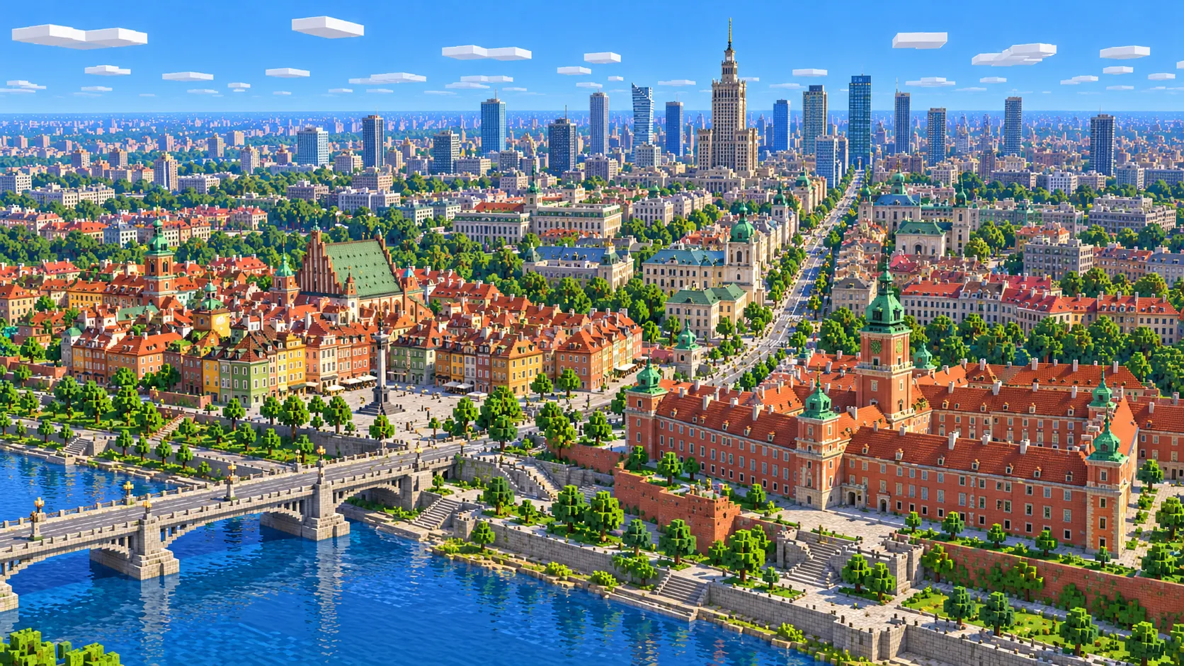
Central Warsaw in one Minecraft world, from the New Town to the Palace on the Isle in Łazienki Park. This Warsaw Minecraft map covers 19.6 km² built from real OpenStreetMap and elevation data. The Old Town and the Royal Castle sit on top of the Vistula escarpment, the Royal Route runs south past the Palace of Culture and Varso Tower, and across the river lie Praga and the National Stadium. You spawn on Castle Square, where Sigismund’s Column stands. Download it for Java or Bedrock, or open it in the in-browser player on this site.

Java Edition · Bedrock Edition

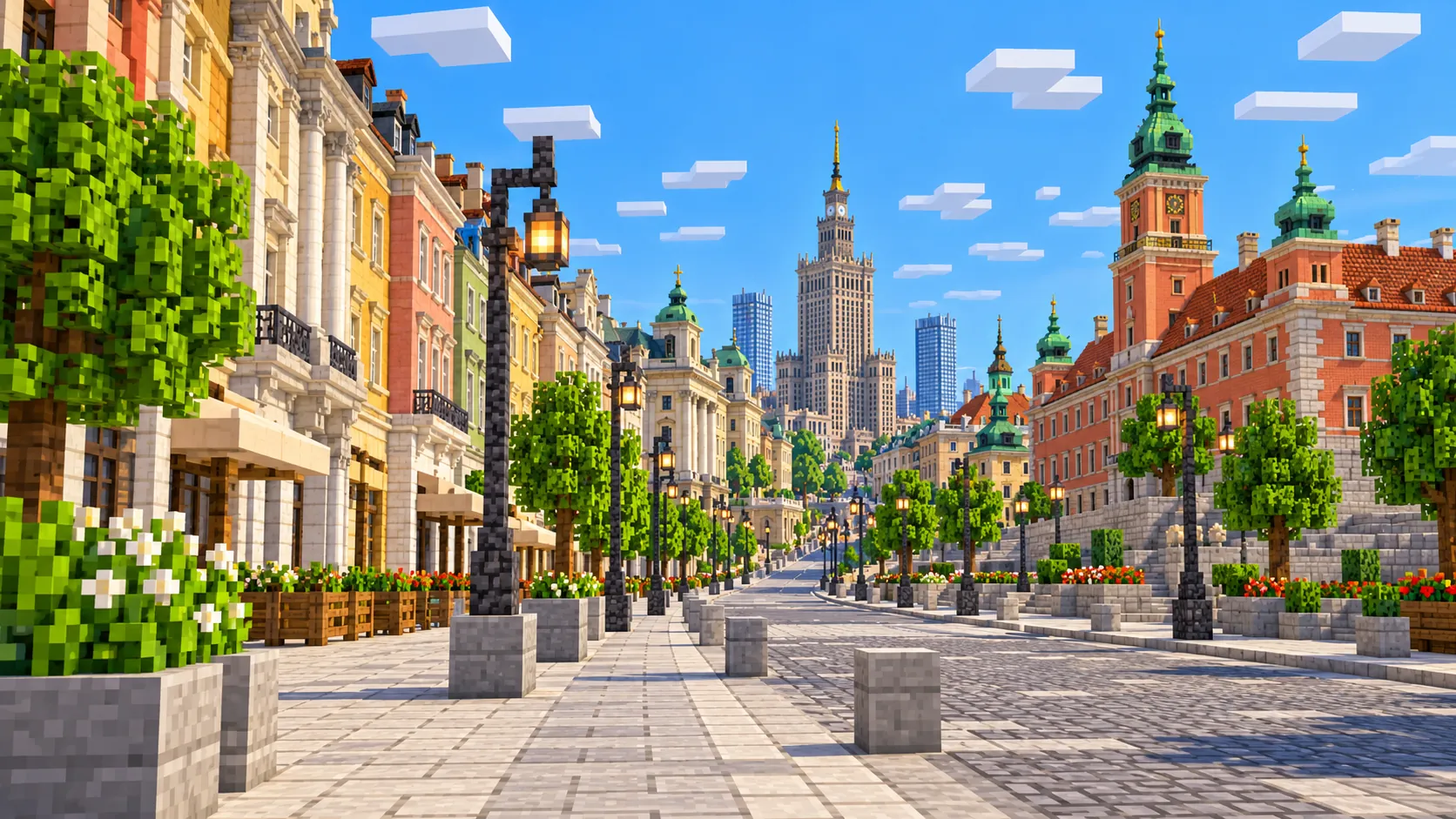
Illustration of central Warsaw in Minecraft blocks seen from above the Vistula: a stone bridge, the red Royal Castle with its green-capped clock tower, the colorful Old Town roofs and Sigismund’s Column, and the Palace of Culture and Science rising over the skyline behind
Illustrations. Generated worlds follow OpenStreetMap data and differ in detail.
Starting area
Central Warsaw: Old Town, Royal Route & Łazienki
Size
19.6 km²
Editions
Java & Bedrock
Download
Ready to play
Data
OpenStreetMap

01 / Overview

Overview: Warsaw as a Minecraft world

The map is a rectangle about 3.75 km east to west and 5.2 km north to south, from 52.211° to 52.258° N and 20.995° to 21.050° E. The north edge runs just past the New Town and the Multimedia Fountain Park. The south edge sits just below the Belweder, so all of Łazienki Park is inside except its southern tip. To the west the map takes in the Saxon Garden, the Palace of Culture and Varso Tower, but stops about 120 m short of the POLIN Museum and about 1 km short of the Warsaw Uprising Museum. To the east it crosses the Vistula into Praga and includes the National Stadium.

The ground is mostly flat, with one feature that shapes the whole city: the Warsaw Escarpment, a steep bank about 25 m high that runs along the west side of the river. The Old Town, the Royal Castle, the Royal Route and Łazienki sit on top of it or along its foot, and the river, the boulevards and the low neighborhood of Powiśle lie below. The generator turns OpenStreetMap roads, building footprints, rail lines, parks and water into blocks at roughly one block per meter and shapes the ground from elevation data, so the escarpment comes through as a real slope, about 25 blocks from the river up to Castle Square, with the streets that climb it in their real places. The world is about 3,750 × 5,230 blocks.

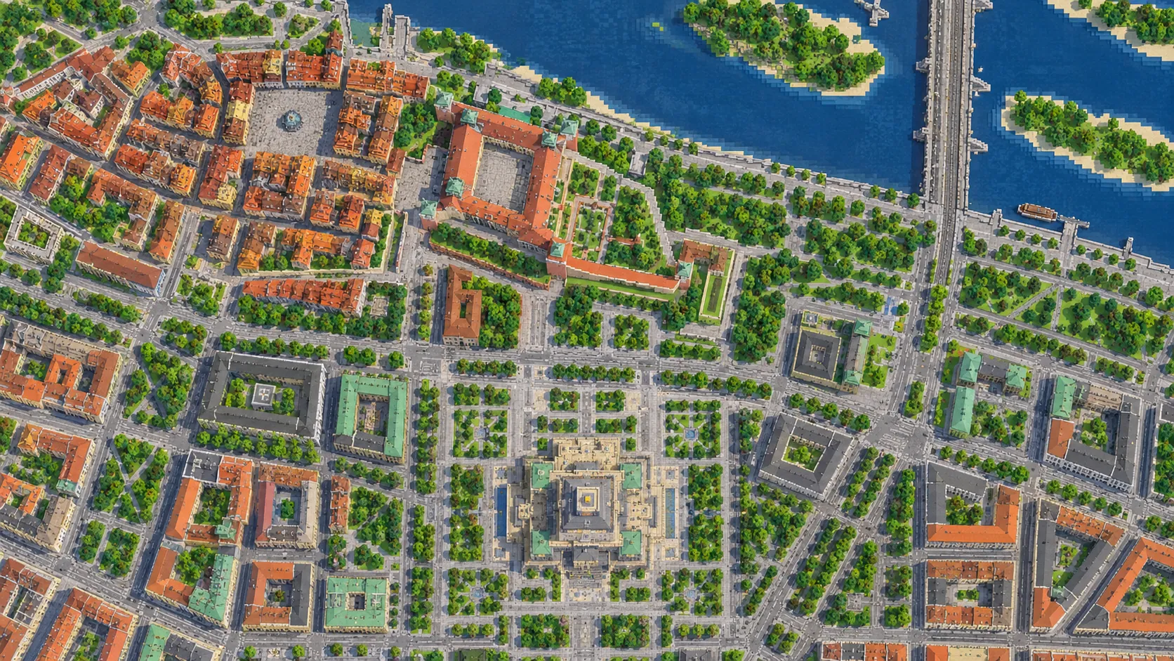
Most of what you see in the Old Town was built after 1945. It was almost entirely destroyed during and after the Warsaw Uprising of 1944, and rebuilt in the late 1940s and 1950s from prewar surveys, photographs and the 18th-century city views painted by Bernardo Bellotto; UNESCO listed it in 1980 as a reconstruction. In the generated world it reads as a tight knot of irregular streets and courtyards around the Market Square, very different from the broad postwar avenues and office towers around the Palace of Culture 2 km to the south, on the same plateau. That contrast between the old street plan at the edge of the escarpment and the wide avenues and glass towers further south is the main reason to explore this map on foot.

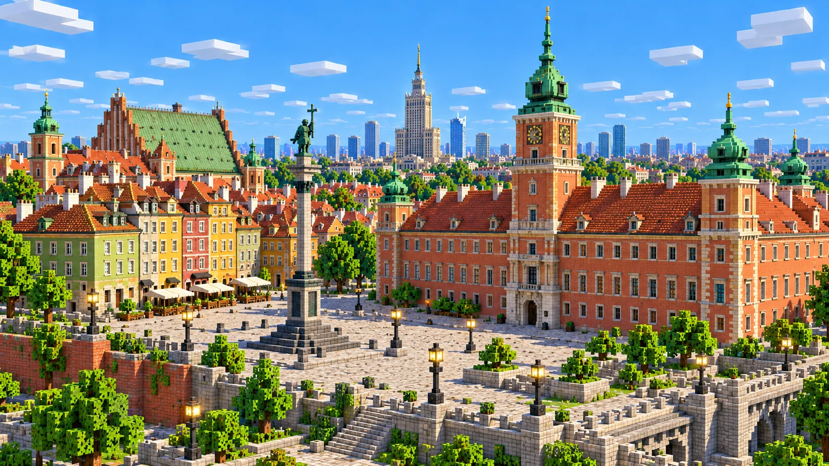
Illustration of the Royal Castle in Warsaw built from Minecraft blocks: a red-orange facade with a central clock tower facing Castle Square, with narrow colorful houses and a tall column in the square
Illustrations. Generated worlds follow OpenStreetMap data and differ in detail.

02 / Inside the map

What's included in the Warsaw map

The recommended starting area covers Castle Square, Sigismund’s Column and the Royal Castle, the Old Town Market Square and the Mermaid, the city walls and the Barbican, the New Town and the Multimedia Fountain Park, Krasiński Square and the Warsaw Uprising Monument, the Grand Theatre, the Saxon Garden and the Tomb of the Unknown Soldier, Krakowskie Przedmieście with the Presidential Palace, St. Anne’s Church, the University of Warsaw and Holy Cross Church, the Copernicus Monument, Nowy Świat, the Palace of Culture and Science, Varso Tower, Złota 44, Warszawa Centralna, the National Museum, the Copernicus Science Centre, the Vistula boulevards and bridges, the National Stadium, Praga with Ząbkowska Street and St. Florian’s Cathedral, the Sejm, Ujazdowski Castle, Łazienki Park with the Palace on the Isle and the Chopin Monument, and the Belweder. Places marked as separate presets are outside it. Open them from the customize section below.

  • Starting area

    Castle Square, Sigismund’s Column and the Royal Castle

    You spawn on Castle Square. The column of King Sigismund III Vasa, 22 m tall and first raised in 1644, stands in the middle; the Royal Castle closes the east side above the escarpment. The castle was blown up in 1944 and rebuilt from 1971, reopening in 1984. The Kubicki Arcades run along its base on the river side, at the foot of the escarpment.

  • Starting area

    The Old Town Market Square and the Barbican

    The Market Square is about 250 m north of the spawn: a rectangle of about 90 by 73 m lined with narrow merchant houses, with the Mermaid statue, the city’s symbol, in the middle. From its northwest corner, Nowomiejska Street leads to the Barbican, a 16th-century gate rebuilt in the 1950s, and the double ring of brick walls that still separates the Old Town from the New Town.

  • Starting area

    The New Town and the Multimedia Fountain Park

    North of the Barbican, Freta Street runs to the New Town Market Square, about 700 m from the spawn; Marie Curie was born on this street in 1867. Below it, on the river side, is the Multimedia Fountain Park, opened in 2011, which sits near the north edge of the map.

  • Starting area

    Krakowskie Przedmieście and Nowy Świat

    The Royal Route starts at Castle Square and runs south. On Krakowskie Przedmieście you pass St. Anne’s Church, the Presidential Palace, the Hotel Bristol, the main gate of the University of Warsaw and Holy Cross Church, where Chopin’s heart is kept in a pillar. The Copernicus Monument stands in front of the Staszic Palace, where the street becomes Nowy Świat and continues to the roundabout at Aleje Jerozolimskie, about 1.8 km from the spawn.

  • Starting area

    The Palace of Culture and Science, Varso and the Central Station

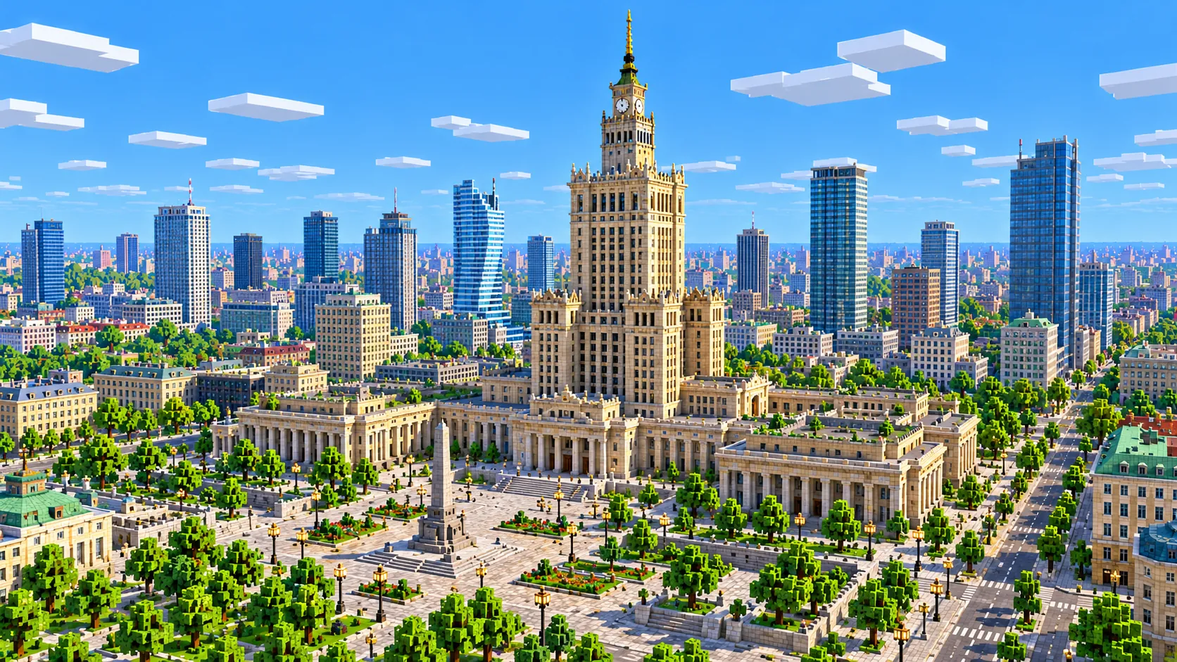
    The Palace of Culture and Science, finished in 1955, is 237 m tall with its spire and stands about 1.9 km south-south-west of the spawn on the huge open square of Plac Defilad. Varso Tower, completed in 2022 and 310 m to the tip of its spire, stands beside Warszawa Centralna, and Daniel Libeskind’s Złota 44, a curved residential tower, stands just west of the Palace of Culture. This is the only part of the map with real skyscrapers.

  • Starting area

    Theatre Square, the Saxon Garden and the Tomb of the Unknown Soldier

    West of Krakowskie Przedmieście, the Grand Theatre fills one side of Theatre Square. Behind it lie Piłsudski Square and the Saxon Garden, opened to the public in 1727. The Tomb of the Unknown Soldier sits under the three arches that survived when the Saxon Palace was blown up in 1944. A short walk north, the Warsaw Uprising Monument stands on Krasiński Square.

  • Starting area

    The Vistula, the boulevards and the National Stadium

    Below the escarpment, the boulevards run along the left bank past the Copernicus Science Centre, which opened in 2010. Three road bridges cross the river fully inside the map: Śląsko-Dąbrowski, Świętokrzyski and Poniatowski; the Łazienkowski Bridge is cut off by the east edge. On the Praga side, about 2.3 km east-south-east of the spawn, stands the National Stadium, built for Euro 2012, with about 58,000 seats.

  • Starting area

    Praga

    The right bank came through the war in far better shape than the center, so much of what stands in the north-east of the map is prewar: the tenements of Ząbkowska Street and the Koneser vodka distillery, now a quarter of shops and offices. St. Florian’s Cathedral, blown up in 1944 and rebuilt by 1972, faces the Old Town across the river.

  • Starting area

    Łazienki Park, the Sejm and the Belweder

    At the end of the Royal Route inside the map, about 3.9 km south of the spawn, lies Łazienki Park. The Palace on the Isle stands on its lake; the Chopin Monument, first unveiled in 1926 and recast in 1958 after the war, is where free piano concerts are held on summer Sundays. Ujazdowski Castle and the Sejm stand just north of the park, and the Belweder sits on its west side near the south edge of the map.

Illustrations. Generated worlds follow OpenStreetMap data and differ in detail.

03 / Why this city

What makes Warsaw special in Minecraft

The escarpment is what sets this map apart from flatter cities like Berlin or Amsterdam. Stand on the castle terrace or at the top of the Old Town stairs and the river, the boulevards and the whole Praga bank are laid out below you. The drop is there in the world, about 25 blocks from Castle Square to the water, so streets like Bednarska and Karowa wind down it. It makes the city easy to read: the Old Town and the center are up, Powiśle and the river are down, and the Poniatowski Bridge runs out from the top of the slope on a long viaduct.

Within about 2.5 km the city changes era several times. The Market Square, Krakowskie Przedmieście, the Palace of Culture and Varso Tower are all that close to each other, and the street plan changes with each: medieval lanes in the Old Town, a long royal avenue, wide postwar axes around Plac Defilad, and the courtyard blocks of Praga. For builders this is a good test map, because each district needs a different palette and roof style to finish.

Building shapes come from footprints with flat roofs, so the castle’s clock tower, the Barbican’s turrets, the church spires and the decorated Old Town gables are not there. Tall buildings that are mapped in parts do better: the Palace of Culture rises in stepped tiers, but without its clock faces, corner pinnacles or carved detail. Statues, including Sigismund’s Column, the Mermaid and the Chopin Monument, appear as small footprints at most. The metro is underground and not generated, and building interiors are empty. What you do get is the real street plan, the real escarpment and river, and every mapped building on its real footprint, most of them at roughly the right height.
04 / Play

Best ways to play the Warsaw map

Challenge 01

Walk the Royal Route to Łazienki

Start at the spawn and follow Krakowskie Przedmieście, Nowy Świat and Aleje Ujazdowskie south to the Palace on the Isle, about 4 km. Mark the stops as you go: St. Anne’s, the University, the Copernicus Monument, Three Crosses Square and Ujazdowski Castle. On a server, put a sign at each stop and you have a guided tour.

Challenge 02

Finish the Old Town

The houses around the Market Square are footprint blocks. Give each one its own color and gable, put the Mermaid back in the middle and add turrets to the Barbican. The square is only about 90 by 73 blocks, so it is a project a small group can finish.

Challenge 03

Dress the Palace of Culture

The stepped tiers are there, up to about Y 204, but the walls are plain. Add the four clock faces, the pinnacles on the corners of each tier and the attics along the lower wings. Then build a viewing deck at the height of the real 30th-floor terrace, about 114 m up, and look down the Royal Route to the Old Town.

Challenge 04

Up the Vistula by boat

Put a boat in below the Multimedia Fountain Park and follow the river upstream, south under the Śląsko-Dąbrowski, Świętokrzyski and Poniatowski bridges, past the Copernicus Science Centre and the National Stadium, until it leaves the map at the east edge. That is about 4 km of river, with the escarpment and the Old Town above you on the right at the start.

05 / Download

Download and install

Download the Central Warsaw: Old Town, Royal Route & Łazienki starting area as a ready-made world for Java or Bedrock Edition.

Java Edition

  1. UnzipExtract the ZIP to get a folder with level.dat inside.
  2. CopyMove the folder into .minecraft/saves.
  3. PlayOpen Minecraft Java Edition and choose Singleplayer.

Bedrock Edition

  1. OpenOn Windows, double-click the .mcworld file. On phones and tablets, open it with Minecraft.
  2. ImportMinecraft imports the world automatically.
  3. PlayFind the new world in your Worlds list and open it.

If the world does not show up

  • Java: check that level.dat sits directly inside the world folder, not one folder deeper.
  • Bedrock: if double-clicking does nothing, open Minecraft first and then open the .mcworld file again.
  • Open the world with the listed Minecraft version or a newer one.
  • Lower your render distance if a large city loads slowly at first.

Step-by-step help: Java import guide · Bedrock import guide

Warsaw mapCentral Warsaw: Old Town, Royal Route & Łazienki

  • Java Edition

    ZIP world folder

    • 145 MB
    • 19.6 km²
    • Java 1.21.4
  • Bedrock Edition

    .mcworld file

    • 73 MB
    • 19.6 km²
    • Bedrock 1.21

06 / Customize

Customize this Warsaw map

Each area opens the generator with the rectangle already drawn. Move it, resize it or change the mode before you generate.

Warsaw: Old Town, Royal Route & Łazienki

19.6 km²

The area of this map: the Old Town and New Town, the Royal Route, the Palace of Culture, the Vistula with Praga and the National Stadium, and Łazienki Park, about 19.6 km².

Open in generator

Wilanów Palace & Gardens

2.8 km²

About 2.8 km² around Wilanów Palace, the royal summer residence at the far end of the Royal Route, about 6.7 km south-east of Łazienki, with its formal gardens and lake.

Open in generator

Wola: Warsaw Uprising Museum & Skyscrapers

2.5 km²

About 2.5 km² west of the map: the Warsaw Uprising Museum in its former tram power station, Warsaw Spire and the office towers around Rondo Daszyńskiego.

Open in generator

07 / Limits

What to expect from the map data

  • The map covers 19.6 km², from 52.211° to 52.258° N and 20.995° to 21.050° E. At about one block per meter the world is roughly 3,750 × 5,230 blocks.
  • Elevation comes from terrain data without height compression. The river surface sits at about Y -53 and Castle Square at about Y -28, so the escarpment is about 25 blocks high. The Palace of Culture tops out at about Y 204 and Varso Tower at about Y 292, both below the build limit at Y 319.
  • Streets, building footprints, parks, water, rail lines and land cover come from OpenStreetMap. Building heights come from height and level tags where they exist and a default height where they do not, so some smaller buildings are shorter or taller than in reality.
  • Roof shapes, church towers and spires, statues, interiors and the underground metro are not generated. Buildings mapped in separate parts, such as the Palace of Culture and Varso Tower, come out stepped; the rest are single blocks with flat tops. Bridges are fixed decks.
  • OpenStreetMap is edited by volunteers, so coverage varies from street to street, and recent changes may be missing.

Map data © OpenStreetMap contributors, available under the Open Database License. Generated with the open-source Arnis project.

Questions before you generate

What does the Warsaw Minecraft map include?

Central Warsaw from the New Town to Łazienki Park: the Old Town with the Royal Castle and the Market Square, the Barbican and the city walls, Krakowskie Przedmieście and Nowy Świat, the Saxon Garden, the Palace of Culture and Science, Varso Tower and the Central Station, the Vistula boulevards and its bridges, the Praga bank with the National Stadium, and Łazienki with the Palace on the Isle. Wilanów, the Warsaw Uprising Museum and the POLIN Museum are outside it.

Is the Warsaw map free?

No. It costs $4.99 or 500 points, paid once. You keep it: the Java and Bedrock versions stay in your account to download again, and you can open it in the in-browser player on this site.

Does the Warsaw map work with Minecraft Java Edition?

Yes. The Java download is a ZIP of about 152 MB, saved in Java 1.21.4. Unzip it so the world folder sits directly in .minecraft/saves, not inside a second folder, then open it from Singleplayer. Newer Java versions upgrade the world when they load it.

Is there a Bedrock version of the Warsaw map?

Yes. The Bedrock download is an .mcworld file of about 77 MB. Open it on Windows, Android or iOS and Minecraft imports the world. Consoles cannot import .mcworld files directly, and Mac has no Bedrock Edition, so Mac players should use the Java version.

What game mode does the world open in?

Creative, at midday, with the spawn point on Castle Square, where Sigismund’s Column stands. Switch to Survival with /gamemode survival once you are in the world.

Is the Old Town as detailed as the real one?

No. Every house around the Market Square and along the Old Town lanes is in its real place with its real footprint, but the walls are plain blocks and the roofs are flat, so the painted facades and gables are yours to add. The street plan and the line of the walls and the Barbican follow OpenStreetMap.

Is the Palace of Culture and Science full height?

Close to it. The tower is mapped in parts, so it comes out as stepped tiers that reach about Y 204, roughly 225 blocks above Plac Defilad. The clock faces, the corner pinnacles and the carved detail are missing. Varso Tower is also there in steps, with its spire as a thin column up to about Y 292.

How big is the map compared with the real city?

It is close to real scale: about one block per meter, so the 19.6 km² area becomes a world of roughly 3,750 × 5,230 blocks. From Castle Square to the Palace of Culture is about 1.9 km in a straight line, in the game as in Warsaw.

Can I use the Warsaw map on a server?

Yes. Put the Java world folder next to your server jar and set level-name in server.properties to its folder name. For Bedrock Dedicated Server, rename the .mcworld to .zip, extract it into its own folder inside worlds and set level-name to that folder’s name. Keep the OpenStreetMap attribution file that comes with the world.

More maps

Browse all city maps · City generator · Terrain generator