Skip to content

Germany / City map

Berlin Minecraft Map

The Brandenburg Gate, the Reichstag, Museum Island and the TV Tower in one Minecraft world, with the line of the Berlin Wall running through it. This Berlin Minecraft map covers about 28.6 km² of the city center, built from real OpenStreetMap data: the Tiergarten up to the Victory Column, the government quarter on the Spree, Unter den Linden, Museum Island, Alexanderplatz, Potsdamer Platz and Checkpoint Charlie, the Berlin Wall Memorial on Bernauer Straße and the East Side Gallery down to the Oberbaum Bridge. You spawn on Pariser Platz, just east of the Brandenburg Gate. Download it for Java or Bedrock, or open it in the in-browser player on this site.

Java Edition · Bedrock Edition

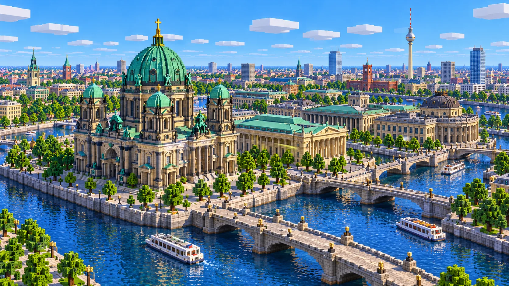
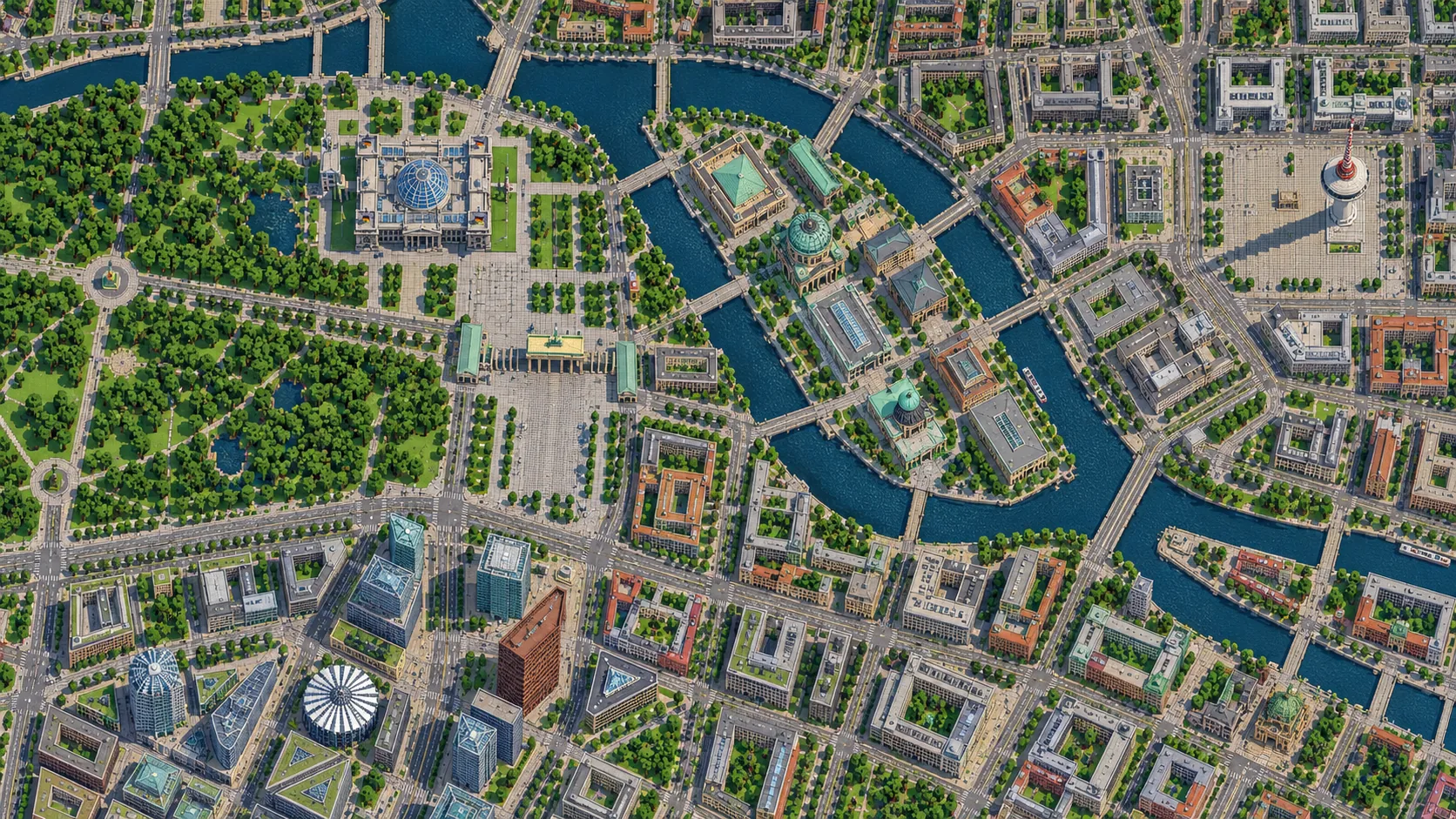
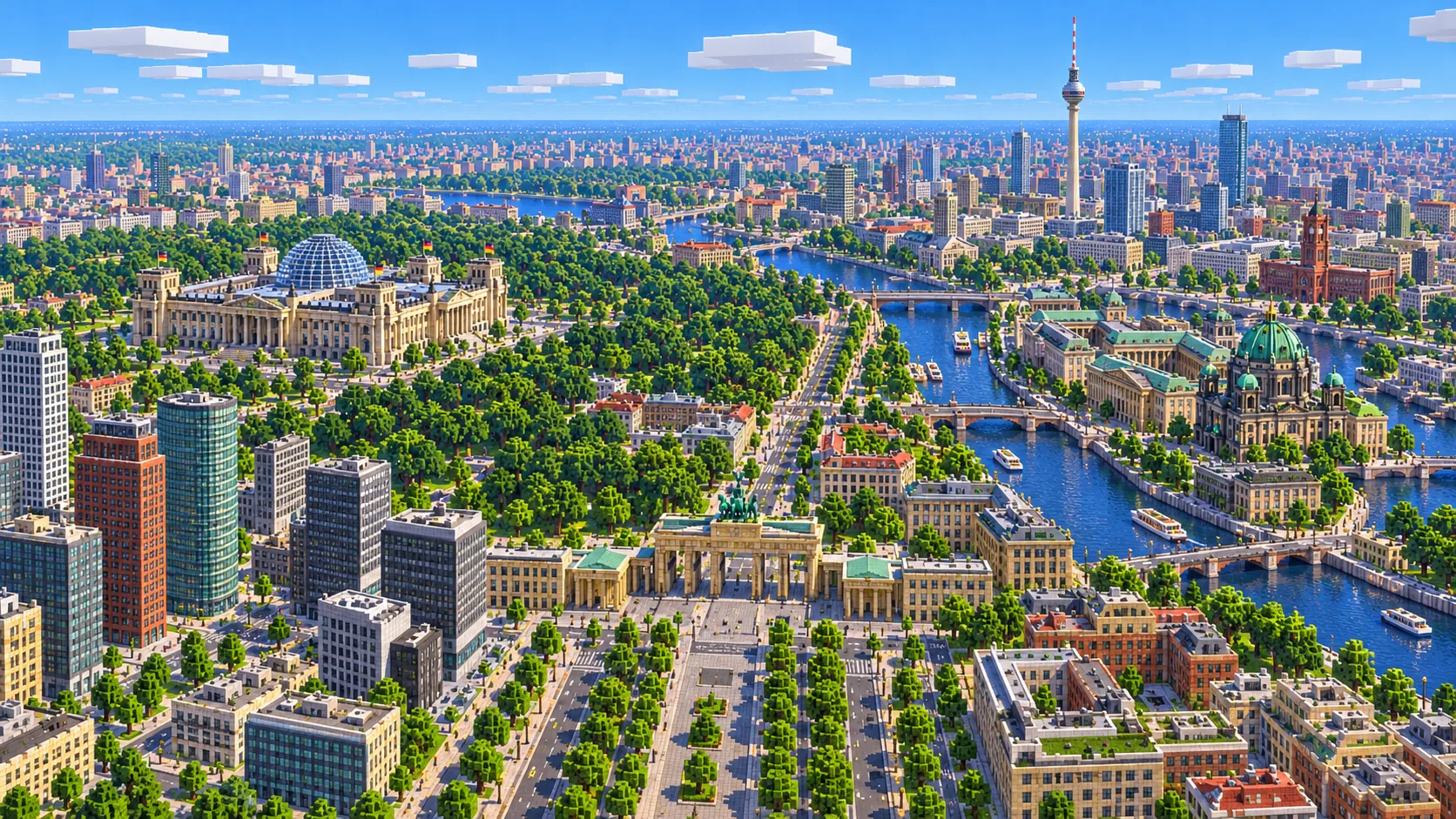
Illustration of central Berlin in Minecraft blocks seen from high above: the Brandenburg Gate at the end of a wide avenue, the glass-domed Reichstag by the river Spree, the green Tiergarten and the TV Tower rising in the distance
Illustrations. Generated worlds follow OpenStreetMap data and differ in detail.
Starting area
Central Berlin: Brandenburg Gate, Museum Island & Alexanderplatz
Size
28.6 km²
Editions
Java & Bedrock
Download
Ready to play
Data
OpenStreetMap

01 / Overview

Overview: Berlin as a Minecraft world

The map is a rectangle about 6.8 km east to west and 4.2 km north to south, from 52.501° to 52.539° N and 13.347° to 13.447° E. The west edge runs through the Tiergarten about 200 m past the Victory Column. The east edge sits just past the Oberbaum Bridge, at the far end of the East Side Gallery. To the north the map takes in the Berlin Wall Memorial on Bernauer Straße and the south of Prenzlauer Berg; to the south it stops at the north edge of Kreuzberg, just below Checkpoint Charlie and the Jewish Museum. Most of the sights of a first visit are inside; the main exceptions are listed below.

From 1961 to 1989 the Berlin Wall cut through this rectangle. The Brandenburg Gate stood in the border strip, the Reichstag was on the western side and Unter den Linden, Museum Island and Alexanderplatz were in East Berlin. Potsdamer Platz, one of the busiest junctions in Europe in the 1920s, was an empty no man’s land. Today the line is marked mostly by a double row of cobblestones in the pavement, but the map still holds its traces: the surviving wall and watchtower at Bernauer Straße, the 1,316 m painted stretch of the East Side Gallery, the wall on Niederkirchnerstraße, Checkpoint Charlie on Friedrichstraße (the hut there is a replica), and Potsdamer Platz, rebuilt in glass and steel after 1990.

The world is generated, not built by hand. The generator reads streets, building footprints, rivers and canals, parks and land cover from OpenStreetMap, turns them into blocks at about one block per meter and shapes the ground from elevation data. Berlin sits on a flat glacial valley, so the terrain barely moves: the Spree, the Landwehr Canal and the Kupfergraben on the west side of Museum Island are the only real breaks in the ground. Street level sits at about Y -49. The center is mapped in great detail in OpenStreetMap, down to the courtyards of the Mitte blocks and the tracks into Hauptbahnhof.

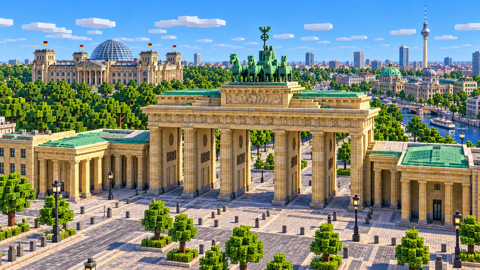
Illustration of the Brandenburg Gate in Minecraft blocks: six pairs of pale stone columns under a flat attic with the four-horse chariot on top, and a paved square in front
Illustrations. Generated worlds follow OpenStreetMap data and differ in detail.

02 / Inside the map

What's included in the Berlin map

The recommended starting area covers the Brandenburg Gate and Pariser Platz, the Reichstag, the Chancellery and the government quarter, Berlin Hauptbahnhof, the Memorial to the Murdered Jews of Europe, the Tiergarten with the Victory Column and Bellevue Palace, Potsdamer Platz, the Kulturforum, Checkpoint Charlie and the Topography of Terror, Gendarmenmarkt, Unter den Linden, Museum Island with the Berlin Cathedral, the Humboldt Forum, the Nikolaiviertel and the Red City Hall, Alexanderplatz and the TV Tower, the Hackescher Markt, the Berlin Wall Memorial on Bernauer Straße, the Museum für Naturkunde, the East Side Gallery and the Oberbaum Bridge. Places marked as separate presets are outside it. Open them from the customize section below.

  • Starting area

    Brandenburg Gate and Pariser Platz

    The spawn is on Pariser Platz, just east of the gate. Carl Gotthard Langhans built it between 1788 and 1791, about 26 m high and 65.5 m wide, and the Quadriga by Johann Gottfried Schadow went on top in 1793. Napoleon took the Quadriga to Paris in 1806; it came back in 1814. The gate stood in the Wall’s border strip until it reopened on December 22, 1989.

  • Starting area

    Reichstag and the government quarter

    The Reichstag is about 330 m north-west of the spawn, on the edge of the Tiergarten. It opened in 1894, burned in 1933 and has housed the Bundestag since 1999, under Norman Foster’s glass dome. Just behind it, the Chancellery, the Paul Löbe building and the other buildings of the “Band des Bundes” line up across the Spree bend, linked by bridges, and Hauptbahnhof, opened in 2006, is about 1.2 km north-west of the spawn.

  • Starting area

    Tiergarten and the Victory Column

    The park fills the west of the map. The Straße des 17. Juni runs straight west from the Brandenburg Gate for just under 2 km to the Großer Stern roundabout and the 66.9 m Victory Column, moved here from in front of the Reichstag in 1938–39. In the world it stands about 60 blocks tall. Bellevue Palace, the president’s residence, stands on the Spree at the north edge of the park.

  • Starting area

    Unter den Linden and Museum Island

    Unter den Linden runs about 1.5 km east from the gate past the State Opera and Humboldt University to the Schlossbrücke. Across the bridge is Museum Island, a UNESCO World Heritage Site since 1999, with the Altes Museum, the Neues Museum, the Alte Nationalgalerie, the Bode Museum, the Pergamon Museum and the Berlin Cathedral, completed in 1905. The rebuilt city palace, now the Humboldt Forum, stands next to the cathedral on the south side of the Lustgarten.

  • Starting area

    Alexanderplatz and the TV Tower

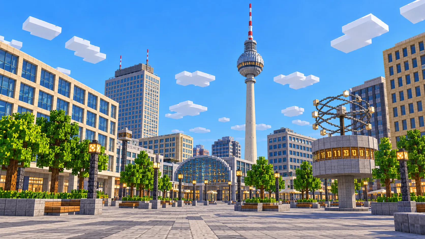
    The TV Tower is about 2.1 km east of the spawn. It was finished in 1969 and is 368 m tall with its antenna, the tallest structure in Germany, with the steel sphere about 200 m up. Around its foot are the Neptune Fountain, the Red City Hall and St. Mary’s Church, and Alexanderplatz with the World Clock lies just past the railway viaduct.

  • Starting area

    Potsdamer Platz, Checkpoint Charlie and Gendarmenmarkt

    South of the spawn the Memorial to the Murdered Jews of Europe fills a block with 2,711 concrete stelae. Potsdamer Platz, rebuilt in the 1990s, is about 750 m south, with the Kulturforum and the Philharmonie beside it. Checkpoint Charlie, the best-known crossing point between East and West Berlin, is about 1.2 km south-east on Friedrichstraße, near the Topography of Terror, and Gendarmenmarkt with its two domed churches lies between them and Unter den Linden.

  • Starting area

    Berlin Wall Memorial and East Side Gallery

    The longest surviving stretch of the Wall and the best-preserved section of the border strip are both in the map. The memorial on Bernauer Straße runs about 1.4 km along the former border strip at the north edge, with an original section of wall, the death strip and a watchtower. The East Side Gallery, 1,316 m of wall painted by 118 artists in 1990, runs along the Spree in the south-east to the double-decker Oberbaum Bridge, about 4.8 km south-east of the spawn.

  • Separate preset

    Kurfürstendamm, Charlottenburg and the Olympiastadion

    Some places players look for are outside this world. The Kaiser Wilhelm Memorial Church and the Kurfürstendamm are about 1 km past the west edge, Charlottenburg Palace about 3.5 km and the Olympiastadion about 7 km. Tempelhofer Feld begins about 2 km south of the south edge. Tempelhof and the Olympiastadion each have their own area below.

Illustrations. Generated worlds follow OpenStreetMap data and differ in detail.

03 / Why this city

What makes Berlin special in Minecraft

Berlin is flat. The streets lie on level ground, so building lines, squares and the wide boulevards come out clean, and the Mitte blocks with their closed courtyards read clearly from the air. The Spree gives the map its shape: it bends north around the government quarter, splits around Museum Island and runs wide past the East Side Gallery to the Oberbaum Bridge.

Berlin also lets you walk its 20th-century history. You can follow the line of the Wall from Bernauer Straße to the Brandenburg Gate, through the empty ground that became Potsdamer Platz, past Checkpoint Charlie and on to the East Side Gallery, and notice how the blocks change between the old East and West. The old line also makes a ready-made border for a survival server split in two, with one crossing at Checkpoint Charlie, though you will need to mark it yourself.

What the generator does not make is the detail that the illustrations on this page show. The Brandenburg Gate comes out as a solid stone-brick block about 27 blocks high with lower side wings, not six pairs of columns with a Quadriga on top. The Reichstag dome, the cathedral domes, roof shapes and facades are not generated, and interiors are empty. Building heights come from OpenStreetMap tags, or a default height where there are none. The East Side Gallery murals are not in the data either: wherever the wall itself comes through, it is plain, ready for players to paint with banners, concrete and terracotta. The TV Tower is the exception that comes out well: a column about 25 blocks across from the street to the build limit at Y 319, with a wider band around Y 160–170 where the sphere sits.

04 / Play

Best ways to play the Berlin map

Challenge 01

Walk the line of the Wall

Start at the watchtower on Bernauer Straße and follow the former border south-west, past the Invalidenfriedhof and the Humboldthafen and along the Spree to the Reichstag and the Brandenburg Gate, about 3.5 km on foot, then on past the Holocaust memorial to Potsdamer Platz and Checkpoint Charlie. Mark the route with a row of stone or a double line of cobblestone in the pavement, the way the city marks it in the real streets.

Challenge 02

Rebuild the Quadriga and the Reichstag dome

The gate and the Reichstag are in place on the map, but as plain blocks. Carve the gate back into six pairs of columns under an attic, about 26 blocks high, and put a four-horse chariot of copper blocks on top facing east, toward Unter den Linden. Then build Foster’s glass dome on the Reichstag with glass panes and a spiral ramp inside.

Challenge 03

Paint the East Side Gallery

The 1,316 m stretch along the Mühlenstraße has no murals in the world, and where the wall itself is missing you can rebuild it on its line by the river. Split it into panels between players on a server and paint each one with banners, concrete and terracotta. It is long enough for dozens of panels, and the Oberbaum Bridge at the east end makes a good finish line.

Challenge 04

Boat the Spree from the government quarter to the Oberbaum Bridge

Put a boat in by the Chancellery and follow the Spree east: past the Reichstag, along the east side of Museum Island and the cathedral, past the Nikolaiviertel and down the wide stretch by the East Side Gallery to the Oberbaum Bridge, about 6 km on the water. That is the route of the city’s tour boats, and it passes most of the landmarks on this page.

05 / Download

Download and install

Download the Central Berlin: Brandenburg Gate, Museum Island & Alexanderplatz starting area as a ready-made world for Java or Bedrock Edition.

Java Edition

  1. UnzipExtract the ZIP to get a folder with level.dat inside.
  2. CopyMove the folder into .minecraft/saves.
  3. PlayOpen Minecraft Java Edition and choose Singleplayer.

Bedrock Edition

  1. OpenOn Windows, double-click the .mcworld file. On phones and tablets, open it with Minecraft.
  2. ImportMinecraft imports the world automatically.
  3. PlayFind the new world in your Worlds list and open it.

If the world does not show up

  • Java: check that level.dat sits directly inside the world folder, not one folder deeper.
  • Bedrock: if double-clicking does nothing, open Minecraft first and then open the .mcworld file again.
  • Open the world with the listed Minecraft version or a newer one.
  • Lower your render distance if a large city loads slowly at first.

Step-by-step help: Java import guide · Bedrock import guide

Berlin mapCentral Berlin: Brandenburg Gate, Museum Island & Alexanderplatz

  • Java Edition

    ZIP world folder

    • 228 MB
    • 28.6 km²
    • Java 1.21.4
  • Bedrock Edition

    .mcworld file

    • 122 MB
    • 28.6 km²
    • Bedrock 1.21

06 / Customize

Customize this Berlin map

Each area opens the generator with the rectangle already drawn. Move it, resize it or change the mode before you generate.

Central Berlin: Brandenburg Gate, Museum Island & Alexanderplatz

28.6 km²

The area of this map: central Berlin from the Victory Column to the Oberbaum Bridge and from Checkpoint Charlie to Bernauer Straße, about 28.6 km².

Open in generator

Tempelhofer Feld & the old airport

4.2 km²

About 4.2 km² around Tempelhofer Feld, about 2 km south of the map: the runways of the old airport, now a public park, and the curved terminal building of 1936–41.

Open in generator

Olympiastadion & Waldbühne

3.3 km²

About 3.3 km² in Charlottenburg around the Olympiastadion of 1936, with the Maifeld, the bell tower and the Waldbühne open-air stage.

Open in generator

07 / Limits

What to expect from the map data

  • The map covers about 28.6 km², from 52.501° to 52.539° N and 13.347° to 13.447° E. At about one block per meter the world is roughly 6,780 × 4,230 blocks.
  • Berlin is flat, so the terrain is close to level across the whole map: the ground drops only at the Spree, the Landwehr Canal and the Kupfergraben, and the streets sit at about Y -49. Distances across the ground stay at about one block per meter.
  • Streets, building footprints, rivers and canals, parks, railways and land cover come from OpenStreetMap. Building heights come from height and level tags where they exist and a default height where they do not.
  • The Quadriga, the Reichstag dome, church domes and towers, the East Side Gallery murals, roof shapes, facades and interiors are not generated. U-Bahn and S-Bahn tunnels are not generated either.
  • OpenStreetMap is edited by volunteers, so coverage varies from street to street, and recent changes may be missing.

Map data © OpenStreetMap contributors, available under the Open Database License. Generated with the open-source Arnis project.

Questions before you generate

What does the Berlin Minecraft map include?

Central Berlin in one world: the Tiergarten with the Victory Column, the Brandenburg Gate and the Reichstag, the government quarter and Hauptbahnhof, Potsdamer Platz, Checkpoint Charlie, Unter den Linden, Museum Island, Alexanderplatz and the TV Tower, the Berlin Wall Memorial on Bernauer Straße and the East Side Gallery. The Kurfürstendamm, Charlottenburg and the Olympiastadion are outside it.

Is the Berlin map free?

No. It costs $6.99 or 700 points, paid once. You keep it: the Java and Bedrock versions stay in your account to download again, and you can open it in the in-browser player on this site.

Does the Berlin map work with Minecraft Java Edition?

Yes. The Java download is a ZIP of about 239 MB, saved in Java 1.21.4. Unzip it so the world folder sits directly in .minecraft/saves, not inside a second folder, then open it from Singleplayer. Newer Java versions upgrade the world when they load it.

Is there a Bedrock version of the Berlin map?

Yes. The Bedrock download is an .mcworld file of about 128 MB. Open it on Windows, Android or iOS and Minecraft imports the world. Consoles cannot import .mcworld files directly, and Mac has no Bedrock Edition, so Mac players should use the Java version.

Is the Berlin Wall in the map?

The parts that still stand are in their real places, as far as they are mapped in OpenStreetMap: the memorial section on Bernauer Straße, the stretch on Niederkirchnerstraße by the Topography of Terror and the East Side Gallery along the Spree. Most of the Wall was torn down in 1990 and 1991, so along the rest of its route there is nothing to generate. The street paving that marks its line is too thin to show up in blocks.

Is the TV Tower in the map?

Yes, and it is the tallest structure in this world. It stands about 2,100 blocks east of the spawn as a column about 25 blocks across, rising from the street at about Y -49 to the build limit at Y 319, close to its real 368 m. A wider band around Y 160–170 stands in for the sphere, which is really at about 200 m. The slim tapering shaft, the steel sphere and the antenna are yours to shape.

Is the Berlin map 1:1 scale?

Across the ground, yes: about one block per meter, so the world is roughly 6,780 × 4,230 blocks and the walk from the spawn on Pariser Platz to Alexanderplatz is about 2,400 blocks in a straight line. Building heights follow OpenStreetMap tags and fall back to a default height where there are none.

What game mode does the world open in?

Creative, at midday, with the spawn point on Pariser Platz just east of the Brandenburg Gate. Switch to Survival with /gamemode survival once you are in the world.

Can I use the Berlin map on a server?

Yes. Put the Java world folder next to your server jar and set level-name in server.properties to its folder name. For Bedrock Dedicated Server, rename the .mcworld to .zip, extract it into its own folder inside worlds and set level-name to that folder’s name. Keep the OpenStreetMap attribution file that comes with the world.
More maps

Browse all city maps · City generator · Terrain generator