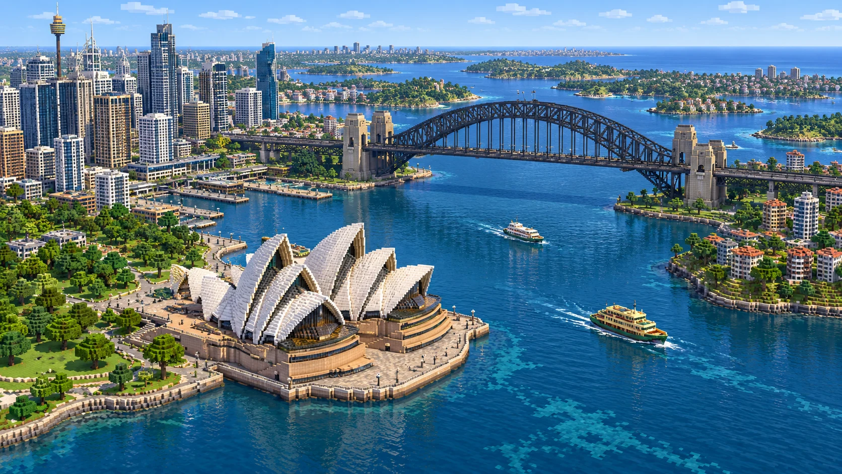
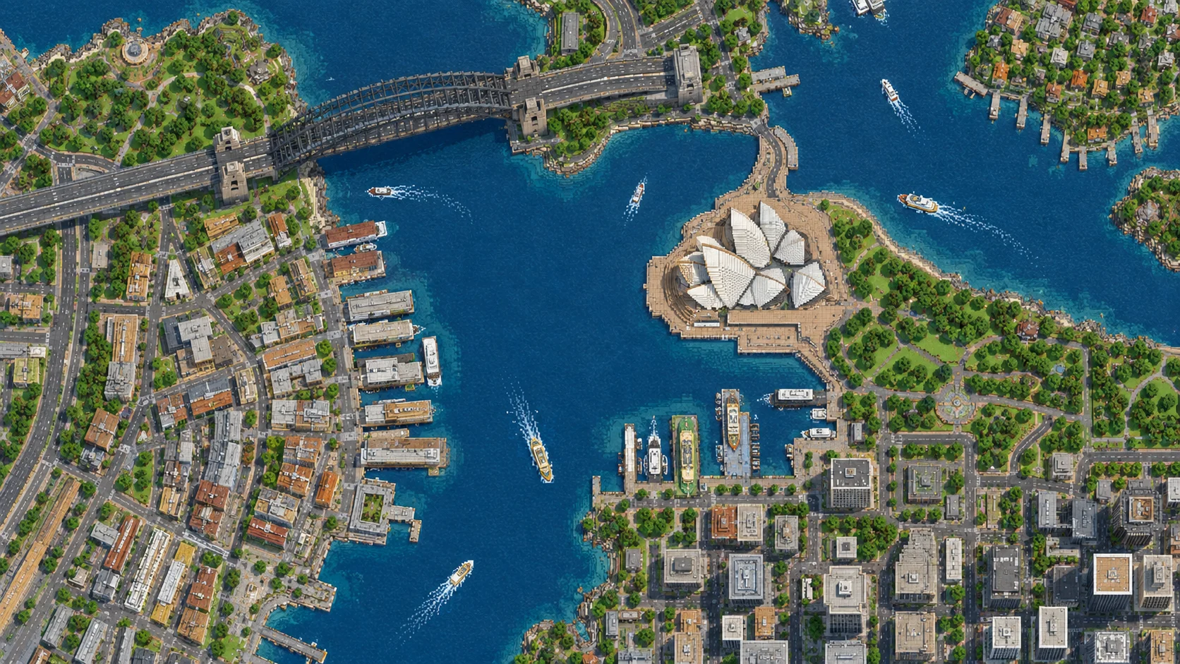
Start on Bennelong Lawn, beside the path between Circular Quay and the Sydney Opera House. The Harbour Bridge crosses to Milsons Point across the water, while the path behind the Opera House follows the edge of the Royal Botanic Garden. This 25.13 km² Sydney Minecraft map covers both shores of the harbour and a stretch of the city centre. Download the Creative world for Java or Bedrock Edition, or open the Java world in the browser player.
Illustrations. Generated worlds follow OpenStreetMap data and differ in detail.
Starting area
Sydney Harbour: Opera House, The Rocks & Kirribilli
Size
25.1 km²
Editions
Java & Bedrock
Download
Ready to play
Data
OpenStreetMap
01 / Overview
From Circular Quay to the other side of the harbour
The rectangle is about 4.7 km wide and 5.3 km from north to south. The bridge sits in the northern half of the map with its approaches on either side of the harbour. The main streets of the city centre go south from Circular Quay toward Town Hall and Central. The western side contains Darling Harbour and Pyrmont. The eastern side takes in the Botanic Garden, Farm Cove and the foreshore at Woolloomooloo. The small bays and points remain distinct when you follow them on foot.
Walk down to Circular Quay before crossing the bridge. The quayside curves around the end of Sydney Cove, and the two sides lead away in different directions. East Circular Quay connects the city to the Opera House. On the western side, go past First Fleet Park and up into The Rocks. Keep following the water around Dawes Point to reach Walsh Bay and its long wharves. Barangaroo Reserve is farther around that shore, with Darling Harbour beyond it.
The vegetation and heights change across the map. At the quay, the foreshore occupies a thin strip between the water and the streets. In the Royal Botanic Garden it opens onto a broad set of paths and lawns, and on the bridge approaches it is the slope that dictates where you can enter. The world uses real street lines, building outlines, land use and elevation. Horizontally, a metre is roughly a block, so a crossing that takes a few minutes in Sydney still covers hundreds of blocks in Minecraft.
Illustrations. Generated worlds follow OpenStreetMap data and differ in detail.
02 / Inside the map
What's included in the Sydney map
The recommended starting area covers Sydney Opera House, Bennelong Point, Bennelong Lawn, Circular Quay, First Fleet Park, The Rocks, Dawes Point, Sydney Harbour Bridge, Milsons Point, Kirribilli, Luna Park, Blues Point, Walsh Bay, Barangaroo Reserve, Darling Harbour, Pyrmont Bridge, Sydney Town Hall, Hyde Park, the Domain, Royal Botanic Garden, Farm Cove and Mrs Macquaries Point. Places marked as separate presets are outside it. Open them from the customize section below.
Starting area
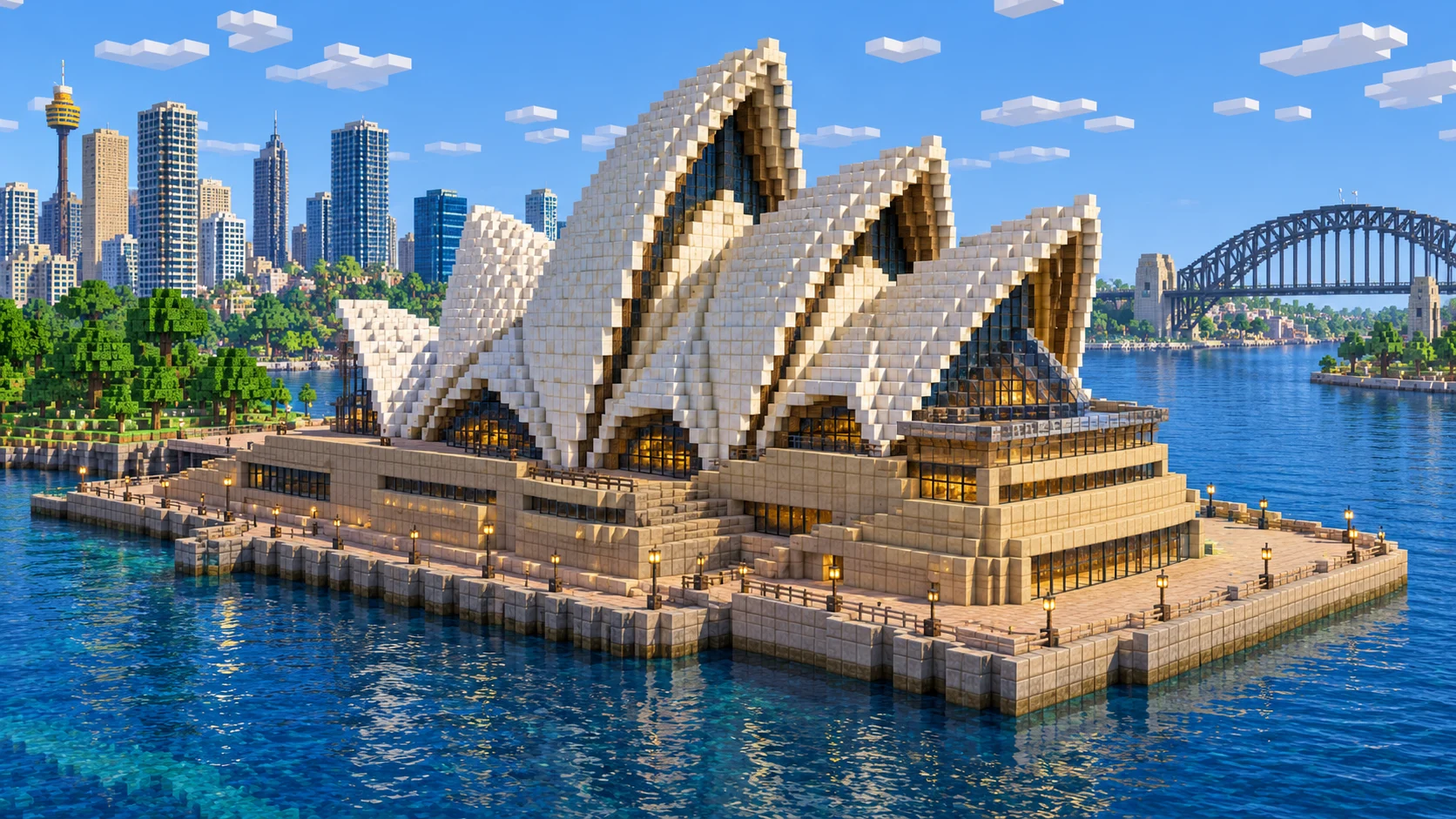
The Opera House at Bennelong Point
The Opera House opened on 20 October 1973. Its podium sits out on the headland, away from the street blocks of the city centre. In the Java world, the stone-brick podium sits around Y −38 with low, dark masonry above it. Build the white shells over that footprint. Jørn Utzon worked out the geometry of the white roof shells from a single sphere. On the building, the shells overlap and change direction. Leave a path around the water side so you can check your version from the quay as well as from the headland.
Starting area
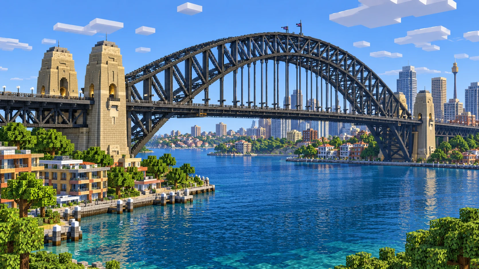
Sydney Harbour Bridge and Milsons Point
The bridge opened in 1932, and its main steel arch spans 503 m. The southern approach rises from the city behind The Rocks. Across the harbour, the northern approach runs inland past the headland at Milsons Point. In the Java world a flat deck crosses the harbour around Y −4. The south-east pylon reaches Y 59. Use the existing deck and pylons to line up the pair of steel arches and connect them with bracing. The height of an arch you add will change how it reads against the city on both shores.
Starting area
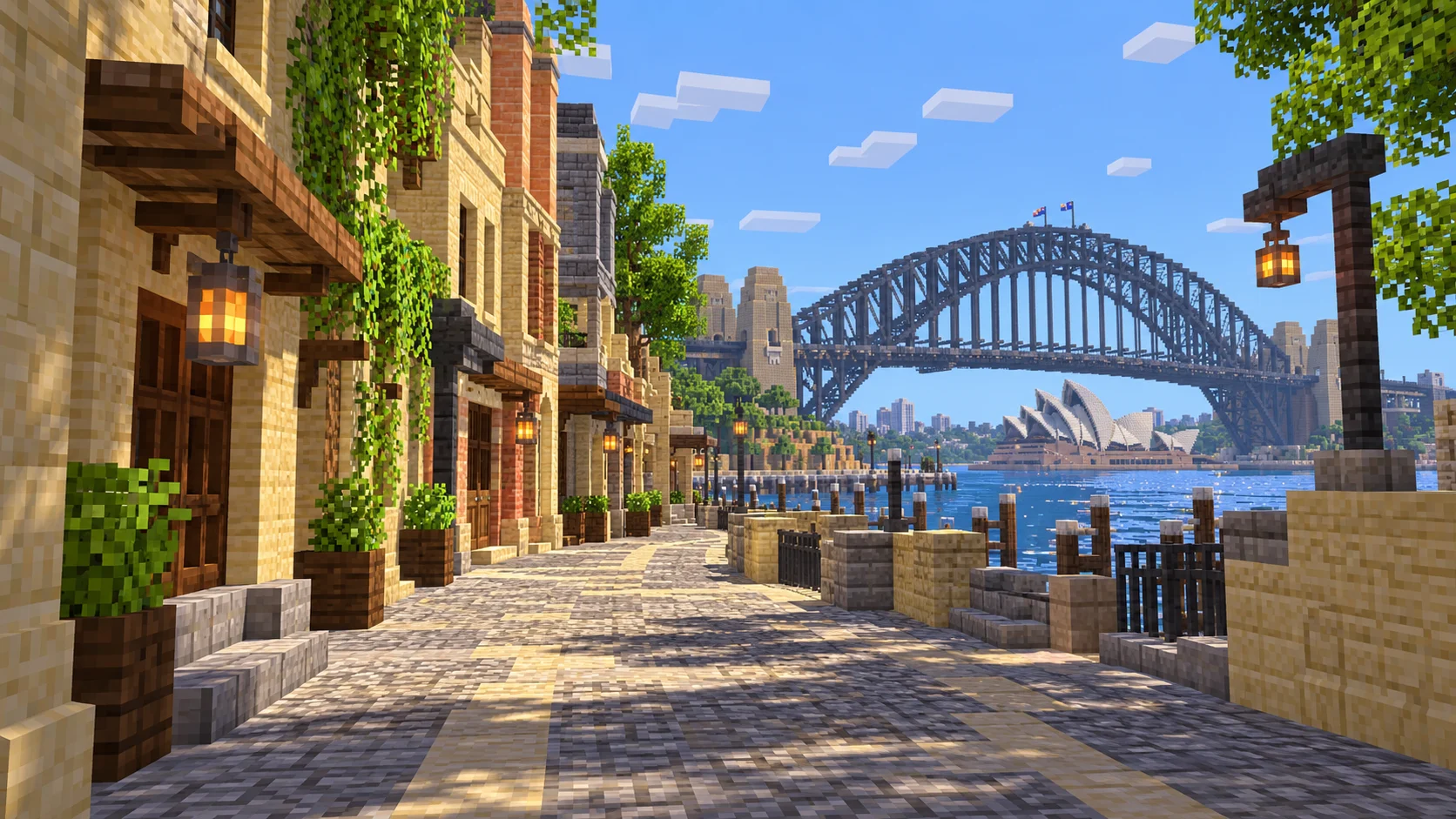
The Rocks and Walsh Bay
The lanes behind Circular Quay rise up toward the bridge on the west side of Sydney Cove. Start at First Fleet Park and find the turn into the narrow blocks of The Rocks. A shopfront you build at the top of a lane needs a different entrance height from the one at the bottom. If you keep following the shoreline west, the rectangular finger wharves of Walsh Bay give you more room to work than the streets behind them.
Starting area
Royal Botanic Garden and Farm Cove
The Royal Botanic Garden dates from 1816. Its waterfront is on the east side of the Opera House, around Farm Cove. Follow the shore towards Mrs Macquaries Point to see where the park opens onto the wider harbour. The path gives you a place to build a lookout that faces the Opera House and bridge together. Put a second bench low down near the water and compare how much of each landmark stays in view.
Starting area
Barangaroo and Darling Harbour
Barangaroo Reserve turns the corner between Walsh Bay and the waterfront leading south to Darling Harbour. The open water here sits between Pyrmont on one side and the city on the other. Use Pyrmont Bridge to divide the harbour into two short sections of a building project: moorings and a walkway to the north, a waterside plaza to the south.
Starting area
Town Hall and Hyde Park
Sydney Town Hall sits on George Street inland from Darling Harbour. Head east through the city blocks to Hyde Park, where the space between rows of buildings suddenly widens. For a city-centre route on a server, give players a way to go from the park to Circular Quay without moving the spawn. Mark two or three street turns with signs so it works even when the harbour is beyond their render distance.
Illustrations. Generated worlds follow OpenStreetMap data and differ in detail.
03 / Why this city
What the harbour gives you to build on
The shoreline is the easiest way to keep your bearings. Sydney Cove, Farm Cove and Darling Harbour sit at different angles to the south shore. Cross between them on land and buildings will interrupt your view. Take a boat into open water or fly from the bridge approaches and you can see how the headlands separate the coves. If you build a lookout, test it from ground level first: a clear view from the air can disappear behind the next row of roofs.
Use the gallery as a reference for projects such as the Opera House shells and the bridge truss. The generator builds from mapped footprints and available heights. A building may appear as a plain volume even if it is recognisable by its location. The gallery shows details you can build by hand, including sandstone trim, glass walls and steel bracing. It also simplifies the spacing between districts. Use the generated shorelines and streets to lay out a build.
04 / Play
Best ways to play the Sydney map
Challenge 01
Set up a Circular Quay ferry crossing
Sydney’s F4 ferry stops at both Circular Quay and Milsons Point. Build one landing near each of those wharves. Run the trip once in a boat to get the approach angle right at each end. At the bridge, steer through the open water between the supports. Place the signs and waiting areas on land. On a server, leave a side berth for returning boats so somebody arriving from The Rocks can join the route without blocking the main landing.
Challenge 02
Build the Opera House shells from the podium up
Trace the podium and pick a water-facing view before placing the first white shell. Sketch a stepped curve and use it as a template for the main shells. Trim the edge with stairs and slabs. Test the shape from Circular Quay and again from Farm Cove. Leave enough space between shells to see the narrow strips where you can add dark glass.
Challenge 03
Give the Harbour Bridge separate walking and rail paths
Follow the centreline of the existing deck before placing the arch. Draw the same curve on both sides so the bracing can join up. Put your footpath on the east side, facing the Opera House. The real bridge carries trains on the west side. If you add rails there, bring the line down in short steps on both shores so it can connect to your streets.
Challenge 04
Connect The Rocks to the Walsh Bay wharves
Choose a short lane near the southern bridge approach and rebuild one side with sandstone, narrow doors and shallow steps. Follow that lane down to the waterfront and lay a walking route out along a wharf. Leave enough room for a boat to turn around its end. Add a stair where the lane drops to the quay so the route works both on foot and from the water.
05 / Download
Download and install
Download the Sydney Harbour: Opera House, The Rocks & Kirribilli starting area as a ready-made world for Java or Bedrock Edition.
Java Edition
UnzipExtract the ZIP to get a folder with level.dat inside.
CopyMove the folder into .minecraft/saves.
PlayOpen Minecraft Java Edition and choose Singleplayer.
Bedrock Edition
OpenOn Windows, double-click the .mcworld file. On phones and tablets, open it with Minecraft.
ImportMinecraft imports the world automatically.
PlayFind the new world in your Worlds list and open it.
If the world does not show up
Java: check that level.dat sits directly inside the world folder, not one folder deeper.
Bedrock: if double-clicking does nothing, open Minecraft first and then open the .mcworld file again.
Open the world with the listed Minecraft version or a newer one.
Lower your render distance if a large city loads slowly at first.
The rectangle covers 25.13 km² between 33.892° and 33.844° S and 151.181° and 151.232° E. The generated Java area measures 4,708 × 5,337 blocks, at about one block per metre. Both editions start at (3122, −25, 1612) on Bennelong Lawn in Creative mode at midday.
OpenStreetMap provides the road network, water, park boundaries and building outlines. Ground height comes from elevation data. Buildings use mapped heights or floor counts when available and a default height elsewhere.
The generator lays out the Opera House site, bridge and wharves. The illustrated roof shells and steel bracing are building projects. The world has no ferry service or furnished interiors.
Bondi Beach and Manly sit outside this download. Their presets open their own rectangles in the generator. Keep the OpenStreetMap attribution file with either edition if you host or share the world.
OpenStreetMap is edited by volunteers, so coverage varies from street to street, and recent changes may be missing.
Yes. During the promotion, sign in to download any published city map for Java or Bedrock without using points or paying.
What is included in the Sydney Minecraft map?
It covers Sydney Harbour around Bennelong Point, Circular Quay and The Rocks, across the Harbour Bridge to Milsons Point and Kirribilli. The Royal Botanic Garden, Barangaroo, Darling Harbour and the streets around Town Hall are also in the download. Each beach preset covers its own area.
How do I install the Sydney world for Java Edition?
Download the 181 MB ZIP, saved with Java 1.21.4. Extract the ZIP into a new folder inside .minecraft/saves and check that level.dat is directly inside that folder. Choose Arnis World 1 from Singleplayer. Keep a copy of the original ZIP if you plan to upgrade the save to a newer version.
Does the Sydney map work on Minecraft Bedrock?
Open the 95 MB .mcworld file in Minecraft Bedrock on Windows, Android or iOS. Once the import finishes, select Arnis World: Sydney on the Worlds screen. Consoles do not import .mcworld files directly.
Are the Opera House sails and the Harbour Bridge arch already built?
The Java world has the Opera House podium and low building volumes, and the bridge has a deck and pylons. Use those shapes as the base for the detailed shells and bracing shown in the illustrations.
Can I build or host a multiplayer version?
For Java, put the world folder next to your server JAR and set level-name in server.properties. For Bedrock Dedicated Server, rename the .mcworld file to .zip, extract it to a folder under worlds and use that folder name in level-name. Leave the included OpenStreetMap attribution with the files.