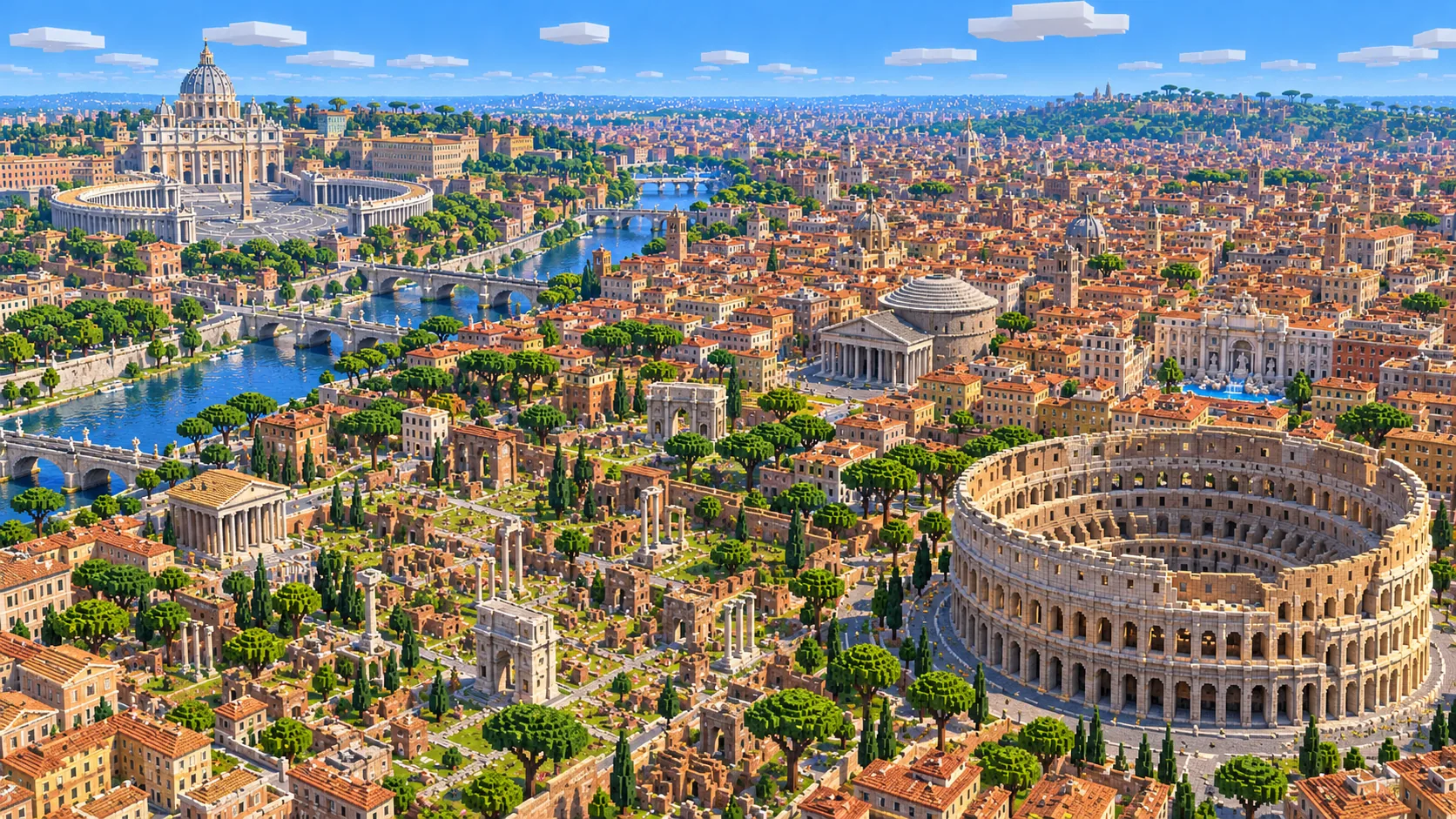
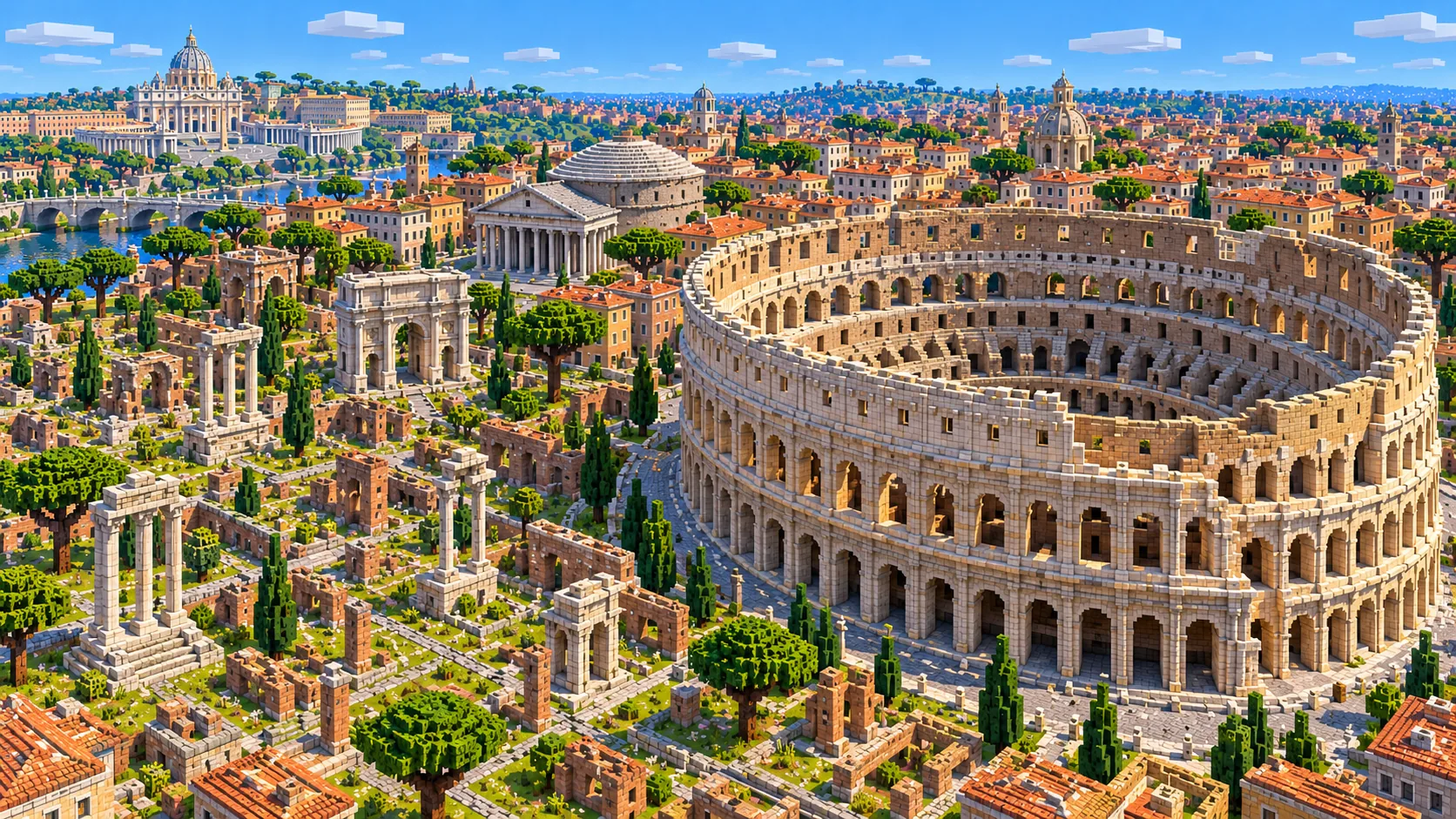
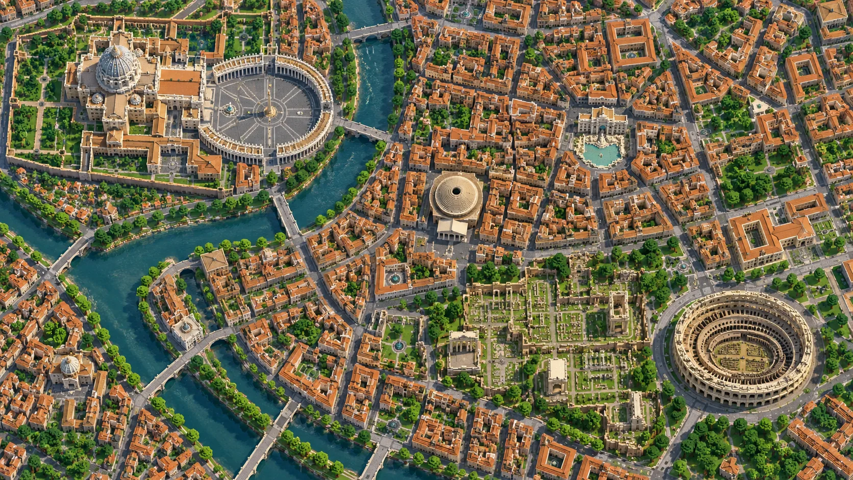
The Colosseum, the Roman Forum, the Pantheon and St Peter’s Basilica in one Minecraft world, with the Tiber between the old city and the Vatican. This Rome Minecraft map covers about 22.8 km² of the city center, built from real OpenStreetMap data: the whole of Vatican City, Castel Sant’Angelo, Piazza Navona, the Trevi Fountain, the Spanish Steps and Piazza del Popolo, Trastevere and the Janiculum, the Palatine and the Circus Maximus, and Termini station on the east side. You spawn at the Colosseum. Download it for Java or Bedrock, or open it in the in-browser player on this site.
Illustrations. Generated worlds follow OpenStreetMap data and differ in detail.
Starting area
Central Rome: Colosseum, Pantheon & the Vatican
Size
22.8 km²
Editions
Java & Bedrock
Download
Ready to play
Data
OpenStreetMap
01 / Overview
Overview: Rome as a Minecraft world
The map is a rectangle of about 5.1 km east to west and 4.4 km north to south. Its west edge runs just past the Vatican walls, so all 0.49 km² of Vatican City is inside, gardens included. The east edge is just beyond Roma Termini; it cuts through St John Lateran, so to get that basilica whole you would generate a separate area around it. The north edge clips Villa Borghese just past the Galleria Borghese, and the south edge runs past the Baths of Caracalla and the Pyramid of Cestius. Most of the city inside the Aurelian Walls fits, along with Trastevere and the Borgo across the river.
Rome has no grid. The ancient center sits in the low ground between the hills, and the medieval streets of the Campo Marzio fill a bend of the Tiber. Via Nazionale and Corso Vittorio Emanuele II were cut through it in the 19th century; Via del Corso is straight for an older reason, because it follows the Roman Via Flaminia. The generator turns OpenStreetMap roads, building footprints, the river, parks and ruins into blocks at roughly one block per meter, then adds terrain from elevation data, so the Palatine, the Capitoline, the Aventine and the Janiculum rise out of the streets as real slopes. The world is about 5,130 × 4,450 blocks. The surface of the Tiber is at about Y -51, the low-lying center stays within a few blocks of it, and St Peter’s Square sits higher, at about Y -37.
From the spawn at the Colosseum it is about 1.5 km in a straight line to the Pantheon and 3.4 km to St Peter’s Basilica. The Pantheon, Piazza Navona, the Trevi Fountain and the Spanish Steps fit inside a single square kilometer. One world holds the ancient city, the Baroque city and the Vatican.
Illustrations. Generated worlds follow OpenStreetMap data and differ in detail.
02 / Inside the map
What's included in the Rome map
The recommended starting area covers the Colosseum and the Arch of Constantine, the Roman Forum and the Palatine, the Imperial Forums and Trajan’s Column, the Circus Maximus, the Baths of Caracalla, Piazza Venezia and the Vittoriano, the Capitoline Hill, the Pantheon, Piazza Navona, Campo de’ Fiori, the Trevi Fountain, the Spanish Steps, Via del Corso, Piazza del Popolo and the Pincio, Villa Borghese and the Galleria Borghese, the Mausoleum of Augustus and the Ara Pacis, Castel Sant’Angelo and Ponte Sant’Angelo, St Peter’s Square and St Peter’s Basilica, the Vatican Museums and Gardens, Tiber Island, Trastevere, the Janiculum, the Aventine, the Pyramid of Cestius, Santa Maria Maggiore and Roma Termini. Places marked as separate presets are outside it. Open them from the customize section below.
Starting area
The Colosseum, the Forum and the Palatine
You spawn just west of the Colosseum, which opened in AD 80 and measures about 189 × 156 m. In the world it is an oval ring around an open arena, and the tall section of the outer wall stands on the north side, about 57 blocks above the street, as the surviving wall does in Rome. West of it the Roman Forum lies in the hollow below the Palatine, and Via dei Fori Imperiali runs about 850 m past the Imperial Forums to Piazza Venezia. The Circus Maximus, about 600 m long, sits in the valley on the far side of the Palatine.
Starting area
Piazza Venezia, the Vittoriano and the Capitoline
The white marble Vittoriano, finished in 1925, is the bulkiest building in the center and the easiest one to steer by. The Capitoline Hill rises right behind it, with Michelangelo’s Piazza del Campidoglio on top, and Via del Corso leaves the square heading straight north.
Starting area
The Pantheon, Piazza Navona and Campo de’ Fiori
The Pantheon has stood since about AD 125; its dome is 43.3 m across and just as high inside. It generates as a stepped round dome about 55 blocks wide, topping out roughly 45 blocks above the piazza. Piazza Navona, 300 m to the west, keeps the long, round-ended shape of Domitian’s stadium, and Campo de’ Fiori is a short walk south of it. This is the densest part of the map, with alleys only a few blocks wide.
Starting area
Trevi, the Spanish Steps and Piazza del Popolo
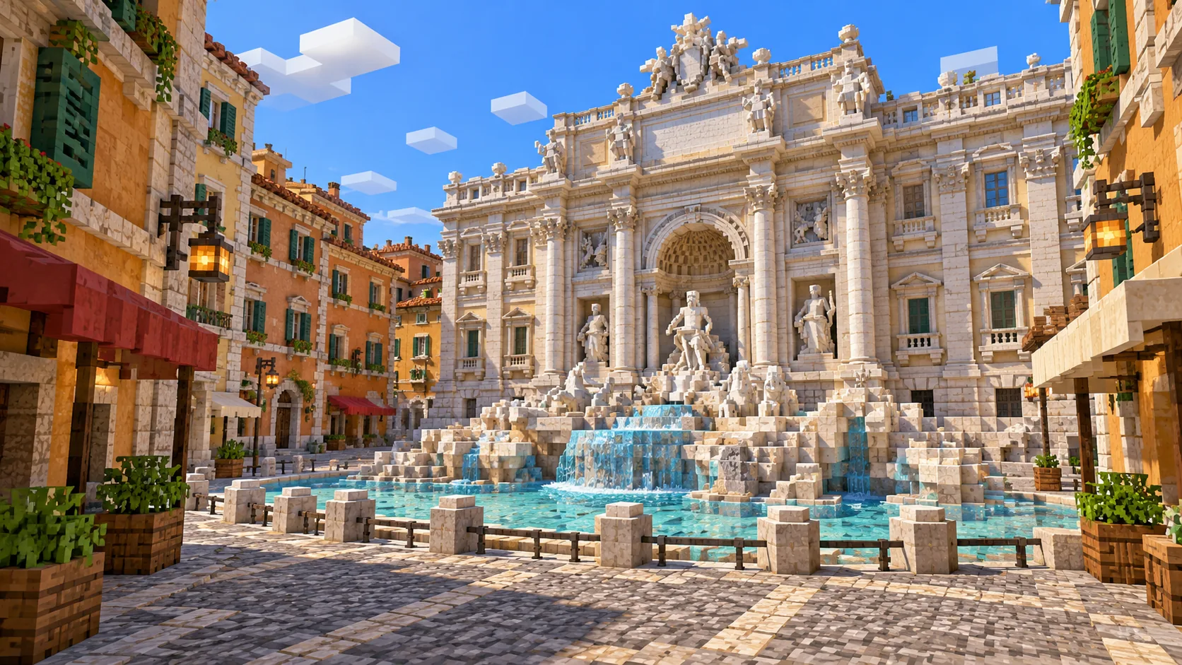
The Trevi Fountain, completed in 1762, fills one side of a small square about 600 m from the Pantheon. The Spanish Steps, 135 of them, climb from Piazza di Spagna to Trinità dei Monti. From the top, a short walk north brings you to the Pincio terrace above Piazza del Popolo, the square inside the old northern gate.
Starting area
Castel Sant’Angelo and the Vatican
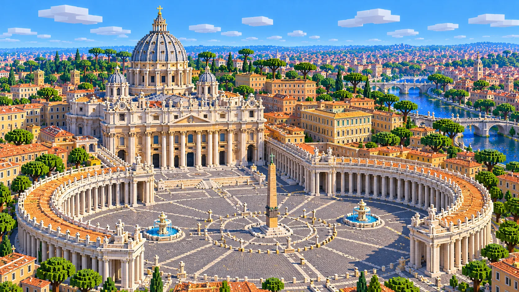
Hadrian’s round mausoleum, later a papal fortress, faces the river across Ponte Sant’Angelo. Via della Conciliazione runs about 500 m west from it to St Peter’s Square, with Bernini’s colonnades around the obelisk, then the basilica, whose dome reaches 136.57 m to the top of the cross. In the world the dome is a stepped round shape that peaks at Y 102, about 140 blocks above the square and the highest point of the map. The Vatican Museums and Gardens fill the rest of the walled state.
Starting area
Trastevere, Tiber Island and the Janiculum
Across the river from the center, Trastevere is a knot of small streets around Santa Maria in Trastevere. Tiber Island sits in the river below the Theatre of Marcellus, reached by the Ponte Fabricio of 62 BC, the oldest Roman bridge still in use, and the rebuilt Ponte Cestio. Above Trastevere the Janiculum ridge rises 30 to 45 blocks above the river, lower than the real hill but still the best lookout over the whole map.
Illustrations. Generated worlds follow OpenStreetMap data and differ in detail.
03 / Why this city
What makes Rome special in Minecraft
Layers. In most cities you build on top of a modern street plan; here the plan itself is a record of 2,000 years. Piazza Navona is long and rounded at one end because Domitian’s stadium was. The curve of Via di Grotta Pinta, behind Campo de’ Fiori, follows the seating of Pompey’s theater from 55 BC. Castel Sant’Angelo is round because it began as a tomb. The generator reproduces these shapes because they are in the street and building data, so the map shows the ancient city even where its buildings have gone.
The river and the hills. The Tiber makes two big bends through the map, one wrapping around the Campo Marzio with Castel Sant’Angelo at its tip, and a second around Tiber Island and Trastevere. The Forum sits low, with the Palatine about 24 blocks above it, and the Janiculum and the Pincio give views over the center. The relief is gentler than in the real city, since the hills come out at roughly two thirds of their height, but it is still a far more varied world to walk than a flat city of the same size.
The map is generated from data, not built by hand, and that sets its limits. Most buildings are blocks with flat roofs and repeated window patterns. The big domes are the exception: the Pantheon and St Peter’s get stepped round domes, and the Colosseum keeps its ring and arena. But the Colosseum’s arches, the coffers inside the Pantheon, the columns of the Forum, Bernini’s colonnades and the statues of the Trevi Fountain are not modeled, and ruins are only as detailed as their mapped outlines. There are no interiors, so the Sistine Chapel is an empty shell. In exchange you get the full street plan of the historic center, with every mapped building in place at roughly the right height, on real terrain.
04 / Play
Best ways to play the Rome map
Challenge 01
From the Colosseum to St Peter’s
Walk the classic route across the map: Via dei Fori Imperiali to Piazza Venezia, west along Corso Vittorio Emanuele II past the Pantheon’s back streets and Piazza Navona, over Ponte Sant’Angelo and up Via della Conciliazione to St Peter’s Square. It is about 4 km and passes many of the places on this page.
Challenge 02
Rebuild the Colosseum
The ring and the arena are already in place at about 180 × 145 blocks, with the high wall on the north side. Cut three tiers of arches into the outer wall, with the windowed attic story above them, add the seating, then dig the hypogeum, the maze of rooms under the arena floor. Leave one bay cut away to show the hypogeum below.
Challenge 03
Boat down the Tiber
Place a boat near Ponte Margherita, close to the north edge, and follow the river south past Castel Sant’Angelo, around the bend by Ponte Sisto and either side of Tiber Island to the Aventine. Where a bridge is too low to pass under, break the boat, walk round and place it again.
Challenge 04
Seven hills for a server
Give each team a hill: the Palatine, the Capitoline, the Aventine, the Caelian, the Esquiline, the Viminal and the Quirinal are all in the map, with the Forum as neutral ground in the middle. Vatican City, with its own walls, makes a natural spawn or embassy zone.
05 / Download
Download and install
Download the Central Rome: Colosseum, Pantheon & the Vatican starting area as a ready-made world for Java or Bedrock Edition.
Java Edition
UnzipExtract the ZIP to get a folder with level.dat inside.
CopyMove the folder into .minecraft/saves.
PlayOpen Minecraft Java Edition and choose Singleplayer.
Bedrock Edition
OpenOn Windows, double-click the .mcworld file. On phones and tablets, open it with Minecraft.
ImportMinecraft imports the world automatically.
PlayFind the new world in your Worlds list and open it.
If the world does not show up
Java: check that level.dat sits directly inside the world folder, not one folder deeper.
Bedrock: if double-clicking does nothing, open Minecraft first and then open the .mcworld file again.
Open the world with the listed Minecraft version or a newer one.
Lower your render distance if a large city loads slowly at first.
South-east of the walls: the Appian Way with the churches and entrances above the Catacombs of San Callisto and San Sebastiano, the Circus of Maxentius and the Tomb of Caecilia Metella, about 4 km² of countryside and Roman road.
About 25 km south-west of the center: the excavated port town of Ostia Antica, with its theater, the Capitolium, the main street (Decumanus Maximus) and whole blocks of Roman houses and warehouses.
The map covers 22.8 km², from 41.876° to 41.916° N and 12.443° to 12.505° E. At about one block per meter the world is roughly 5,130 × 4,450 blocks.
Terrain comes from elevation data, so the hills and the river valley are real slopes. Building heights come from the height and level tags in OpenStreetMap; buildings without a tag get a default height, so some churches and palaces are lower or higher than in reality.
Mapped domes are generated as stepped round domes (the Pantheon and St Peter’s among them), and the Colosseum as a ring with an open arena. Arches, columns, statues and fountain sculpture are not generated, and other ruins appear as their mapped outlines.
Interiors, the Metro, catacombs and other underground spaces are not generated. Vatican City is mapped like the rest of Rome and is fully inside the world.
OpenStreetMap is edited by volunteers, so coverage varies from street to street, and recent changes may be missing.
The historic center from the Vatican walls to Termini and from Piazza del Popolo to the Baths of Caracalla: the Colosseum, the Roman Forum and the Palatine, the Circus Maximus, Piazza Venezia, the Pantheon, Piazza Navona, the Trevi Fountain, the Spanish Steps, Villa Borghese, Castel Sant’Angelo, Vatican City with St Peter’s, Trastevere and the Janiculum. St John Lateran is cut by the east edge, and the Appian Way, EUR and Ostia Antica are outside it.
Is the Rome map free?
No. It costs $6.99 or 700 points, paid once. You keep it: the Java and Bedrock versions stay in your account to download again, and you can open it in the in-browser player on this site.
Does the Rome map work with Minecraft Java Edition?
Yes. The Java download is a ZIP of about 178 MB, saved in Java 1.21.4. Unzip it so the world folder sits directly in .minecraft/saves, not inside a second folder, then open it from Singleplayer. Newer Java versions upgrade the world when they load it.
Is there a Bedrock version of the Rome map?
Yes. The Bedrock download is an .mcworld file of about 94 MB. Open it on Windows, Android or iOS and Minecraft imports the world. Consoles cannot import .mcworld files directly, and Mac has no Bedrock Edition, so Mac players should use the Java version.
Is the Colosseum built in the map?
Yes, as an oval ring around an open arena, in the right place and close to the real size. The tall part of the outer wall stands on the north side, about 57 blocks above the street, and the rest of the ring is lower, like the real ruin. There are no arches or seating tiers: the walls are solid stone, ready for you to carve.
Is the Vatican in the map?
Yes, all of it. Vatican City is about 0.49 km² and lies completely inside the west part of the world: St Peter’s Square, the basilica, the Vatican Museums, the gardens and the walls. Interiors such as the Sistine Chapel are not generated.
What game mode does the world open in?
Creative, at midday, with the spawn point just west of the Colosseum. Switch to Survival with /gamemode survival once you are in the world.
Can I use the Rome map on a server?
Yes. Put the Java world folder next to your server jar and set level-name in server.properties to its folder name. For Bedrock Dedicated Server, rename the .mcworld to .zip, extract it into its own folder inside worlds and set level-name to that folder’s name. Keep the OpenStreetMap attribution file that comes with the world.