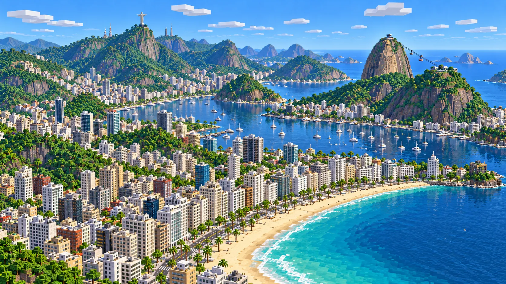
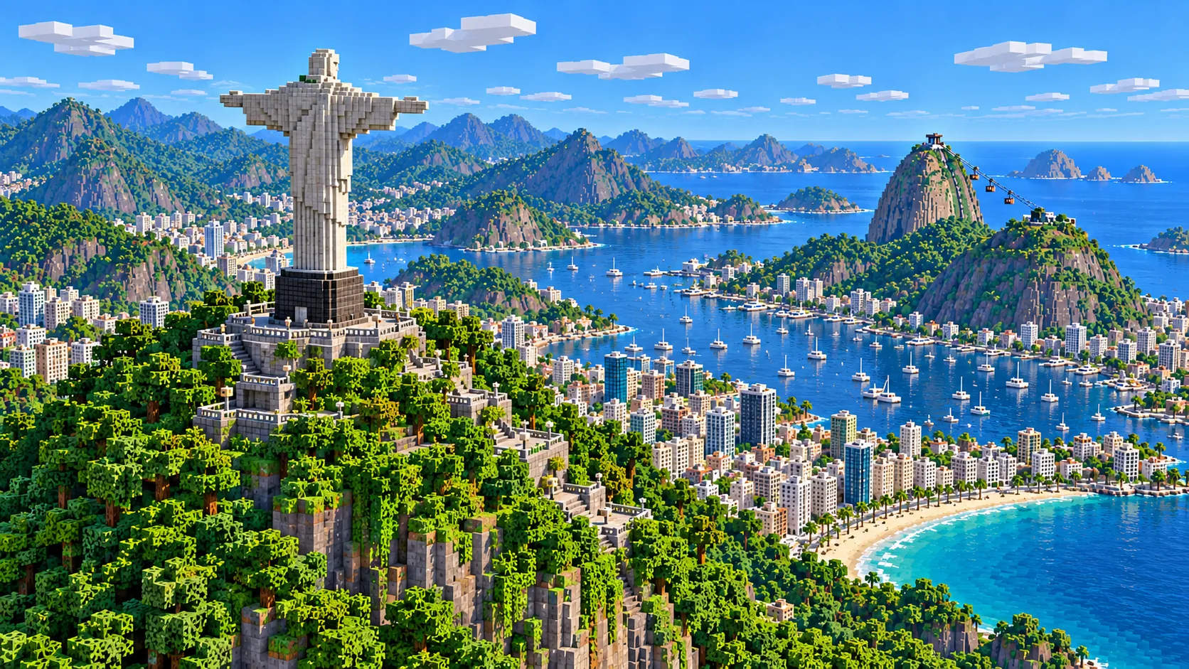
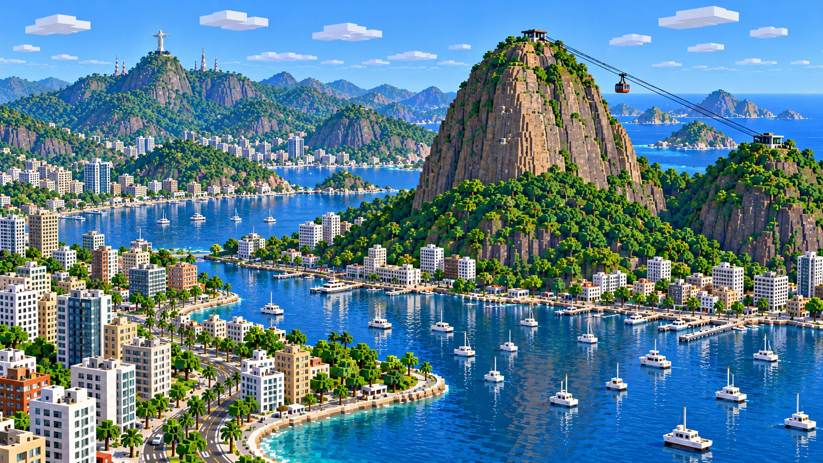
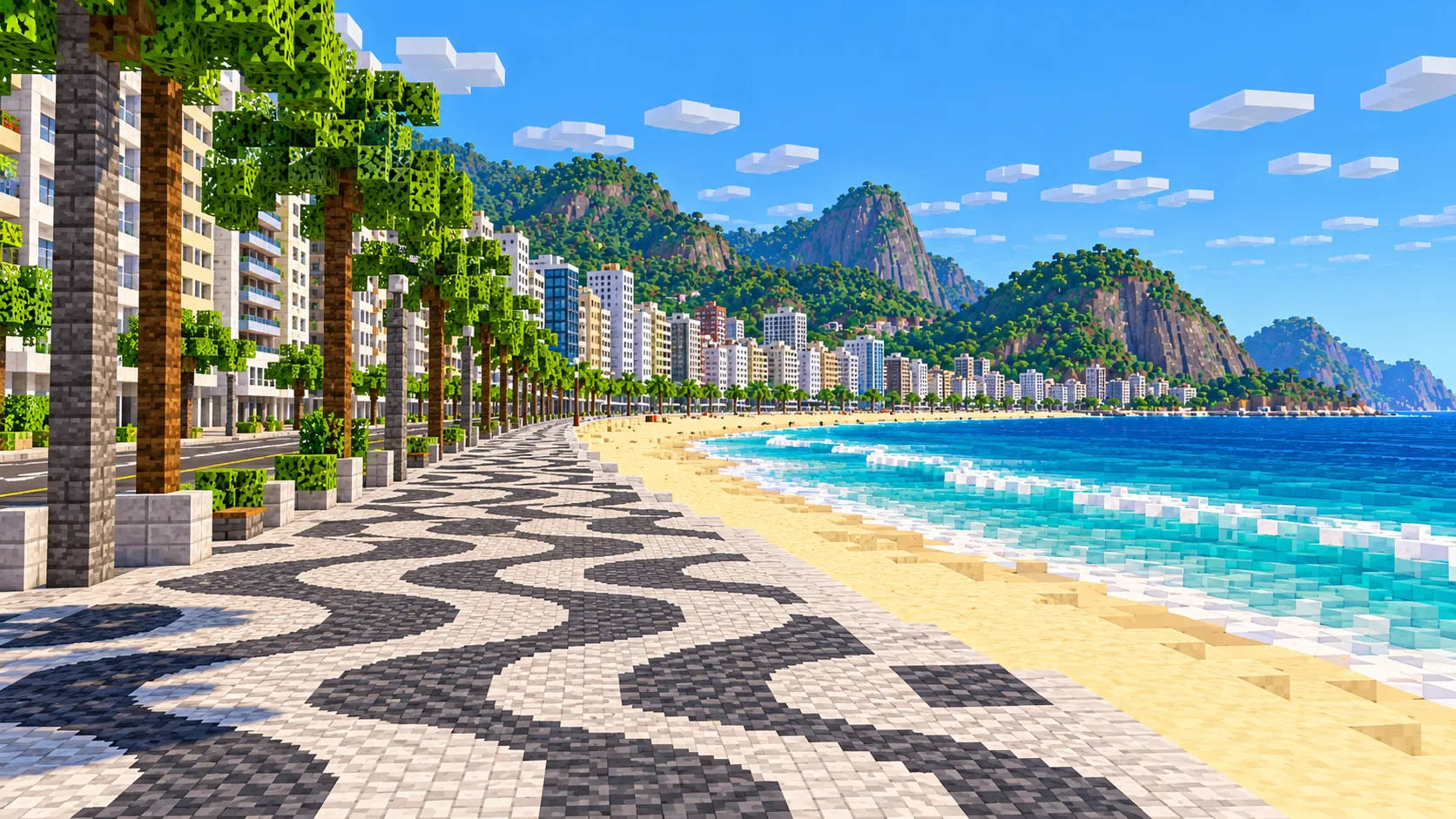
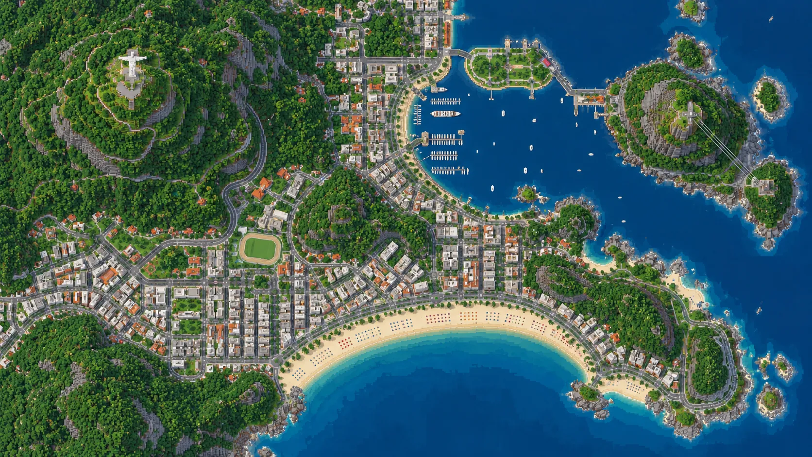
Christ the Redeemer, Sugarloaf and Copacabana in one Minecraft world. This Rio de Janeiro Minecraft map covers about 38 km² of the South Zone, built from real OpenStreetMap and elevation data: the whole of Copacabana and Leme, nearly all of Ipanema with the Arpoador rock, Urca with Sugarloaf and Morro da Urca, Botafogo bay, most of the Lagoa Rodrigo de Freitas, and the forested ridge up to the summit of Corcovado. You spawn on the sand of Copacabana beach, in front of the Copacabana Palace. Download it for Java or Bedrock, or open it in the in-browser player on this site.
Illustrations. Generated worlds follow OpenStreetMap data and differ in detail.
Starting area
South Zone: Copacabana, Sugarloaf & Corcovado
Size
37.9 km²
Editions
Java & Bedrock
Download
Ready to play
Data
OpenStreetMap
01 / Overview
Overview: Rio de Janeiro as a Minecraft world
The map is a rectangle about 6.56 km east to west and 5.75 km north to south, from 22.940° to 22.992° S and 43.150° to 43.214° W. That is most of what people mean by Rio’s Zona Sul. The east edge runs just past Sugarloaf into the mouth of Guanabara Bay. The north edge cuts through Botafogo and Cosme Velho, just past the lower station of the Corcovado train. To the west the map stops about 250 m short of the Jardim de Alah canal, where Ipanema ends and Leblon begins, and to the south it takes in the ocean off Copacabana and Ipanema. The Maracanã stadium, the old Centro and Lapa are 4 to 5 km north and have their own areas below.
Rio grew in the gaps between granite hills that rise straight out of the sea, and the rectangle holds about ten of them: Corcovado at 710 m, Sugarloaf at about 395 m, Morro Dona Marta at about 364 m, the ridge of Morro dos Cabritos (about 372 m) behind Copacabana, Morro da Babilônia and Morro do Leme between Copacabana and Urca, and the smaller rocks of Cantagalo and Arpoador. Copacabana, Botafogo and Ipanema are flat strips squeezed between those hills and the water, and they are joined by road tunnels through the rock. Much of the ground above the streets is forest, part of the Tijuca National Park on the Corcovado side.
The world is generated, not built by hand. The generator reads streets, building footprints, beaches, water, parks and land cover from OpenStreetMap, turns them into blocks at about one block per meter and shapes the ground from elevation data. The drop from the top of Corcovado to the sea is more than a Minecraft world can hold at full height, so the heights are scaled down; see the notes below. Rio is well mapped in OpenStreetMap, so the apartment blocks behind Avenida Atlântica, the hillside communities and the trails on the hills are in their real places.
Illustrations. Generated worlds follow OpenStreetMap data and differ in detail.
02 / Inside the map
What's included in the Rio de Janeiro map
The recommended starting area covers Christ the Redeemer on Corcovado and the Corcovado rack railway from Cosme Velho, Sugarloaf and Morro da Urca with the cable car stations, Praia Vermelha and the Urca waterfront, Botafogo beach and bay, the Dona Marta lookout, Copacabana and Leme beaches with Avenida Atlântica and the Copacabana Palace, the Copacabana Fort, the Arpoador rock, Ipanema beach and the Lagoa Rodrigo de Freitas. Places marked as separate presets are outside it. Open them from the customize section below.
Starting area
Christ the Redeemer and Corcovado
The statue stands on the 710 m summit of Corcovado in the north-west of the map, about 3.8 km from the spawn. It is 30 m tall on an 8 m pedestal, with arms 28 m across, and was inaugurated in 1931. The Corcovado rack railway, opened in 1884, climbs about 3.8 km through the forest from its lower station in Cosme Velho, at the north edge of the map, to just below the summit.
Starting area
Sugarloaf, Morro da Urca and the cable car
The two granite domes stand at the east edge, about 3 km from the spawn. The cable car opened its first section, from Praia Vermelha up to the 220 m Morro da Urca, in 1912, and a second section crosses to the summit of Sugarloaf, about 395 m. The station buildings at all three stops are in the map; the cable itself is not.
Starting area
Copacabana and Leme
The beach curves about 4 km from the Leme rock in the north-east to the Copacabana Fort at the south-west end, with Avenida Atlântica and its promenade along the sand and a solid wall of apartment blocks behind. The spawn is on the beach in front of the Copacabana Palace hotel, about a third of the way along from Leme.
Starting area
Arpoador and Ipanema
Past the Copacabana Fort, the Arpoador rock juts into the sea between the two beaches. Ipanema beach runs about 2 km west from it inside the map, with the street grid of Ipanema behind. In the real city the twin peaks of Morro Dois Irmãos rise just past the west edge; they are not in the map.
Starting area
Urca, Praia Vermelha and the bay mouth
Urca is a small, low neighborhood on flat land at the foot of Sugarloaf. Praia Vermelha faces the open sea on its south side; the Mureta da Urca, a low sea wall on the bay side, looks across to Botafogo. Rio was founded on March 1, 1565, on the narrow strip of land between Sugarloaf and Morro Cara de Cão, and the Fortaleza de São João still guards that spot, right on the north edge of the map.
Starting area
Botafogo bay and the Dona Marta lookout
Botafogo beach lines a round cove of Guanabara Bay along the north edge, filled with moored boats, with Sugarloaf across the water. Behind Botafogo the ground climbs to the Dona Marta lookout, at about 360 m, just below the 364 m peak, which has one of the classic views of the bay with Sugarloaf beyond it.
Starting area
Lagoa Rodrigo de Freitas
The lagoon behind Ipanema sits in the west of the map, with Corcovado rising above its north shore. All but the westernmost few hundred meters are inside the world. A path runs around the shore, and Parque Lage, at the foot of Corcovado, is just north of it at the edge of the map.
Separate preset
Maracanã, Centro, Leblon and the Botanical Garden
Four places players often look for are outside this world. The Maracanã stadium is about 5 km north of Corcovado, the Centro and the Lapa arches about 4 km north of Botafogo, and Leblon and the Jardim Botânico just past the west edge. The Maracanã and Centro each have an area below.
Illustrations. Generated worlds follow OpenStreetMap data and differ in detail.
03 / Why this city
What makes Rio special in Minecraft
Most generated cities are flat grids where the elevation data barely shows. Rio is the opposite. From the spawn on Copacabana beach you look up at steep forested hills on three sides, and the neighborhoods fill only the flat ground between them and the sea. Walk inland from Avenida Atlântica and within a few hundred meters the streets end against a slope. Corcovado and Sugarloaf come straight from the elevation data, and the trails, roads and railway that climb them follow their real lines over the scaled terrain.
The map holds two kinds of coast: the long ocean beaches of Copacabana and Ipanema facing south, and the sheltered coves of Guanabara Bay at Botafogo and Urca facing north. Between them, Sugarloaf and the hills of Urca and Leme stand right at the bay mouth. Botafogo cove opens north into the bay at the map’s edge, so inside the world you cross between the two coasts over land, through the streets of Botafogo or over the hills, rather than by sea.
What the generator does not make is the detail that the illustrations on this page show. Christ the Redeemer is a point on the summit in OpenStreetMap, so it does not appear as a statue; you get the summit with its viewing platform and the outlines of the station, shops and terraces just below it, and the statue is yours to build. The cable car’s cable and cabins, the wave pattern of the Copacabana promenade, beach kiosks, roof shapes and interiors are not generated either. Buildings take their height from OpenStreetMap tags, or a default height where there are none, and the hillside communities come out as dense clusters of small blocks.
04 / Play
Best ways to play the Rio de Janeiro map
Challenge 01
Climb from Copacabana to Christ the Redeemer
Start at the spawn and head north-west: through the streets of Copacabana, past the Lagoa and up the Corcovado ridge to the summit, about 3.8 km in a straight line and much more on the winding road. Then build the statue on the empty summit. The summit is at about Y 255, which leaves about 60 blocks under the build limit: room for a full-size statue, 30 blocks tall on an 8-block pedestal with arms 28 blocks across, which reads from Copacabana far better than one shrunk to match the compressed hills.
Challenge 02
Rebuild the Sugarloaf cable car
The three stations are in the map: Praia Vermelha at sea level, Morro da Urca and the top of Sugarloaf. String the two spans between them with chains or fences and hang a cabin of glass and red concrete from each, or run a minecart line on a scaffold for a ride that actually moves.
Challenge 03
Lay the Copacabana wave pavement
The promenade along Avenida Atlântica is generated as a plain walkway. Pave it in the famous black and white wave pattern, in its current form a 1970 design by Roberto Burle Marx, with polished blackstone and white concrete or calcite. The beach is about 4 km long, so split it between players on a server and meet in the middle at the Copacabana Palace.
Challenge 04
Sail the ocean beaches from Sugarloaf to Ipanema
Put a boat in at Praia Vermelha, the small beach between Sugarloaf and Morro da Babilônia, and head out around the Leme rock. Then run along the whole curve of Leme and Copacabana to the fort, past the Arpoador rock and down Ipanema to the west edge of the map: about 8 km of open water with the city on one side the whole way.
05 / Download
Download and install
Download the South Zone: Copacabana, Sugarloaf & Corcovado starting area as a ready-made world for Java or Bedrock Edition.
Java Edition
UnzipExtract the ZIP to get a folder with level.dat inside.
CopyMove the folder into .minecraft/saves.
PlayOpen Minecraft Java Edition and choose Singleplayer.
Bedrock Edition
OpenOn Windows, double-click the .mcworld file. On phones and tablets, open it with Minecraft.
ImportMinecraft imports the world automatically.
PlayFind the new world in your Worlds list and open it.
If the world does not show up
Java: check that level.dat sits directly inside the world folder, not one folder deeper.
Bedrock: if double-clicking does nothing, open Minecraft first and then open the .mcworld file again.
Open the world with the listed Minecraft version or a newer one.
Lower your render distance if a large city loads slowly at first.
About 3.3 km² of the old Centro about 4 km north of Botafogo: the Lapa arches, the Selarón steps, the Theatro Municipal, Cinelândia and the cone of the Metropolitan Cathedral.
About 5 km² in the North Zone around the Maracanã stadium, with the Quinta da Boa Vista park and the former imperial palace that housed the National Museum.
The map covers about 38 km², from 22.940° to 22.992° S and 43.150° to 43.214° W. At about one block per meter across the ground the world is roughly 6,560 × 5,750 blocks.
Heights are compressed about 2.3 to 1 so that the 710 m rise from the sea to the top of Corcovado fits in a Minecraft world, while distances across the ground stay at about one block per meter. The sea is at about Y -56 and Copacabana beach and the Lagoa just above it, the top of Morro da Urca is at about Y 70, Sugarloaf at about Y 117 and the summit of Corcovado at about Y 255, about 60 blocks below the build limit at Y 319.
Streets, building footprints, beaches, the bay, the lagoon, parks, trails and land cover come from OpenStreetMap. Building heights come from height and level tags where they exist and a default height where they do not.
Christ the Redeemer and the other statues, the cable car’s cable and cabins, the promenade’s wave pattern, roof shapes and interiors are not generated. Roads inside the tunnels between Botafogo, Copacabana and Ipanema may not come through as open tunnels.
OpenStreetMap is edited by volunteers, so coverage varies from street to street, and recent changes may be missing.
What does the Rio de Janeiro Minecraft map include?
Rio’s South Zone in one world: Corcovado with the Christ the Redeemer summit and the rack railway, Sugarloaf and Morro da Urca with Urca and Praia Vermelha, Botafogo beach and bay, the whole of Copacabana and Leme, the Arpoador rock and nearly all of Ipanema, and most of the Lagoa Rodrigo de Freitas. Leblon, the Botanical Garden, the Centro and the Maracanã are outside it.
Is the Rio de Janeiro map free?
No. It costs $6.99 or 700 points, paid once. You keep it: the Java and Bedrock versions stay in your account to download again, and you can open it in the in-browser player on this site.
Is the Christ the Redeemer statue in the map?
Its place is. The summit of Corcovado and the railway up to it are generated from real data, but the statue itself is mapped as a single point, so the world has no statue on the summit. Most players build it themselves; the summit is a good flat base for it.
Does the Rio map work with Minecraft Java Edition?
Yes. The Java download is a ZIP of about 229 MB, saved in Java 1.21.4. Unzip it so the world folder sits directly in .minecraft/saves, not inside a second folder, then open it from Singleplayer. Newer Java versions upgrade the world when they load it.
Is there a Bedrock version of the Rio map?
Yes. The Bedrock download is an .mcworld file of about 120 MB. Open it on Windows, Android or iOS and Minecraft imports the world. Consoles cannot import .mcworld files directly, and Mac has no Bedrock Edition, so Mac players should use the Java version.
Are Corcovado and Sugarloaf their real height?
Not at true height. Corcovado rises 710 m from the sea, more than the 384 blocks of height a Minecraft world has, so the generator compresses heights about 2.3 to 1. Sugarloaf stands about 173 blocks above the water instead of about 395 m, and the summit of Corcovado about 310 blocks. Distances across the ground stay at about one block per meter, so the hills look wider and less steep than the real ones.
Is the Maracanã stadium in the map?
No. The Maracanã is in the North Zone, about 5 km north of Corcovado. The Maracanã area on this page generates the stadium and the Quinta da Boa Vista park next to it as a separate world of about 5 km².
What game mode does the world open in?
Creative, at midday, with the spawn point on Copacabana beach in front of the Copacabana Palace. Switch to Survival with /gamemode survival once you are in the world.
Can I use the Rio map on a server?
Yes. Put the Java world folder next to your server jar and set level-name in server.properties to its folder name. For Bedrock Dedicated Server, extract the .mcworld into the worlds folder. Keep the OpenStreetMap attribution file that comes with the world.