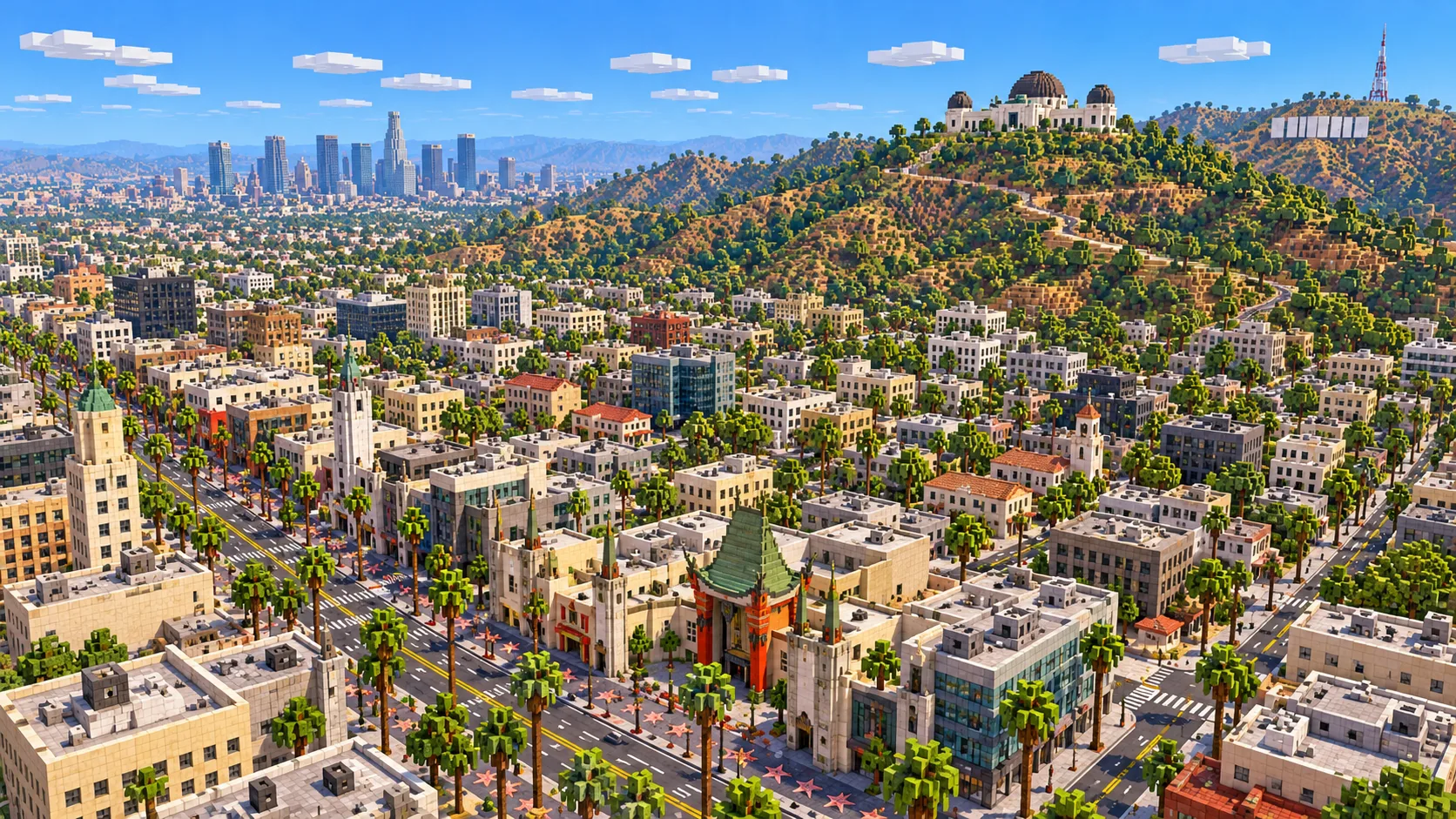
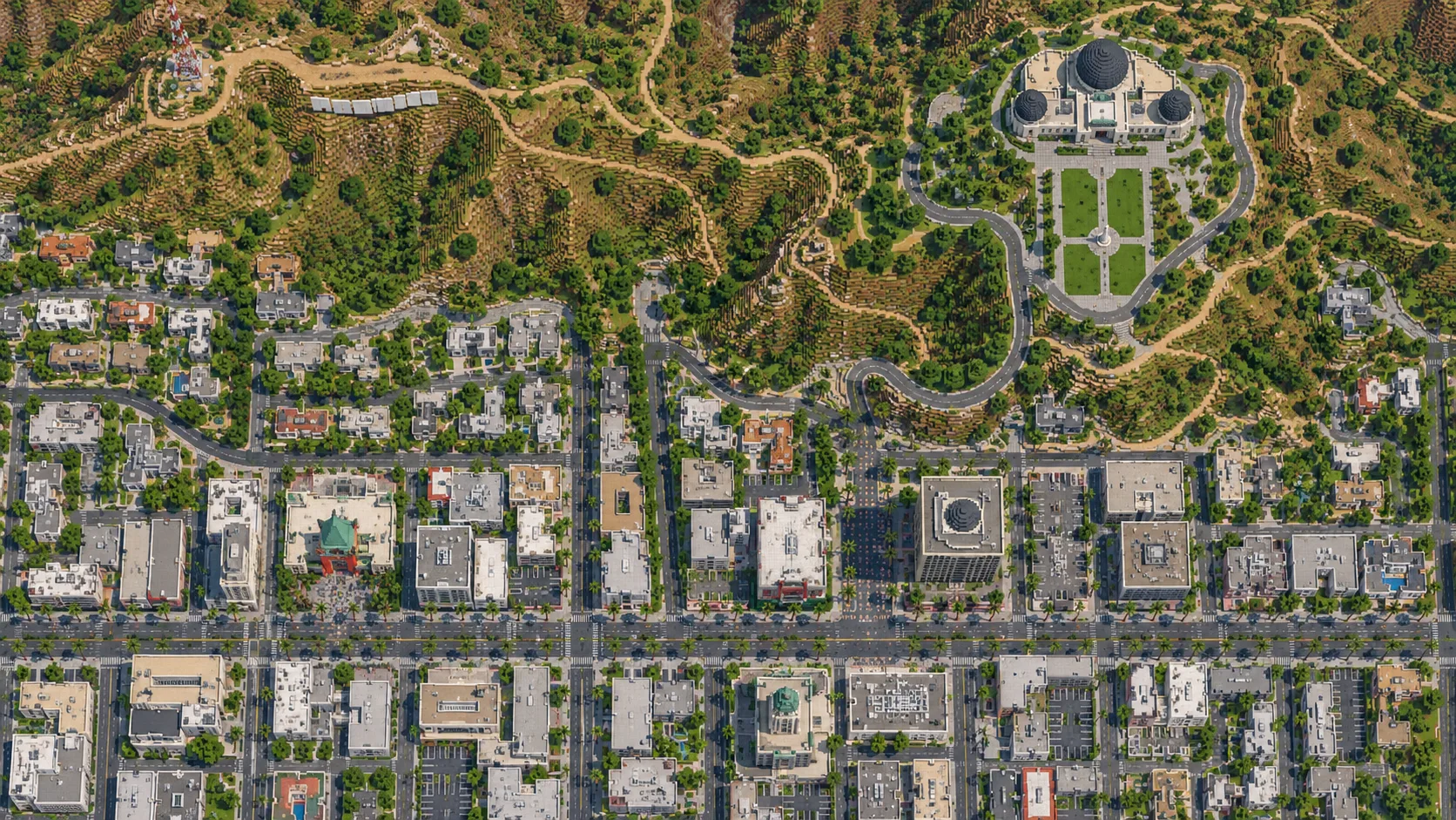
Hollywood Boulevard, the Hollywood Hills and Griffith Observatory in one Minecraft world. This Los Angeles Minecraft map covers about 28 km² of Hollywood, built from OpenStreetMap data and real elevation. Down in the flats are the Walk of Fame from La Brea Avenue to Gower Street, the TCL Chinese Theatre, the Dolby Theatre, the Capitol Records Tower and Sunset Boulevard. Up in the hills are the Hollywood Bowl, Lake Hollywood and Mount Lee, where the Hollywood Sign stands. To the east is the south-west corner of Griffith Park, with the Observatory, Bronson Canyon and the Greek Theatre. You spawn on the Observatory lawn, high above the city. It is Hollywood, not all of Los Angeles: Santa Monica, Downtown and Universal Studios are outside it. Download it for Java or Bedrock, or open it in the in-browser player on this site.
Illustrations. Generated worlds follow OpenStreetMap data and differ in detail.
Starting area
Los Angeles: Hollywood, the Hollywood Sign & Griffith Observatory
Size
28.3 km²
Editions
Java & Bedrock
Download
Ready to play
Data
OpenStreetMap
01 / Overview
Overview: Hollywood as a Minecraft world
Los Angeles is too spread out for one rectangle. Santa Monica Pier is about 18 km from the Chinese Theatre and Downtown about 10 km, while the generator stops at 50 km². So this map picks the part most people mean when they say they want to build L.A.: Hollywood. The world is about 5.5 km from west to east and 5.1 km from south to north. The south edge runs a little below Sunset Boulevard, the west edge just past Runyon Canyon, and the east edge along Vermont Avenue, so Barnsdall Art Park and the Greek Theatre are in and the shops on Hillhurst Avenue are not. To the north the map climbs into the hills and ends just past the summit of Mount Lee, behind the Hollywood Sign.
Half the map is city and half is hills, and the line between them is sharp. South of Franklin Avenue the ground is a flat grid of boulevards, apartment blocks and studios. North of it the land folds up into the Hollywood Hills, the eastern end of the Santa Monica Mountains: steep canyons, ridge-top streets, the Hollywood Bowl in its natural amphitheater, Lake Hollywood behind its dam, and the open, roadless slopes of Griffith Park. The generator turns OpenStreetMap roads, building footprints, water and land cover into blocks at about one block per meter and shapes the ground from elevation data. The hills are too high to fit at full scale above the city, so heights are scaled down a little: one block of height stands for about 1.3 m, while distances on the ground stay at about one block per meter. Hollywood and Vine is at about Y -41, Lake Hollywood at about Y 39, Mount Hollywood at about Y 257 and the top of Mount Lee at about Y 275.
From the spawn on the Observatory lawn it is about 2.7 km in a straight line to the Hollywood Sign, 4.2 km to the Chinese Theatre and 2.9 km to the Capitol Records Tower. Mount Lee and Mount Hollywood face each other across the top of the park, with Bronson Canyon on the slope between them. On a clear day the real Observatory looks across the whole basin; in the world the view ends at the map edge, about 2.5 km south of the Observatory and a few hundred meters past Sunset Boulevard.
Illustrations. Generated worlds follow OpenStreetMap data and differ in detail.
02 / Inside the map
What's included in the Los Angeles map
The recommended starting area covers Hollywood Boulevard and the Hollywood Walk of Fame, the TCL Chinese Theatre, the Dolby Theatre, the El Capitan Theatre, the Hollywood Roosevelt Hotel, the Capitol Records Tower, Hollywood and Vine, the Pantages Theatre, Sunset and Vine with the Cinerama Dome, Hollywood High School, Runyon Canyon Park, the Hollywood Bowl, Lake Hollywood and Mulholland Dam, Mount Lee and the Hollywood Sign, Griffith Observatory, Mount Hollywood, Bronson Canyon and the Bronson Caves, the Greek Theatre, Barnsdall Art Park and Hollyhock House. Places marked as separate presets are outside it. Open them from the customize section below.
Starting area
Griffith Observatory and Mount Hollywood
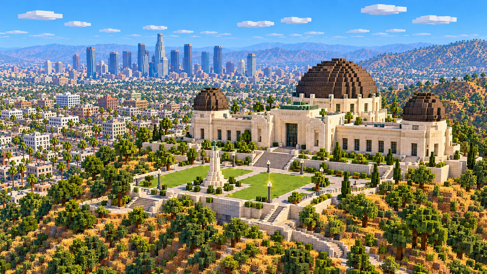
The spawn point. The Observatory opened in May 1935 on the south slope of Mount Hollywood, about 346 m above sea level, and admission has been free ever since under the terms of Griffith J. Griffith’s gift. In the world it is a flat-roofed block on the real footprint, its roof at about Y 175, with the lawn and the parking lot on the slope below it. The trail from the parking lot to the 495 m summit of Mount Hollywood is about 2 km.
Starting area
Mount Lee and the Hollywood Sign
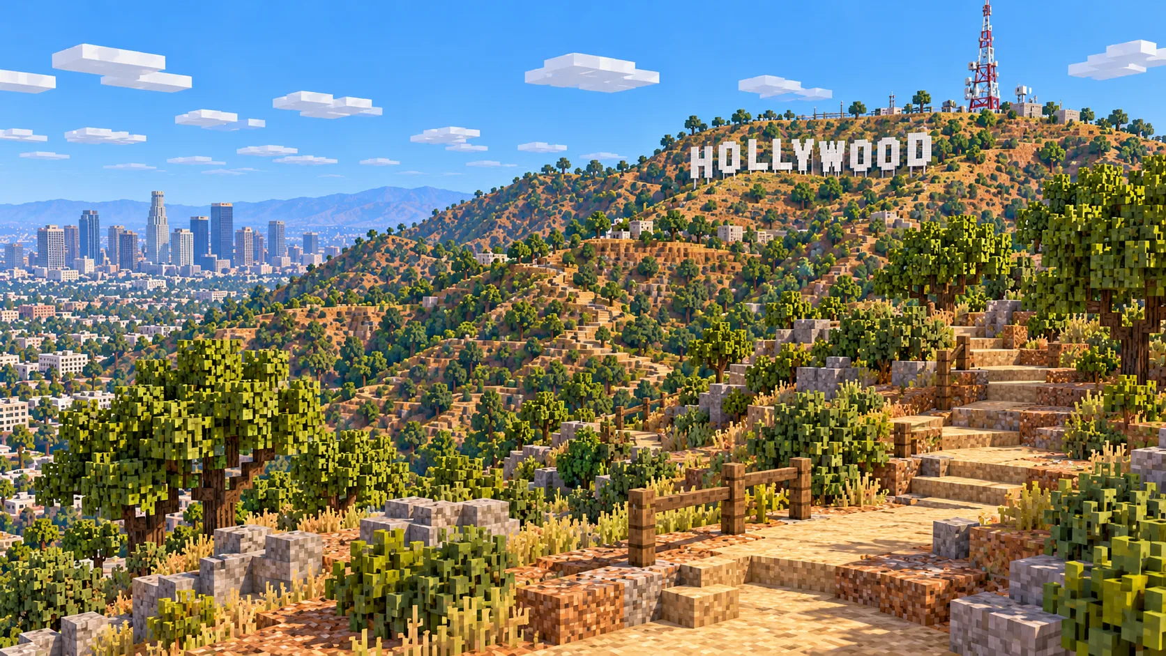
The sign went up in 1923 as HOLLYWOODLAND, an advertisement for a housing tract below it. The last four letters came down in 1949, and the current steel letters, each about 13.7 m (45 ft) tall, replaced the decaying originals in 1978. They stand on the south face of Mount Lee (about 520 m), below the summit antenna. In the world the slope under the letters runs from about Y 228 to Y 247 and the summit is at about Y 275; the letters themselves are not there.
Starting area
Hollywood Boulevard and the Walk of Fame
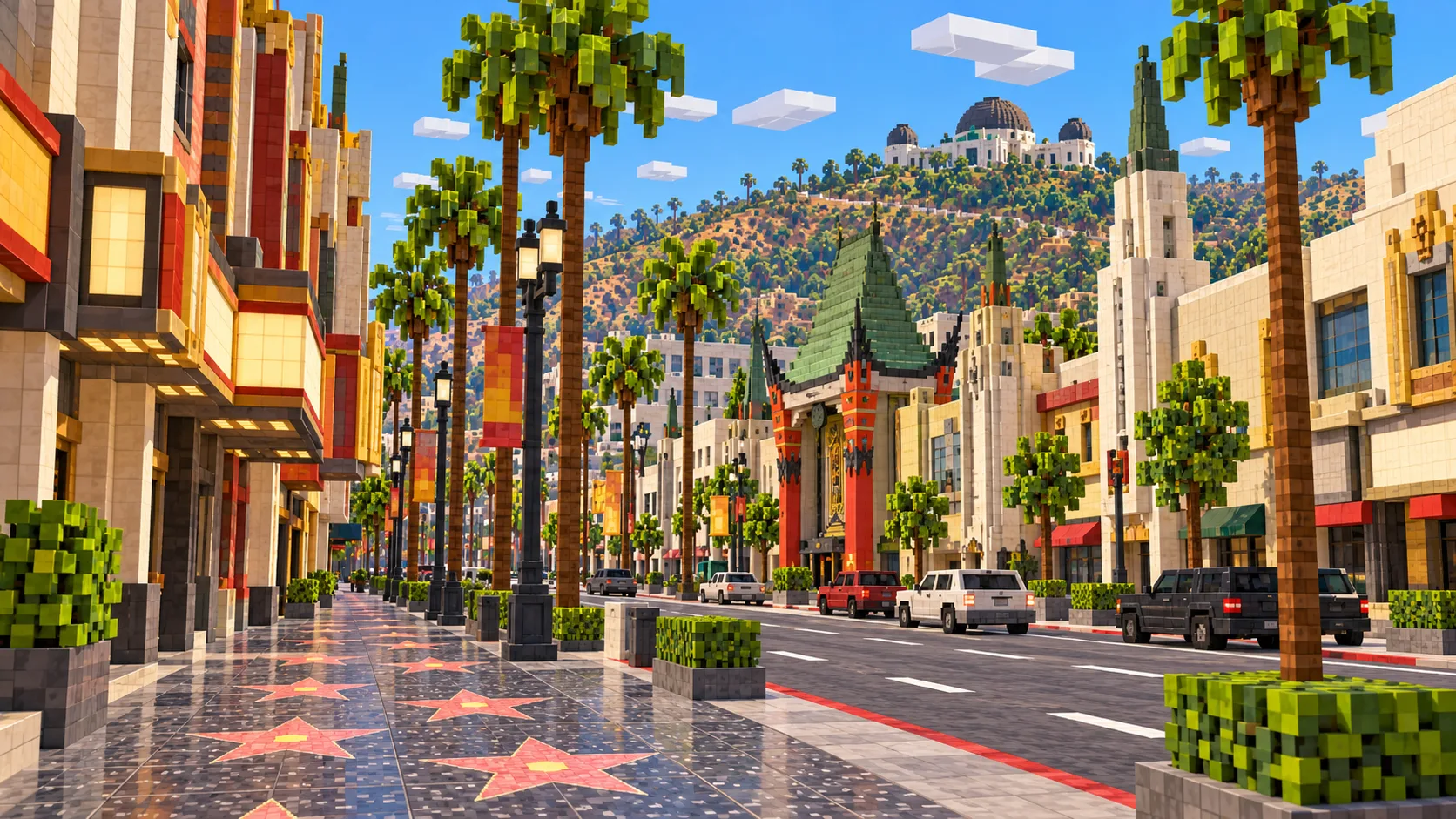
The Walk of Fame runs along Hollywood Boulevard from La Brea Avenue to Gower Street, about 2 km, with a short stretch down Vine Street. Along it are the TCL Chinese Theatre (opened as Grauman’s Chinese in 1927), the Dolby Theatre (home of the Academy Awards since 2002), the El Capitan across the street and the Hollywood Roosevelt Hotel, where the first Oscars were handed out in 1929. The buildings stand as footprints with flat roofs and the stars are not in the pavement, but the boulevard itself runs the full width of the map, about 5.5 km, so it is the easiest line to follow.
Starting area
Capitol Records, Hollywood & Vine and Sunset Boulevard
One block north of Hollywood and Vine, the Capitol Records Tower, finished in 1956, is 13 storeys and about 46 m tall, and is often said to look like a stack of records. Its round footprint comes through in the world, so the cylinder is easy to spot from the air among the rectangular blocks around it. Further south the map reaches Sunset Boulevard and the Cinerama Dome near Sunset and Vine, whose geodesic dome becomes a flat-topped circle.
Starting area
The Hollywood Bowl and Lake Hollywood
Walk about 1 km north from the Chinese Theatre, up Highland Avenue, and the ground drops into a bowl-shaped hollow: the Hollywood Bowl, where concerts have been held since 1922. The hollow is in the elevation data, so the slope is there; the seats and the band shell are not. About 1.5 km north-east of the Bowl, Lake Hollywood fills a canyon behind Mulholland Dam, a concrete dam from the mid-1920s. A path of about 5 km circles the reservoir, with the sign on the ridge above its north end.
Starting area
Bronson Canyon and the Greek Theatre
Bronson Canyon, an old quarry on the south side of Griffith Park, has a short tunnel known as the Bronson Caves, used as the entrance to the Batcave in the 1960s Batman TV series and in dozens of westerns. The tunnel itself is not in the world: the generator builds terrain as a solid surface. On the east side of the map the Greek Theatre, an outdoor amphitheater opened in 1930, sits in a canyon below the Observatory.
Illustrations. Generated worlds follow OpenStreetMap data and differ in detail.
03 / Why this city
What makes Los Angeles special in Minecraft
Most city maps are flat; this one has mountains in it. Hollywood and Vine sits at about Y -41 and the top of Mount Lee at about Y 275, so the hills rise more than 300 blocks above the street, only 3–4 km to the north. From the boulevard the ridge fills the northern skyline, and from the Observatory terrace, with the render distance turned up, the street grid opens out below you.
The street plan does the rest. Hollywood is a grid of long east–west streets, Sunset Boulevard, Hollywood Boulevard and Franklin Avenue, crossed by north–south ones like Highland, Cahuenga and Vine. At the hills the grid breaks into winding streets that follow the canyons. In Griffith Park there are only fire roads and trails, and the generator draws those as paths across open scrub.
The world is generated, not hand-built, so here is what is missing. The Hollywood Sign is mapped in OpenStreetMap as a point of interest, not as nine letter shapes, so the letters are not generated; you get the real slope they stand on and the summit above. The Observatory is a single building footprint with a height, so its three domes are flat. The Walk of Fame stars, the Chinese Theatre’s pagoda roof, the Bowl’s shell, the Cinerama Dome’s geodesic panels and every interior are absent. Buildings without height tags in OpenStreetMap get a default height. What you get instead is every mapped street, the real hills and canyons, and the main landmarks in their real places.
04 / Play
Best ways to play the Los Angeles map
Challenge 01
Put the sign back
Fly to the south face of Mount Lee and build the nine letters yourself. At the real size each letter is about 14 blocks tall and the whole sign is about 107 blocks long, so it fits on the slope with room to spare. White concrete reads best from a distance. The Observatory terrace is 2.7 km away, well past the 32-chunk maximum render distance in Java, so to see the sign from there as on the postcards you need a distant-view mod such as Distant Horizons.
Challenge 02
Walk the Walk of Fame
Start at La Brea Avenue and walk east along Hollywood Boulevard to Gower Street, about 2 km, past the Roosevelt, the Chinese Theatre, the Dolby and the El Capitan, then turn down Vine Street. On a server, give every player a section of sidewalk to fill with stars, pink terracotta set in black concrete; the real walk has more than 2,800.
Challenge 03
Hike from the boulevard to the Observatory
The usual real hike starts at Ferndell, at the top of Western Avenue, but a better challenge in Survival is the direct one: from Hollywood and Vine to the Observatory lawn, about 3 km in a straight line, climbing about 160 blocks on foot. Then continue up the trail to the top of Mount Hollywood.
Challenge 04
Restore the domes and the Bowl
The Observatory is a plain box at its real height. Give it its three domes, the large planetarium dome in the middle and two smaller telescope domes at the ends, using smooth sandstone or white terracotta for the walls and waxed copper or deepslate tiles for the domes. Afterwards, build the Hollywood Bowl’s nested arch shell in its hollow off Highland Avenue.
05 / Download
Download and install
Download the Los Angeles: Hollywood, the Hollywood Sign & Griffith Observatory starting area as a ready-made world for Java or Bedrock Edition.
Java Edition
UnzipExtract the ZIP to get a folder with level.dat inside.
CopyMove the folder into .minecraft/saves.
PlayOpen Minecraft Java Edition and choose Singleplayer.
Bedrock Edition
OpenOn Windows, double-click the .mcworld file. On phones and tablets, open it with Minecraft.
ImportMinecraft imports the world automatically.
PlayFind the new world in your Worlds list and open it.
If the world does not show up
Java: check that level.dat sits directly inside the world folder, not one folder deeper.
Bedrock: if double-clicking does nothing, open Minecraft first and then open the .mcworld file again.
Open the world with the listed Minecraft version or a newer one.
Lower your render distance if a large city loads slowly at first.
Los Angeles mapLos Angeles: Hollywood, the Hollywood Sign & Griffith Observatory
Java Edition
ZIP world folder
204 MB
28.3 km²
Java 1.21.4
Bedrock Edition
.mcworld file
116 MB
28.3 km²
Bedrock 1.21
06 / Customize
Customize this Los Angeles map
Each area opens the generator with the rectangle already drawn. Move it, resize it or change the mode before you generate.
Los Angeles: Hollywood, the Hollywood Sign & Griffith Observatory
28.3 km²
The area of this map: Hollywood from Runyon Canyon to Vermont Avenue and from just below Sunset Boulevard to Mount Lee, with the south-west corner of Griffith Park.
About 10 km south-east of the Chinese Theatre: City Hall, the Walt Disney Concert Hall, Grand Park, the Bunker Hill towers and Union Station, about 5 km² in all.
On the coast, about 18 km west of the Chinese Theatre: Santa Monica Pier, the beach, Palisades Park on the bluff and the Third Street Promenade, about 4 km².
The map covers about 28 km², from 34.095° to 34.141° N and 118.352° to 118.292° W. At about one block per meter the world is about 5,520 × 5,120 blocks.
Terrain comes from elevation data, scaled down slightly so the hills fit under the build limit: one block of height is about 1.3 m. The world uses the full height range, so street level sits below the usual sea level of Y 63: Hollywood and Vine is at about Y -41, Lake Hollywood at about Y 39, the Observatory roof at about Y 175, Mount Hollywood at about Y 257 and Mount Lee at about Y 275. Buildings keep their tagged heights; the Capitol Records Tower rises about 50 blocks above the street.
Building heights come from the height and building:levels tags in OpenStreetMap; buildings without a tag get a default height. Roofs are flat and there are no interiors or tunnels.
Santa Monica, Downtown, Universal Studios, the Sunset Strip in West Hollywood, Paramount Pictures, Hollywood Forever Cemetery and the Los Angeles Zoo are outside the map. Downtown and Santa Monica have presets of their own.
OpenStreetMap is edited by volunteers, so coverage varies from street to street, and recent changes may be missing.
About 28 km² of Hollywood: Hollywood Boulevard with the Walk of Fame, the TCL Chinese Theatre, the Dolby Theatre and the Capitol Records Tower, Sunset and Vine, Runyon Canyon, the Hollywood Bowl, Lake Hollywood, Mount Lee with the Hollywood Sign site, and the south-west corner of Griffith Park with the Observatory, Mount Hollywood, Bronson Canyon and the Greek Theatre.
Is the Los Angeles map free?
No. It costs $6.99 or 700 points, paid once. You keep it: the Java and Bedrock versions stay in your account to download again, and you can open it in the in-browser player on this site.
Is the Hollywood Sign in the map?
Its hill is, the letters are not. OpenStreetMap records the sign as a single point, so the generator has no letter shapes to build. Mount Lee and the slope under the sign are real terrain, and building the nine letters there yourself is the first thing most players do.
Is Santa Monica in the Los Angeles map?
No. Santa Monica Pier is about 18 km from Hollywood, and a rectangle covering both would be far over the generator’s 50 km² limit. The Santa Monica preset on this page generates the pier, the beach and the Promenade as a separate world of about 4 km².
Does the Los Angeles map work with Minecraft Java Edition?
Yes. The Java download is a ZIP of about 214 MB, saved in Java 1.21.4. Unzip it so the world folder sits directly in .minecraft/saves, not inside a second folder, then open it from Singleplayer. Newer Java versions upgrade the world when they load it.
Is there a Bedrock version of the Los Angeles map?
Yes. The Bedrock download is an .mcworld file of about 122 MB. Open it on Windows, Android or iOS and Minecraft imports the world. Consoles cannot import .mcworld files directly, and Mac has no Bedrock Edition, so Mac players should use the Java version.
What game mode does the world open in?
Creative, at midday, with the spawn point on the lawn in front of Griffith Observatory. Switch to Survival with /gamemode survival. In single player that needs cheats on (Open to LAN, then Allow Cheats); on a server you need operator rights.
Can I use the Los Angeles map on a server?
Yes. Put the Java world folder next to your server jar and set level-name in server.properties to its folder name. For Bedrock Dedicated Server, rename the .mcworld to .zip, extract it into its own folder inside worlds and set level-name to that folder’s name. Keep the OpenStreetMap attribution file that comes with the world.