Skip to content

Türkiye / City map

Istanbul Minecraft Map: Sultanahmet to Galata

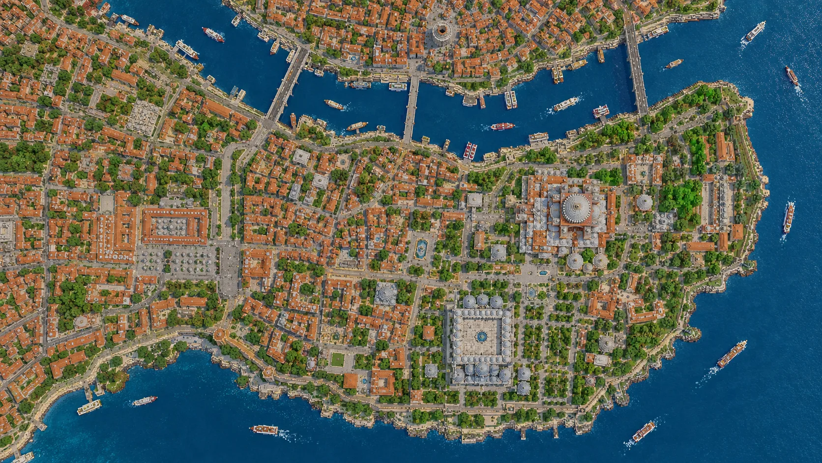
Istanbul’s historic peninsula, Galata and a slice of Asia in one Minecraft world, from the Fatih Mosque to the Üsküdar shore. This Istanbul Minecraft map covers about 27 km² built from OpenStreetMap data: the historic peninsula from Sarayburnu and Sultanahmet west to the Valens Aqueduct and the Fatih Mosque, the lower Golden Horn with its three bridges, Galata and Beyoğlu up to Taksim Square and Dolmabahçe Palace, and across the mouth of the Bosphorus a strip of the Asian shore at Üsküdar with the Maiden’s Tower offshore. You spawn in Sultanahmet Park, between Hagia Sophia and the Blue Mosque. Download it for Java or Bedrock, or open it in the in-browser player on this site.

Java Edition · Bedrock Edition

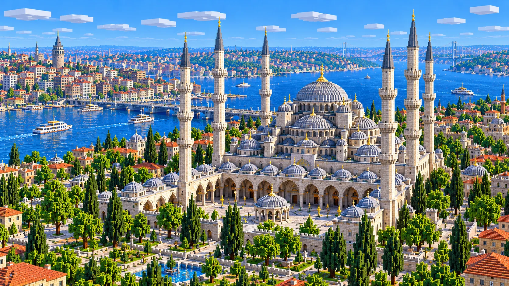
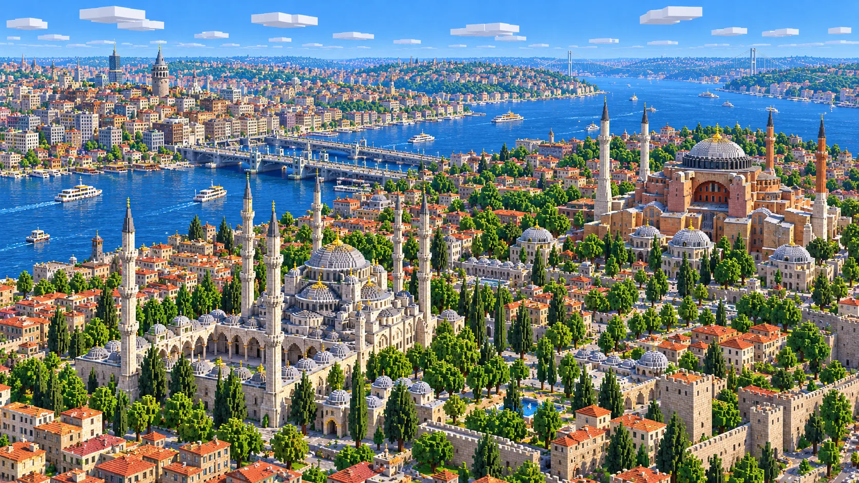
Illustration of central Istanbul in Minecraft blocks seen from high above: the Blue Mosque with its cascade of domes and minarets in front, Hagia Sophia to the upper right, and the Golden Horn with a bridge leading to the Galata hillside and its round tower
Illustrations. Generated worlds follow OpenStreetMap data and differ in detail.
Starting area
Istanbul: Sultanahmet, the Golden Horn & Galata
Size
27.4 km²
Editions
Java & Bedrock
Download
Ready to play
Data
OpenStreetMap

01 / Overview

Overview: Istanbul as a Minecraft world

The map is a rectangle about 5.9 km east to west and 4.7 km north to south, roughly 5,880 × 4,670 blocks. Roughly a third of it is water. The Golden Horn opens off the Bosphorus on the east side and runs west-northwest, separating the old city on the peninsula from Galata and Beyoğlu on the far side; the Bosphorus runs along the east edge; and the Sea of Marmara fills the south-east corner. The south edge follows the Marmara shore just below Sultanahmet and Kumkapı, the west edge runs just past the Fatih Mosque, and the north edge sits just above Taksim Square and Dolmabahçe Palace.

Most of the map is the European side, but not all of it. Across the mouth of the Bosphorus, a strip of the Asian shore is inside the east edge, about 600 m deep at Salacak and narrowing to about 200 m at the Üsküdar pier, so the world reaches two continents. The water between Sarayburnu, the tip of the peninsula, and the Asian shore is a bit over 2 km wide, and the Maiden’s Tower stands on its small islet just off Salacak. Kadıköy, Haydarpaşa Station and the Princes’ Islands are outside the map to the south.

The world is generated, not built by hand. The generator reads streets, building footprints, the coastline, parks and land cover from OpenStreetMap, turns them into blocks at about one block per meter, and shapes the ground from elevation data. That matters here, because old Istanbul is a city of hills. The peninsula rises from the water to around 40–60 m along the ridge that carries the Grand Bazaar and the Süleymaniye, and on the far shore the ground climbs from Karaköy past Galata Tower to Taksim, about 80 m above the Bosphorus. Every building is still a simple extruded shape.

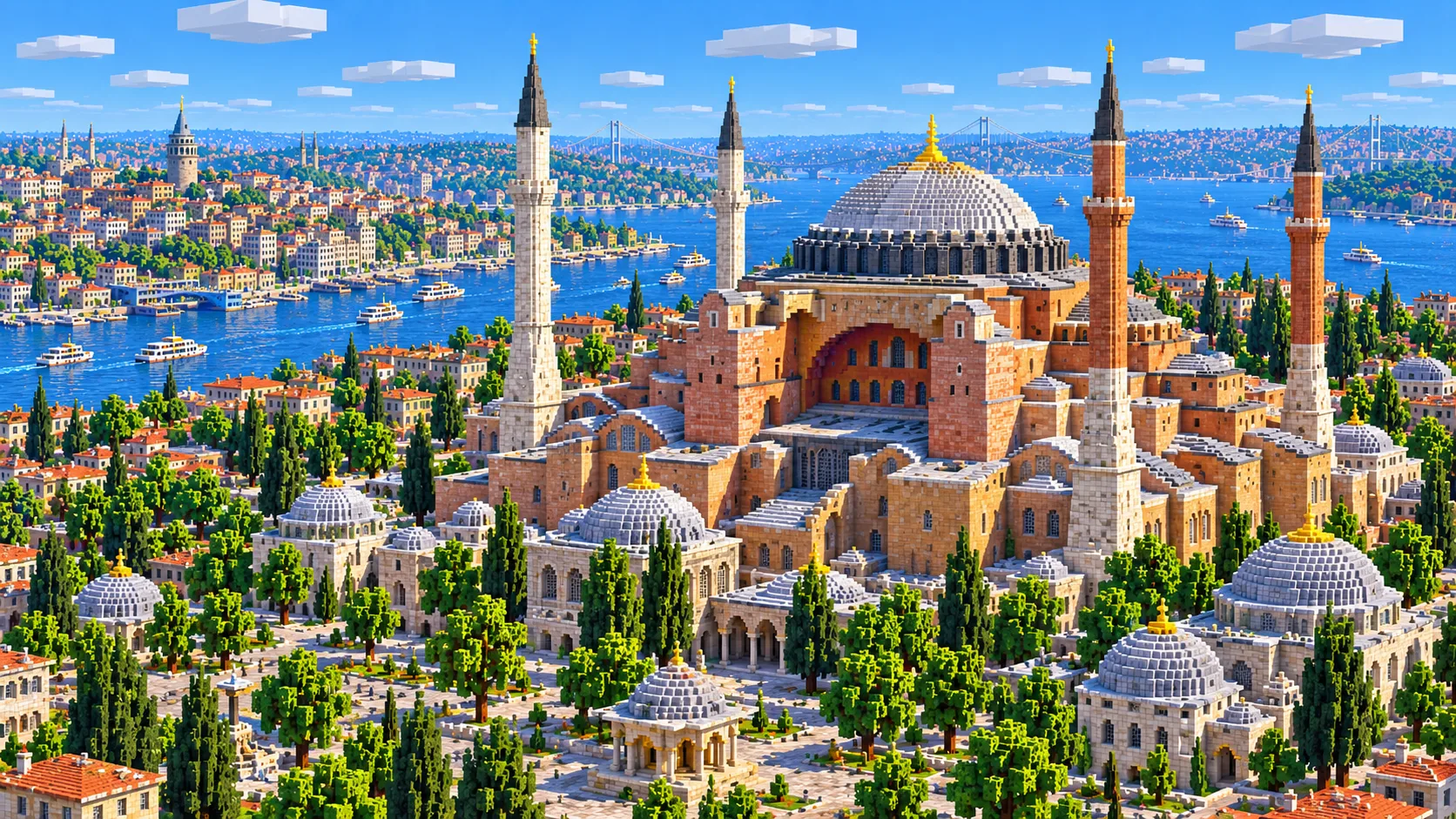
Illustration of Hagia Sophia built from Minecraft blocks, with its broad central dome and half-domes in warm stone, four slender minarets and a garden forecourt
Illustrations. Generated worlds follow OpenStreetMap data and differ in detail.

02 / Inside the map

What's included in the Istanbul map

The recommended starting area covers Hagia Sophia, the Blue Mosque (Sultan Ahmed Mosque), Sultanahmet Park, the Hippodrome with the Obelisk of Theodosius, the Basilica Cistern site, Topkapı Palace, Gülhane Park, Sarayburnu, the Grand Bazaar, Beyazıt Square, the Süleymaniye Mosque, the Spice Bazaar, the New Mosque at Eminönü, Sirkeci Station, the Rüstem Pasha Mosque, the Valens Aqueduct, the Fatih Mosque, Kumkapı on the Sea of Marmara, the Golden Horn, the Galata Bridge, the Atatürk Bridge, the Golden Horn Metro Bridge, Karaköy, Galata Tower, İstiklal Avenue, Taksim Square, Dolmabahçe Palace, the Üsküdar waterfront with the Mihrimah Sultan Mosque and the Maiden’s Tower. Places marked as separate presets are outside it. Open them from the customize section below.

  • Starting area

    Hagia Sophia and the Blue Mosque

    You spawn in Sultanahmet Park, with the two buildings about 400 m apart on either side. Hagia Sophia, completed in 537 and a mosque again since 2020, carries a main dome 31 m across and 55 m above the floor. The Sultan Ahmed Mosque, called the Blue Mosque for the tiles inside, was built from 1609 to 1616 and has six minarets.

  • Starting area

    The Hippodrome and the Basilica Cistern

    Walk out of the spawn toward the Blue Mosque and the Hippodrome is the long square just west of it. It follows the outline of the Byzantine chariot track. The Egyptian obelisk raised there by Theodosius I in 390 still stands on its marble base. Across the tram line from Hagia Sophia is the entrance to the Basilica Cistern, a 6th-century reservoir 140 by 70 m with 336 columns; it is underground, so only the street above appears in the world.

  • Starting area

    Topkapı Palace, Gülhane Park and Sarayburnu

    Behind Hagia Sophia the palace fills the end of the peninsula: courtyards, kitchens and pavilions in walled terraces above the water. The sultans lived here for about four centuries until the court moved to Dolmabahçe in the 1850s. Gülhane Park, once the palace’s outer garden, runs down the slope to the shore road, and Sarayburnu, the point where the Golden Horn meets the Bosphorus, is just below.

  • Starting area

    The Grand Bazaar, Beyazıt and the Süleymaniye

    West of Sultanahmet along Divan Yolu, the covered Grand Bazaar sits on the ridge with Beyazıt Square and Istanbul University next to it. A few minutes north, the Süleymaniye Mosque, built by the architect Sinan between 1550 and 1557, stands on one of the city’s highest points and overlooks the Golden Horn. Its courtyard and the schools and tombs around it come out as a cluster of courtyard footprints around the mosque.

  • Starting area

    Eminönü, the Spice Bazaar and the New Mosque

    At the foot of the slope by the Golden Horn, the New Mosque, finished in 1665, faces the ferry piers and the southern end of the Galata Bridge. Its L-shaped Spice Bazaar is right behind it, and Sirkeci Station, the old terminus of the Orient Express, is a short walk east. The tiled Rüstem Pasha Mosque hides on a raised platform among the market streets to the west.

  • Starting area

    The Valens Aqueduct and the Fatih Mosque

    Near the west edge, the Roman aqueduct completed in 368 still crosses the valley between two hills. About 920 m of it stands, up to 29 m high, and Atatürk Boulevard passes under its arches. The Fatih Mosque, on the site of the Byzantine Church of the Holy Apostles, is about 600 m northwest, 150 m inside the map’s west edge.

  • Starting area

    The Golden Horn and its bridges

    The inlet is the map’s central line. About 3 km of it is in the world, from the mouth to the shores below the Fatih Mosque, with three bridges across: the Galata Bridge between Eminönü and Karaköy, about 490 m long and opened in 1994; the Golden Horn Metro Bridge, opened in 2014; and the Atatürk Bridge at Unkapanı. The ferry piers of Eminönü and Karaköy face each other at the mouth.

  • Starting area

    Galata Tower, İstiklal Avenue and Taksim

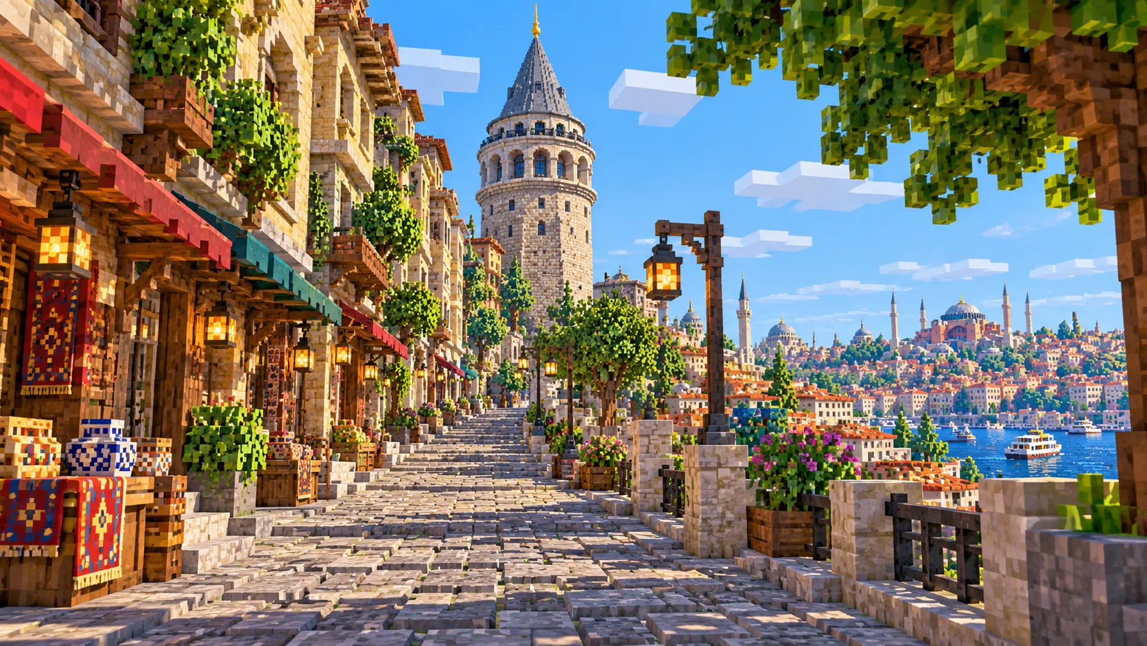
    From Karaköy the streets climb steeply to Galata Tower, a round Genoese tower completed in 1348 and about 63 m tall. Beyond it, İstiklal Avenue runs about 1.4 km along the ridge from Tünel to Taksim Square. The Tünel funicular, opened in 1875 under the slope, is underground and not generated.

  • Starting area

    Dolmabahçe Palace and the Üsküdar shore

    Dolmabahçe Palace, completed in 1856, lines the European shore of the Bosphorus near the map’s north edge. Across the water, the Üsküdar ferry pier and Sinan’s Mihrimah Sultan Mosque sit right at the east edge, about 200 m inside it, and the Maiden’s Tower stands on its islet off Salacak, about 200 m from the shore.

  • Separate preset

    The Bosphorus Bridge, Rumeli Hisarı and the land walls

    Places players often look for that are outside this world. The Bosphorus Bridge, opened in 1973, is about 1.5 km past the north-east corner, with Ortaköy at its European end. The fortress of Rumeli Hisarı is about 5 km beyond the bridge, farther up the strait. The Chora Church is about 750 m west of the map, and the Theodosian land walls run just beyond it, roughly 1 km out. The bridge and the fortress each have an area below.
Illustrations. Generated worlds follow OpenStreetMap data and differ in detail.

03 / Why this city

What makes Istanbul special in Minecraft

The water is the reason to play Istanbul. In most city maps the river is a strip through the middle; here three bodies of water meet in one world. The Golden Horn is calm and narrow, the Bosphorus is a strait about 2 km wide at its mouth, and the Sea of Marmara laps the south edge. On Sarayburnu all three waters meet at your feet; take a boat about 2,000 blocks east and you land in Asia. It is the only map in this library that spans two continents.

The ground is the second reason. Old Istanbul was described as a city of seven hills, and the elevation data gives you the slopes they sit on. The great mosques were built on the crests, so in the world the Süleymaniye and the Fatih Mosque stand on high ground above the Golden Horn, and the streets of Galata climb so steeply from Karaköy that some are stairways in real life, like the Camondo Steps. Walk from the Galata Bridge to Taksim and you go up about 80 blocks.

What the generator does not make are the domes and minarets that define the skyline. Hagia Sophia, the Blue Mosque and the Süleymaniye come out as their footprints and courtyards, raised to roughly the right height with flat tops. There are no domes, half-domes or tiles, minarets come out as stubby columns if at all, and Galata Tower is a round stack of blocks without its conical roof. The Basilica Cistern, the Tünel and the Marmaray rail tunnel under the Bosphorus are underground and not in the world, and no building has an interior. The illustrations on this page show the city after you rebuild it; the world gives you the plan, the shores and the hills.

04 / Play

Best ways to play the Istanbul map

Challenge 01

Cross from Europe to Asia by boat

Put a boat in at the Eminönü ferry piers, next to the Galata Bridge, and steer out of the Golden Horn past Sarayburnu. Head across the Bosphorus to the Üsküdar pier, about 3.5 km of water, passing the Maiden’s Tower on your right as you come in to the Asian shore. Ferries make the same crossing in about 20 minutes; a boat on open water is quicker.

Challenge 02

Raise the domes of Hagia Sophia and the Blue Mosque

Both footprints are in place around the spawn. Hagia Sophia needs one huge dome, about 31 blocks across and 55 blocks above the floor, carried on two half-domes to the east and west. The Blue Mosque is a cascade: a central dome, four half-domes, smaller domes stepping down, and six minarets. Smooth stone and light-blue terracotta work for the domes, and end rods or stone brick walls make thin minaret tops.

Challenge 03

Give the Galata Bridge its lower deck

The real Galata Bridge has two levels: the road and tram on top, and a row of fish restaurants under it at water level. The generated bridge is a single deck about 490 blocks long, so build the lower level underneath, then line the top railing with players fishing, as they do in the real city every day.

Challenge 04

Put water back in the Valens Aqueduct

The aqueduct carried water across the valley between the city’s fourth and third hills for centuries. Rebuild its two tiers of arches on the generated footprint, run a channel along the top and fill it with water, then let it fall into a cistern you dig under Sultanahmet: a working version of the system that fed the Basilica Cistern.

05 / Download

Download and install

Download the Istanbul: Sultanahmet, the Golden Horn & Galata starting area as a ready-made world for Java or Bedrock Edition.

Java Edition

  1. UnzipExtract the ZIP to get a folder with level.dat inside.
  2. CopyMove the folder into .minecraft/saves.
  3. PlayOpen Minecraft Java Edition and choose Singleplayer.

Bedrock Edition

  1. OpenOn Windows, double-click the .mcworld file. On phones and tablets, open it with Minecraft.
  2. ImportMinecraft imports the world automatically.
  3. PlayFind the new world in your Worlds list and open it.

If the world does not show up

  • Java: check that level.dat sits directly inside the world folder, not one folder deeper.
  • Bedrock: if double-clicking does nothing, open Minecraft first and then open the .mcworld file again.
  • Open the world with the listed Minecraft version or a newer one.
  • Lower your render distance if a large city loads slowly at first.

Step-by-step help: Java import guide · Bedrock import guide

Istanbul mapIstanbul: Sultanahmet, the Golden Horn & Galata

  • Java Edition

    ZIP world folder

    • 167 MB
    • 27.4 km²
    • Java 1.21.4
  • Bedrock Edition

    .mcworld file

    • 82 MB
    • 27.4 km²
    • Bedrock 1.21

06 / Customize

Customize this Istanbul map

Each area opens the generator with the rectangle already drawn. Move it, resize it or change the mode before you generate.

Istanbul: Sultanahmet, the Golden Horn & Galata

27.4 km²

The area of this map: the historic peninsula, the Golden Horn, Galata and Beyoğlu to Taksim, and the mouth of the Bosphorus with the Üsküdar shore, about 27 km².

Open in generator

Ortaköy & the Bosphorus Bridge

3.8 km²

About 3.8 km² just north-east of this map: the Bosphorus Bridge, 1,560 m long with 165 m towers, the Ortaköy Mosque at its European end and Beylerbeyi Palace on the Asian shore.

Open in generator

Rumeli Hisarı & Anadolu Hisarı

5.6 km²

About 5.6 km² up the Bosphorus at its narrowest stretch: the fortress of Rumeli Hisarı, built in 1452 before the conquest of the city, Anadolu Hisarı across the water and the Fatih Sultan Mehmet Bridge.

Open in generator

07 / Limits

What to expect from the map data

  • The map covers about 27 km², from 41.000° to 41.042° N and 28.948° to 29.018° E. At about one block per meter the world is roughly 5,880 × 4,670 blocks.
  • The ground comes from elevation data. The peninsula rises to around 40–60 m along its ridge, and Taksim is about 80 m above the Bosphorus, so the hills, the Galata slope and the low shores are where they are in the city.
  • Streets, building footprints, the coastline, parks and land cover come from OpenStreetMap. Building heights come from height and level tags where they exist and a default height where they do not.
  • Domes, minarets, roof shapes, tilework, the Galata Tower’s conical roof, bridge details and interiors are not generated, and underground places such as the Basilica Cistern and the Tünel are not in the world. The bridges are road decks over the water.
  • OpenStreetMap is edited by volunteers, so coverage varies from street to street, and recent changes may be missing.

Map data © OpenStreetMap contributors, available under the Open Database License. Generated with the open-source Arnis project.

Questions before you generate

What does the Istanbul Minecraft map include?

The historic peninsula from Sultanahmet and Topkapı Palace west to the Valens Aqueduct and the Fatih Mosque, with the Grand Bazaar, the Süleymaniye and Eminönü; the Golden Horn with the Galata, Metro and Atatürk bridges; Galata, İstiklal Avenue, Taksim and Dolmabahçe Palace; and the Üsküdar shore with the Maiden’s Tower. The Bosphorus Bridge and Rumeli Hisarı are separate areas.

Is the Istanbul map free?

No. It costs $6.99 or 700 points, paid once. You keep it: the Java and Bedrock versions stay in your account to download again, and you can open it in the in-browser player on this site.

Does the Istanbul map work with Minecraft Java Edition?

Yes. The Java download is a ZIP of about 175 MB, saved in Java 1.21.4. Unzip it so the world folder sits directly in .minecraft/saves, not inside a second folder, then open it from Singleplayer. Newer Java versions upgrade the world when they load it.

Is there a Bedrock version of the Istanbul map?

Yes. The Bedrock download is an .mcworld file of about 86 MB. Open it on Windows, Android or iOS and Minecraft imports the world. Consoles cannot import .mcworld files directly, and Mac has no Bedrock Edition, so Mac players should use the Java version.

Are Hagia Sophia and the Blue Mosque in the map, with their domes?

Both are in the map, and you spawn between them. You get their footprints, courtyards and rough height, but not the domes or minarets: the roofs are flat. The footprints are accurate, so they are a good base for building the domes yourself.

Does the map include the Asian side of Istanbul?

A strip of it. The east edge takes in a strip of the Asian shore, about 600 m deep at Salacak and 200 m at Üsküdar, with the Üsküdar ferry pier, the Mihrimah Sultan Mosque and the Maiden’s Tower offshore. Kadıköy and the rest of the Asian side are outside the map.

Is the Bosphorus Bridge in the map?

No. The Bosphorus Bridge is about 1.5 km beyond the map’s north-east corner. Use the Ortaköy and Bosphorus Bridge area on this page to generate the bridge, the Ortaköy Mosque and Beylerbeyi Palace as a separate world of about 3.8 km².

Is the Istanbul map 1:1 scale?

Across the ground, yes: about one block per meter, so the world is roughly 5,880 × 4,670 blocks, and Hagia Sophia to Galata Tower is about 2,000 blocks as the crow flies, and closer to 2,500 on foot over the Galata Bridge. Building heights follow OpenStreetMap tags and fall back to a default height where there are none.

What game mode does the world open in?

Creative, at midday, with the spawn point in Sultanahmet Park between Hagia Sophia and the Blue Mosque. Switch to Survival with /gamemode survival once you are in the world.

Can I use the Istanbul map on a server?

Yes. Put the Java world folder next to your server jar and set level-name in server.properties to its folder name. For Bedrock Dedicated Server, extract the .mcworld into the worlds folder. Keep the OpenStreetMap attribution file that comes with the world.

More maps

Browse all city maps · City generator · Terrain generator