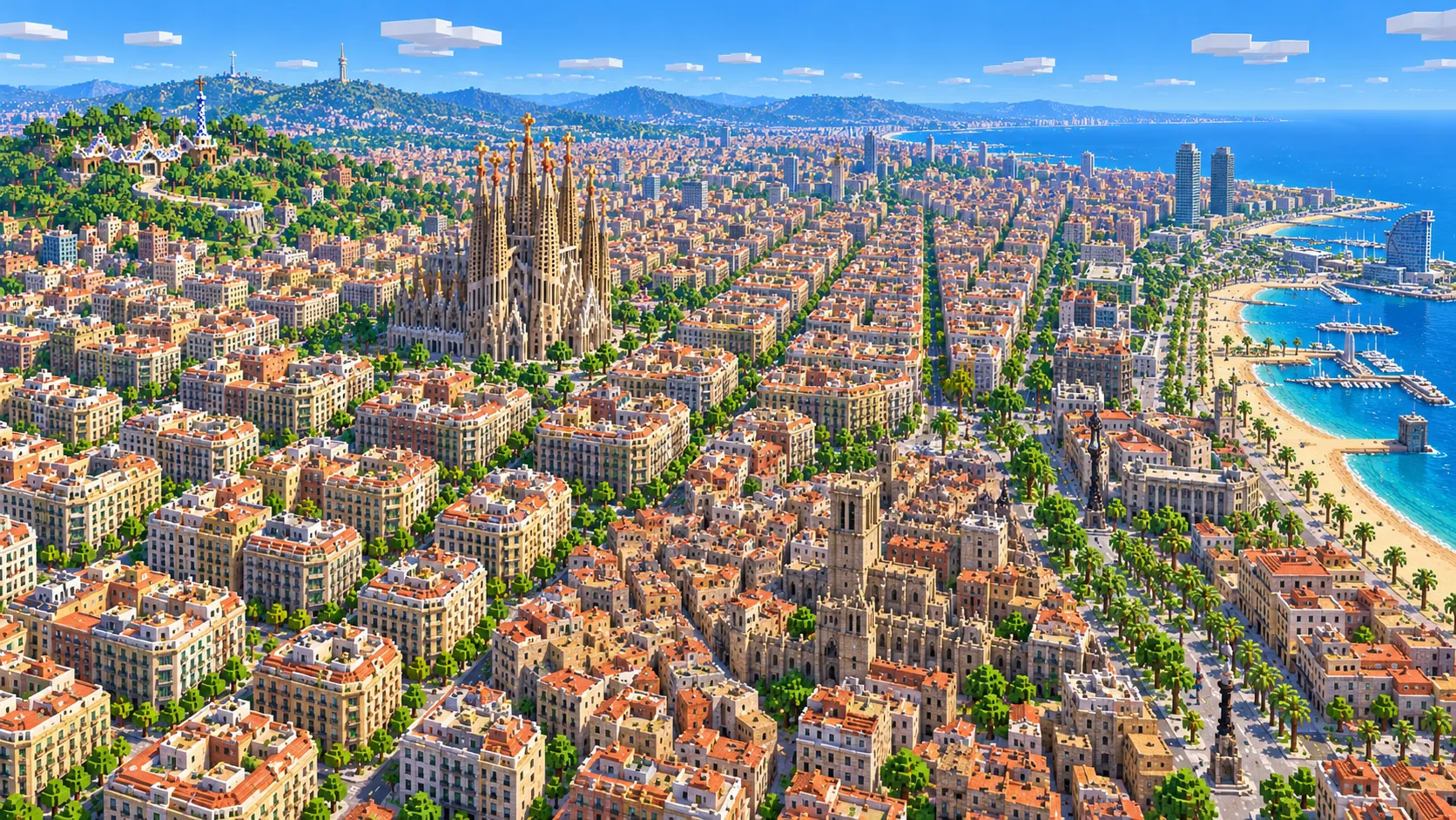
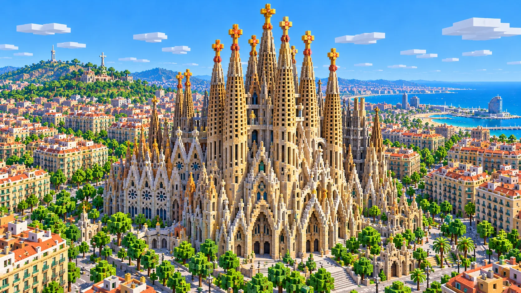
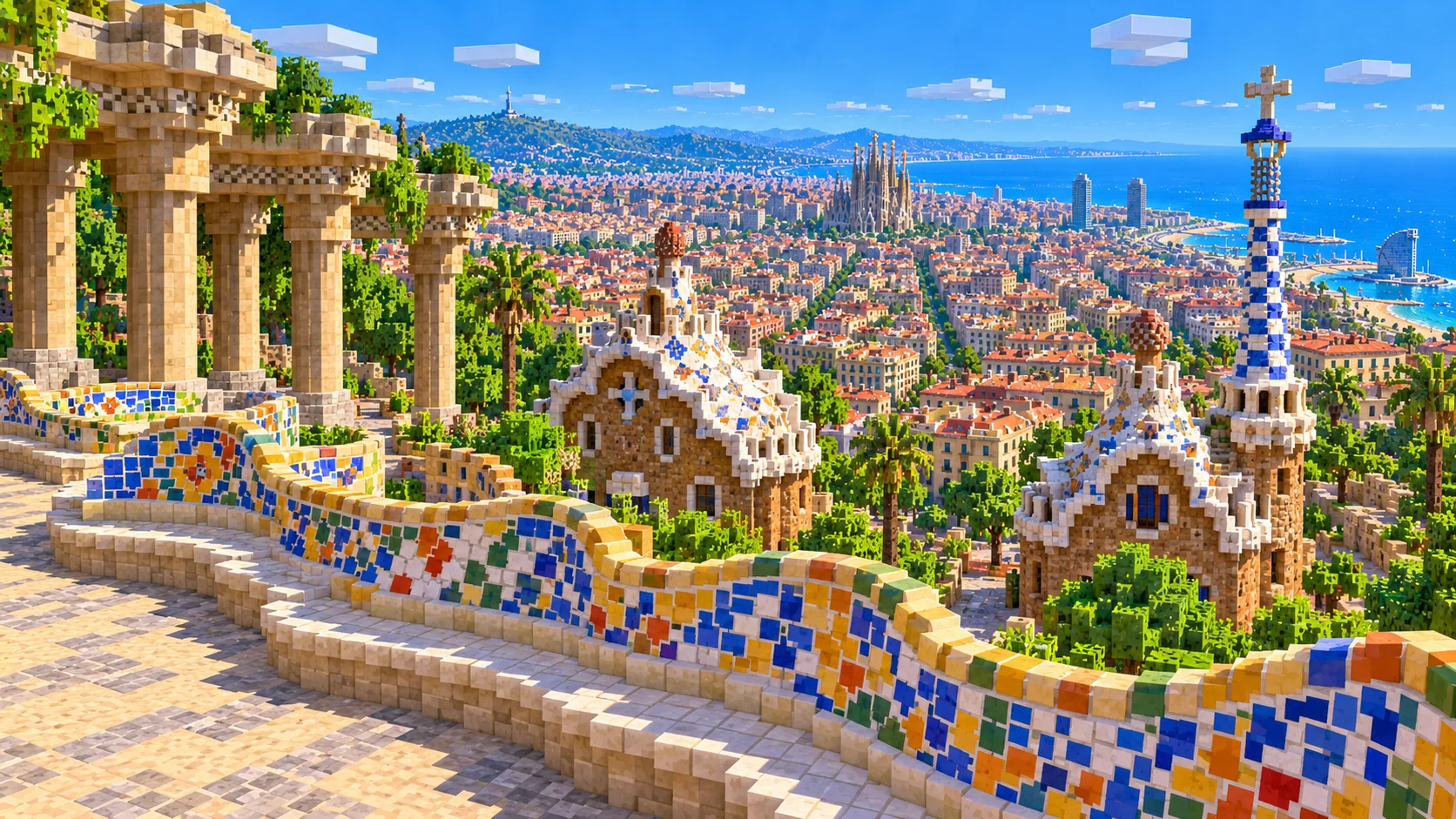
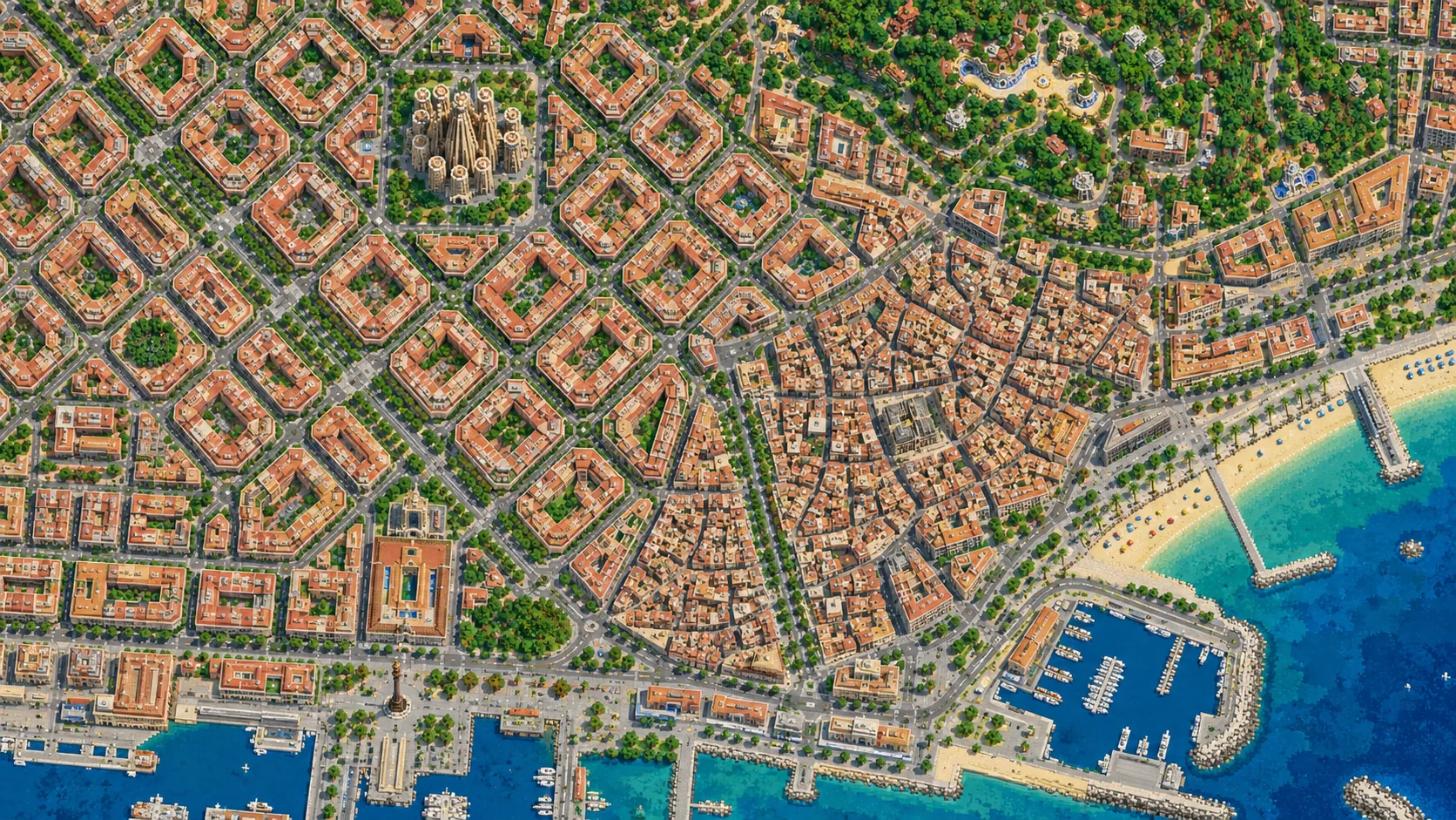
The Sagrada Família, the Eixample grid, the Gothic Quarter and the beach at Barceloneta in one Minecraft world, with Montjuïc in the south-west corner and Park Güell in the north. This Barcelona Minecraft map covers about 30 km² of the city, built from real OpenStreetMap data and elevation: Ciutat Vella and La Rambla, Passeig de Gràcia with Casa Batlló and Casa Milà, most of Gràcia, the Parc de la Ciutadella, the Port Vell and the Olympic waterfront up to the Port Olímpic, and the Turó de la Rovira with the Bunkers del Carmel. You spawn in Plaça de Gaudí, across the pond from the Nativity façade. Download it for Java or Bedrock, or open it in the in-browser player on this site.
Illustrations. Generated worlds follow OpenStreetMap data and differ in detail.
Starting area
Barcelona: Sagrada Família, Eixample & the old town
Size
30.1 km²
Editions
Java & Bedrock
Download
Ready to play
Data
OpenStreetMap
01 / Overview
Overview: Barcelona as a Minecraft world
The map is a rectangle about 4.7 km from west to east and 6.4 km from south to north. Barcelona’s street grid is tilted about 45° off north, so the rectangle cuts it diagonally. The south-west corner holds Montjuïc and Plaça d’Espanya; the west edge passes a few hundred meters beyond the square, so Sants station and Camp Nou are outside. To the north the map takes in Gràcia, Park Güell and the Turó de la Rovira with the Bunkers del Carmel, right on the edge. The east edge runs just past the Port Olímpic and its two towers. Most of the coast between the foot of Montjuïc and the Port Olímpic is inside, about 4 km of harbor and beach.
On the shore are Port Vell, the old fishermen’s quarter of Barceloneta and the 1992 Olympic waterfront. Behind them is Ciutat Vella, the old town of the Raval, the Gothic Quarter and El Born, with La Rambla between the first two. Then comes the Eixample, the grid that Ildefons Cerdà planned in 1859, and above it the old village center of Gràcia and the first hills, Park Güell and the Turó de la Rovira. The Collserola range rises beyond the north edge. The generator turns OpenStreetMap roads, building footprints, the coastline, parks and land use into blocks at about one block per meter and shapes the ground from elevation data, so the slope from the beach up to Park Güell and the hill of Montjuïc are real terrain. Heights are close to real: the sea is at about Y -49, Plaça de Catalunya at about Y -16, the Park Güell terrace near Y 94 and the top of Montjuïc around Y 133, about 180 blocks above the water.
From the spawn at the Sagrada Família it is about 1.5 km to Casa Milà, 2 km to Plaça de Catalunya, 2.2 km to the Park Güell terrace, 3.2 km to the Columbus Monument at the bottom of La Rambla and 4.6 km to Montjuïc Castle. The sights are far apart, so the map runs to about 30 km²: a tighter box would cut either Park Güell or the beach.
Illustrations. Generated worlds follow OpenStreetMap data and differ in detail.
02 / Inside the map
What's included in the Barcelona map
The recommended starting area covers the Sagrada Família and Plaça de Gaudí, Avinguda de Gaudí and the Sant Pau Recinte Modernista, the Eixample, Passeig de Gràcia with Casa Batlló and Casa Milà (La Pedrera), Plaça de Catalunya, La Rambla and La Boqueria, the Gothic Quarter and Barcelona Cathedral, El Born and Santa Maria del Mar, the Palau de la Música Catalana, the Arc de Triomf and the Parc de la Ciutadella, the Columbus Monument and Port Vell, Barceloneta and its beach, the W Barcelona hotel, the Port Olímpic with Hotel Arts and Torre Mapfre, Torre Glòries, Gràcia, Park Güell, the Bunkers del Carmel, Montjuïc with its castle, the Magic Fountain, the MNAC and the Olympic Stadium, Plaça d’Espanya and the Torre de Sant Sebastià of the port cable car. Places marked as separate presets are outside it. Open them from the customize section below.
Starting area
The Sagrada Família and Avinguda de Gaudí
You start in Plaça de Gaudí, across the pond from the Nativity façade. Gaudí took over the church in 1883, a year after work began, and the central Tower of Jesus Christ was topped out with its cross in February 2026, at 172.5 m. The basilica fills an Eixample block of its own, and in the world it is a stepped cluster of block towers that peaks in the middle at Y 152, about 172 blocks above the square, because OpenStreetMap carries the central tower’s height. Avinguda de Gaudí, a pedestrian avenue cutting diagonally across the grid, runs north from it for under a kilometer to the Sant Pau Recinte Modernista, the old hospital by Lluís Domènech i Montaner.
Starting area
The Eixample and Passeig de Gràcia
Cerdà’s grid fills the middle of the map: blocks about 113 m across, with the corners cut off at 45° so every crossing opens into a small octagonal plaza. Avinguda Diagonal cuts across it at 45°, while the wide Gran Via follows the grid. On Passeig de Gràcia, Casa Batlló (remodeled 1904–1906) and Casa Milà, known as La Pedrera (1906–1912), stand about 500 m apart on the same avenue.
Starting area
La Rambla, the Gothic Quarter and El Born
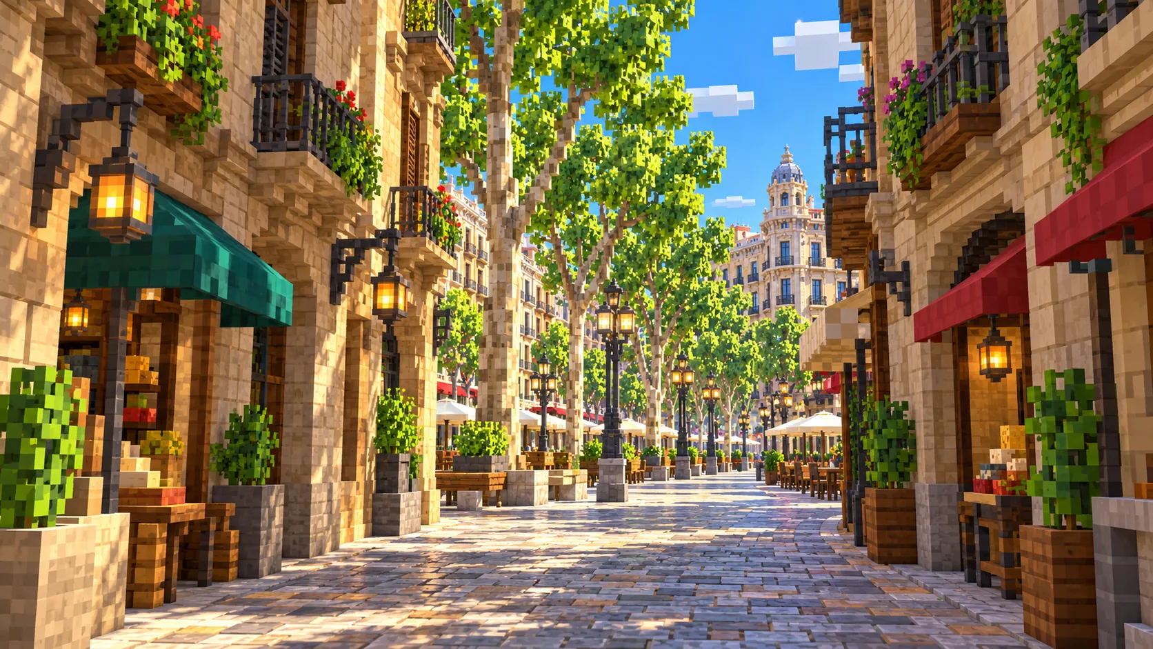
La Rambla runs about 1.2 km from Plaça de Catalunya down to the 60 m Columbus Monument at the port, passing La Boqueria market. East of it are the Gothic Quarter around the cathedral and, across Via Laietana, El Born with Santa Maria del Mar, built in just 54 years, from 1329 to 1383. The lanes are only three or four Minecraft blocks wide and turn constantly, unlike the straight blocks of the Eixample.
Starting area
Ciutadella, Barceloneta and the Olympic waterfront
The brick Arc de Triomf was the gateway to the 1888 Universal Exhibition, held in the Parc de la Ciutadella just south of it. South of the park, Barceloneta is a triangle of narrow parallel streets between the harbor and the sea, with the beach on its outer edge. The sail-shaped W Barcelona closes the beach to the south; the two 154 m towers of Hotel Arts and Torre Mapfre, completed in 1992, stand at the Port Olímpic on the east edge. Both come out at full height, about 157 blocks above the street.
Starting area
Park Güell, Gràcia and the Bunkers del Carmel
Park Güell, built from 1900 to 1914 as a garden estate and opened as a public park in 1926, covers a hillside near the north-west corner. Its terrace looks down over Gràcia and the Eixample to the sea. Below it, Gràcia keeps the small squares of a former village. To the east, the Turó de la Rovira, 262 m high, carries the Civil War anti-aircraft battery known as the Bunkers del Carmel. It is the highest ground on the map, above Y 200.
Starting area
Montjuïc and Plaça d’Espanya
The hill in the south-west corner rises straight from the port. The castle sits on top, and the north slope holds the buildings of the 1929 International Exhibition: the Palau Nacional with the MNAC, the Magic Fountain below it and Plaça d’Espanya at the bottom. The Olympic Stadium, opened for the 1929 exhibition and rebuilt inside its old façade for the 1992 Games, is on the ridge. The port cable car, which opened in 1931, crosses from Barceloneta to Montjuïc. Its Barceloneta tower, the Torre de Sant Sebastià, stands in the world at close to its real height; the middle tower in the port comes out as a stub, and there is no cable.
Illustrations. Generated worlds follow OpenStreetMap data and differ in detail.
03 / Why this city
What makes Barcelona special in Minecraft
The Eixample grid is what makes this map recognizable from above, and the generator reproduces it almost exactly. Every block is the same octagon, about 113 blocks across with chamfered corners, built around an inner courtyard, and the pattern repeats hundreds of times. Ciutat Vella sits right against it: cross Plaça de Catalunya and the octagons give way to medieval lanes where no two streets run parallel.
The ground rises from the sea. Walk inland from the beach and the grid climbs gently towards Collserola: Plaça de Catalunya is about 33 blocks above the water. Montjuïc stands over the harbor in the south-west, and Park Güell and the Turó de la Rovira close the map in the north.
The map is generated, not hand-built, and that sets its limits. The Sagrada Família is the obvious one: OpenStreetMap stores the basilica as a footprint with a height, not as a cluster of spires, so the world has a stepped cluster of solid block towers at the right height and on the right footprint, not Gaudí’s openwork spires, façades or sculpture. The same goes for the wave-shaped roof of Casa Milà, the mosaic dragon and serpentine bench of Park Güell and the bone-like balconies of Casa Batlló. Building heights come from OpenStreetMap tags or a default value, and there are no interiors. What you do get is the full street plan of central Barcelona, every mapped building, on real terrain.
04 / Play
Best ways to play the Barcelona map
Challenge 01
Finish the Sagrada Família
The real church took 144 years to reach its full height, and it still is not finished; you start with the volume already standing at spawn. The generated mass gives you the footprint and the height of the central Tower of Jesus Christ, 172 blocks above the square. Carve the four tapering spires of the Nativity façade facing the pond, the Passion façade on the far side and the openwork tops, then add the cross. The peak at Y 152 leaves 168 blocks below the Java build limit of Y 320.
Challenge 02
Walk from the hills to the beach
Start on the Park Güell terrace and head downhill through Gràcia, along Passeig de Gràcia past Casa Milà and Casa Batlló, across Plaça de Catalunya and down La Rambla to the Columbus Monument. Follow the harbor to Barceloneta and finish on the sand. It is about 6 km: downhill to Plaça de Catalunya, then flat along La Rambla and the harbor.
Challenge 03
Bring back the mosaics
Park Güell’s serpentine bench and Gaudí’s rooftops come out plain. Redo them in trencadís, the broken-tile mosaic Gaudí used, with glazed terracotta and concrete in every color, plus a little stained glass for shine. The bench on the terrace is about 110 m long, so on a multiplayer server each player can take a section.
Challenge 04
Build the port cable car
The line runs from the Torre de Sant Sebastià in Barceloneta to the Torre Jaume I in the port and up to the Miramar station on Montjuïc, about 1.3 km in all. The Sant Sebastià tower is already standing; raise the Torre Jaume I to its real 107 m, string chains between them, hang a cabin under each span and run a minecart line on scaffolding if you want it to move. The ride crosses the whole harbor, with the beach on one side and the grid, the Sagrada Família in it, on the other.
05 / Download
Download and install
Download the Barcelona: Sagrada Família, Eixample & the old town starting area as a ready-made world for Java or Bedrock Edition.
Java Edition
UnzipExtract the ZIP to get a folder with level.dat inside.
CopyMove the folder into .minecraft/saves.
PlayOpen Minecraft Java Edition and choose Singleplayer.
Bedrock Edition
OpenOn Windows, double-click the .mcworld file. On phones and tablets, open it with Minecraft.
ImportMinecraft imports the world automatically.
PlayFind the new world in your Worlds list and open it.
If the world does not show up
Java: check that level.dat sits directly inside the world folder, not one folder deeper.
Bedrock: if double-clicking does nothing, open Minecraft first and then open the .mcworld file again.
Open the world with the listed Minecraft version or a newer one.
Lower your render distance if a large city loads slowly at first.
About 2 km west of the main map: FC Barcelona’s Camp Nou, the university campus and the Pedralbes palace gardens, with the gate of the Güell Pavilions and its iron dragon.
The map covers about 30 km², from 41.362° to 41.420° N and 2.146° to 2.202° E. At about one block per meter the world is roughly 4,680 × 6,450 blocks.
Terrain comes from elevation data at close to real height: the sea is at about Y -49, the top of Montjuïc around Y 133 and the Turó de la Rovira, the highest ground, above Y 200. Building heights come from the height and building:levels tags in OpenStreetMap; buildings without a tag get a default height.
The Sagrada Família is a stepped mass of solid towers at its real height; Casa Batlló, Casa Milà and Park Güell appear as their mapped footprints and simplified volumes. Spires, mosaics, sculpted façades, the cable car’s cable and cabins and the Magic Fountain’s water show are not generated.
Interiors, the Metro and other underground spaces are not generated. Camp Nou, Tibidabo, Sants station and the beaches east of the Port Olímpic are outside the map; the first two have presets of their own.
OpenStreetMap is edited by volunteers, so coverage varies from street to street, and recent changes may be missing.
About 30 km² of central Barcelona: the Sagrada Família, the Eixample with Passeig de Gràcia, Casa Batlló and Casa Milà, Plaça de Catalunya, La Rambla, the Gothic Quarter, El Born, the Parc de la Ciutadella, Port Vell, Barceloneta beach, the Olympic waterfront to the Port Olímpic, Gràcia, Park Güell, the Bunkers del Carmel and Montjuïc with Plaça d’Espanya. Camp Nou and Tibidabo are outside it.
Is the Barcelona map free?
No. It costs $6.99 or 700 points, paid once. You keep it: the Java and Bedrock versions stay in your account to download again, and you can open it in the in-browser player on this site.
Is the Sagrada Família built in the map?
As a simplified version, yes. Right by the spawn point it stands as a stepped cluster of solid block towers on the real footprint, peaking at Y 152, about 172 blocks above the square, like the 172.5 m central tower. The spires, façades and sculpture are not modeled, so the shape is blocky; you can carve the detail in yourself.
Does the Barcelona map work with Minecraft Java Edition?
Yes. The Java download is a ZIP of about 284 MB, saved in Java 1.21.4. Unzip it so the world folder sits directly in .minecraft/saves, not inside a second folder, then open it from Singleplayer. Newer Java versions upgrade the world when they load it.
Is there a Bedrock version of the Barcelona map?
Yes. The Bedrock download is an .mcworld file of about 154 MB. Open it on Windows, Android or iOS and Minecraft imports the world. Consoles cannot import .mcworld files directly, and Mac has no Bedrock Edition, so Mac players should use the Java version.
Is Camp Nou in the Barcelona map?
No. Camp Nou is about 2 km west of the map’s west edge. The Camp Nou preset on this page generates the stadium and the Pedralbes area as a separate world of about 4.5 km².
What game mode does the world open in?
Creative, at midday, with the spawn point in Plaça de Gaudí in front of the Sagrada Família. Switch to Survival with /gamemode survival once you are in the world (on a server that needs operator rights).
Can I use the Barcelona map on a server?
Yes. Put the Java world folder next to your server jar and set level-name in server.properties to its folder name. For Bedrock Dedicated Server, rename the .mcworld to .zip, extract it into its own folder inside worlds and set level-name to that folder’s name. Keep the OpenStreetMap attribution file that comes with the world.